


![Request for Information – Potential [Placeholder for Prize]](https://assets.science.nasa.gov/dynamicimage/assets/science/psd/solar/2023/09/s/solarsystem_0.jpg?w=1024)


On the night of July 14-15, 1965, the Mariner 4 spacecraft made history when it completed the first flyby reconnaissance of Mars after a 228-day journey from Earth. Programmatically, Mariner 4’s journey began in November 1962, when NASA approved the Mariner Mars 1964 Project to send two spacecraft to fly by Mars to take photographs and make other measurements during the encounter. The Jet Propulsion Laboratory (JPL) in Pasadena, California, managed the project, building on its experience from the successful Mariner 2 encounter with Venus in December 1962.
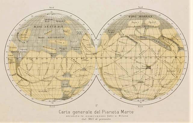
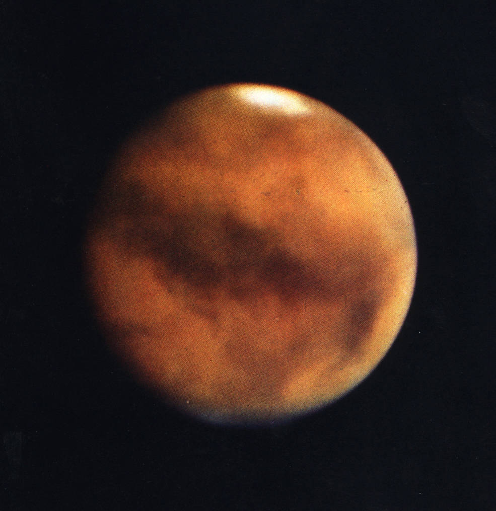
Left: Diagram by Schiaparelli showing his observations of canali. Right: The best
Earth-based telescopic image of Mars prior to Mariner 4’s mission, from the
favorable 1956 opposition.
Credits: Mt. Wilson Observatory.
Compared with our deeper yet still incomplete understanding of the Red Planet today, scientists in the 1960s knew relatively little about Mars. In the late 19th century, Italian astronomer Giovanni Schiaparelli claimed to have observed linear patterns on the surface of the planet that he called canali, which unfortunately were mis-translated into English as canals, leading some to believe they were built by intelligent beings on Mars. Although that idea fell out of favor among scientists by the early 20th century, it did permeate into science fiction as well as popular culture. Notions of a planet with a global climate relatively similar to Earth’s, including the possibility that it harbored some form of extraterrestrial life, remained popular even among scientists into the 1960s. The best Earth-based telescopic images of Mars revealed little surface detail but did show areas that changed size, shape and color with the Martian seasons, indicative to some observers of at least some form of simple plant-like life forms.
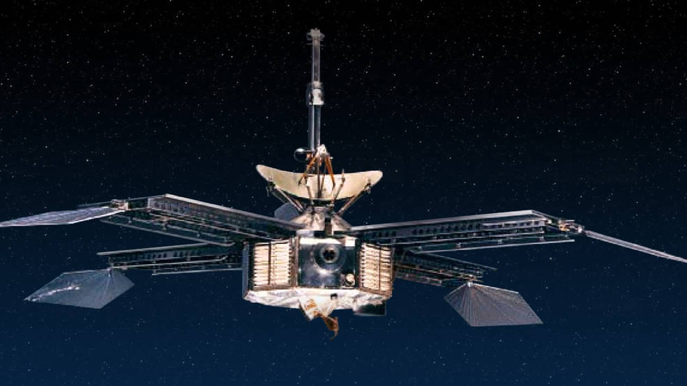
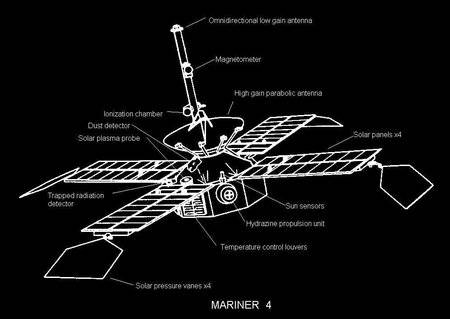
Left: Photograph of the Mariner 3 and 4 spacecraft. Right: Schematic of
the Mariner 4 spacecraft indicating the science instruments.
To carry out their observations during their transit from Earth and during their flybys of Mars, each of the 575-pound Mariner Mars 1964 spacecraft carried seven science instruments:
- The television imaging system enabled topographic reconnaissance of the Martian surface.
- The Helium Magnetometer measured magnetic field strength around the planet.
- The Ionization Chamber and particle flux detector measured the omnidirectional flux of particle radiation near Mars and in interplanetary space.
- The Cosmic Dust Detector measured dust particle momentum and mass distribution.
- The Cosmic Ray Telescope measured charged particles.
- The Trapped Radiation Detector consisted of three Geiger-Muller detectors to measure any charged particles that may be trapped by a Martian magnetic field.
- The Solar Plasma Probe measured the density, velocity, temperature, and direction of movement of protons streaming from the Sun.
Each spacecraft generated 310 watts of electrical power at Mars from photovoltaic cells mounted on four solar panels mounted in a windmill-like arrangement around the probe’s octagonal frame. Mounted on the end of each solar panel were steerable pressure vanes to use the solar wind to control the spacecraft’s orientation. The experimental pressure vanes supplemented a set of nitrogen gas thrusters for attitude control. The spacecraft converted the analog signal from the camera to digital format, and following the flyby transmitted the photographs back to Earth at a rate of 8 1/3 bits per second, seemingly glacial today but, as the first digital imaging system used beyond Earth, considered state of the art for the mid-1960s. Each photograph took 10 hours to relay to Earth.
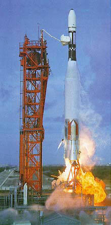
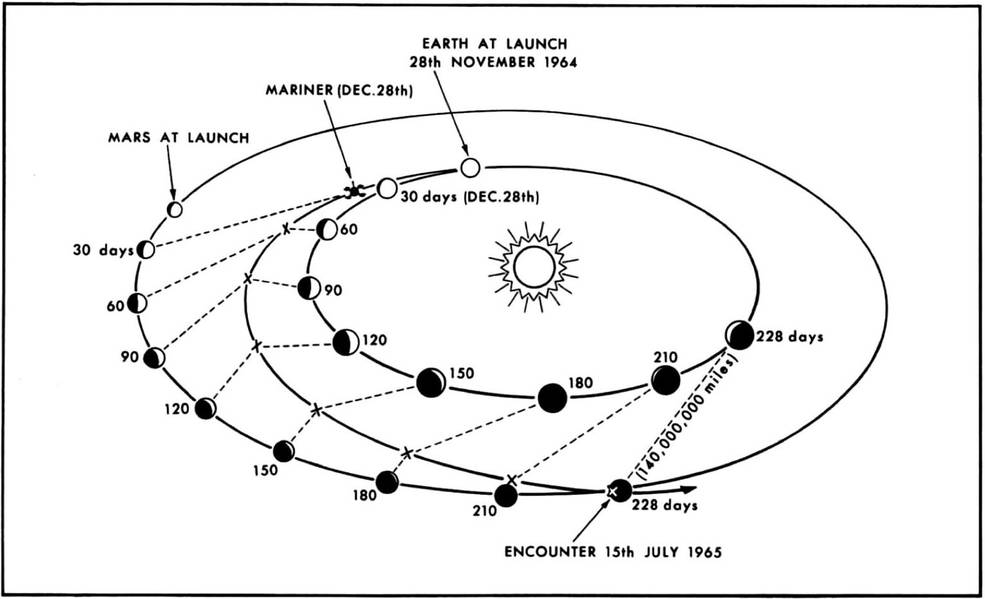
Left: Launch of Mariner 4. Right: Trajectory of Mariner 4 to Mars.
The first of the two spacecraft, Mariner 3, launched from Cape Kennedy Air Force Station, Florida, on Nov. 5, 1964, atop an Atlas-Agena D rocket. Due to the failure of the spacecraft’s payload shroud to jettison, its solar panels could not deploy and Mariner 3 sailed on into solar orbit as an inert spacecraft. Beneath a hastily redesigned payload shroud, the second spacecraft, Mariner 4, successfully launched on Nov. 28, just two days before the close of the launch window. During the eight-month cruise phase to Mars, the spacecraft took measurements on the conditions of interplanetary space and relayed the data to Earth. On July 14, 1965, Mariner 4 passed within 6,118 miles of Mars, snapping 22 photographs of the planet and taking scientific measurements. The spacecraft passed behind the planet as seen from Earth, allowing a radio occultation study to estimate the density of the Martian atmosphere. Playback of the flyby imagery began soon after Mariner 4 emerged from behind Mars and continued until Aug. 3.
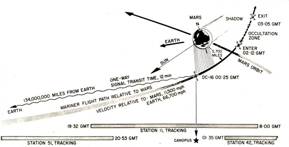
Schematic representation of Mariner 4’s flyby of Mars.
At JPL, a “real-time data translator” machine converted the Mariner 4 digital image data into numbers printed on strips of paper. Too anxious to wait for the official processed image, employees from the Telecommunications Section attached these strips side by side to a display panel and hand colored the numbers like a paint-by-numbers picture. The completed image was framed and presented to JPL director William H. Pickering.
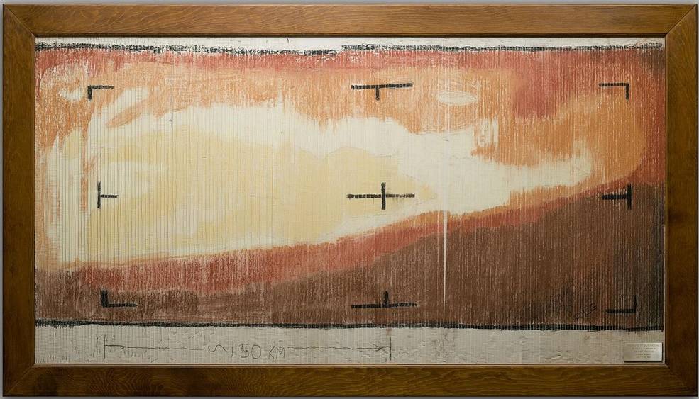
A hand-rendered picture from data transmitted by Mariner 4, made by
eager engineers who didn’t want to wait for the official image.
The radio occultation results indicated a very low surface atmospheric pressure, about 1% that at Earth’s sea level. Scientists estimated the surface temperature at about -100o C and the spacecraft detected no magnetic field or trapped radiation belts around the planet. The photographs revealed a cratered surface resembling the Moon, although the photographs covered less than 1% of the Martian surface and did not represent Mars as we know it today. By sheer chance, Mariner 4 imaged some of the oldest and most heavily cratered terrain on Mars, missing some of the more diverse and geologically more recent features. All in all, these findings dashed many scientists’ expectations of Mars as a place hospitable to life.
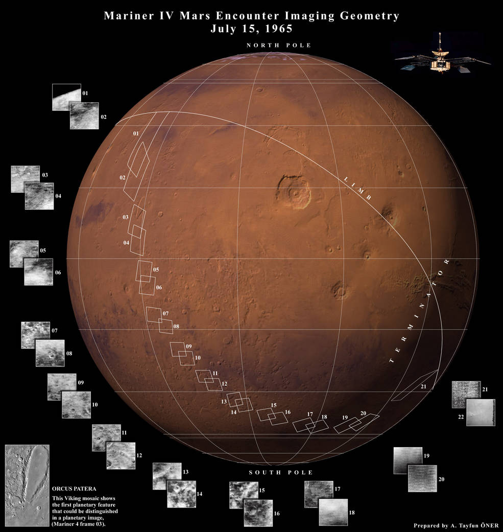
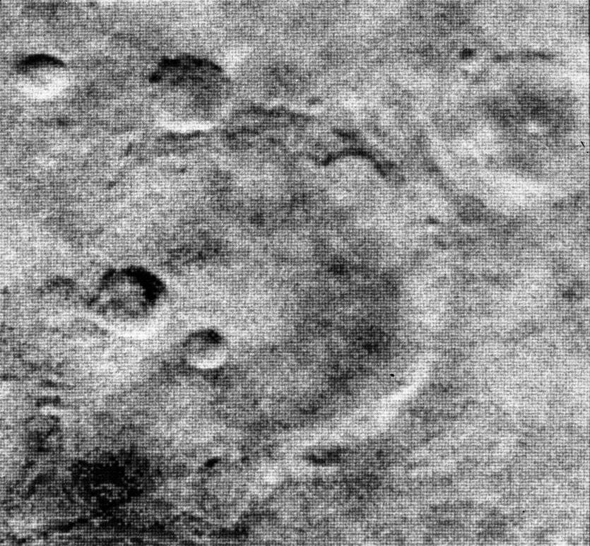
Left: Global image of Mars indicating the areas imaged by Mariner 4.
Right: The highest resolution of the Mariner 4 photographs taken from
a distance of 7,830 miles showing a cratered surface.
Although the images and data that Mariner 4 returned may have the dashed the hopes of some scientists that Mars harbored some form of life, its results should be placed in proper perspective. The imagery covered about 1% of the planet’s surface and the best resolution achieved was just under a mile per pixel, with significantly less on many of the images. When compared with imagery acquired later by spacecraft with more sophisticated imaging systems, it’s clear that as ground-breaking as Mariner 4 was, it missed a great deal. The photographs below of the same area (southern Amazonia Planitia) on Mars show the progressive improvement in resolution achieved as newer technology became available, beginning with the Mariner 4 photograph, followed by the Viking 1 Orbiter in 1980, the Mars Express orbiter in 2012 and finally the High Resolution Imaging Science Experiment (HiRISE) instrument aboard Mars Reconnaissance Orbiter in 2017 (the yellow rectangle in the preceding three photos), with a resolution of 50 centimeters per pixel.
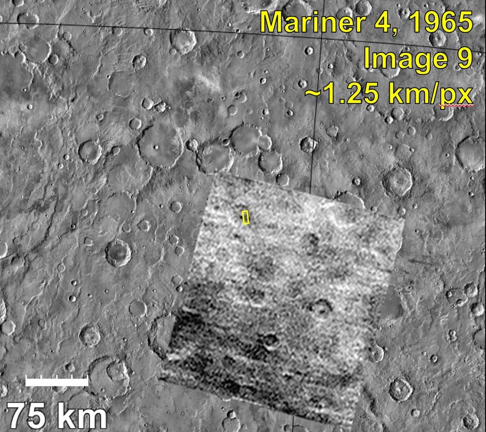
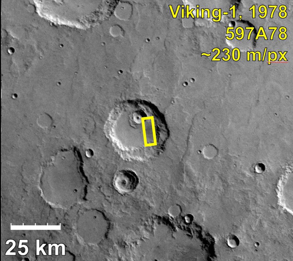
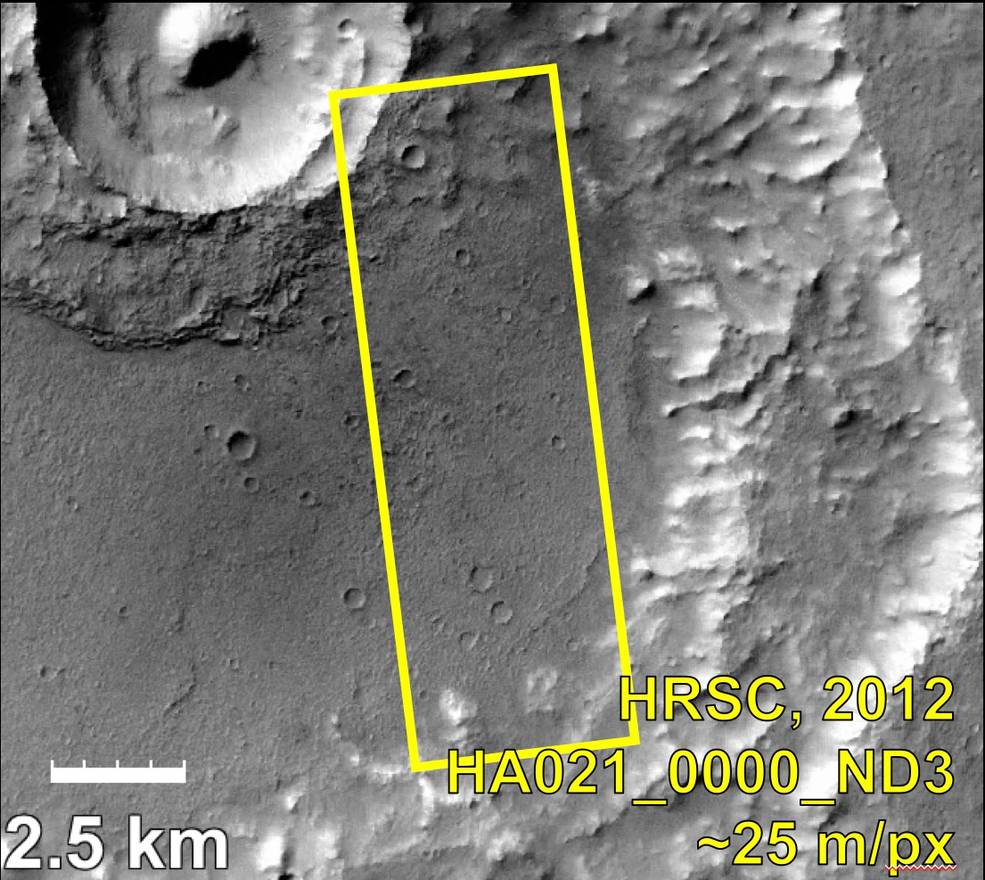
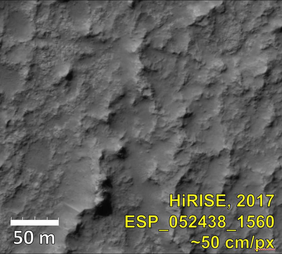
Photographs of the same area in the southern Amazonia Planitia region on Mars as viewed by spacecraft over the years
(left to right) Mariner 4 in 1965, Viking 1 Orbiter in 1980, Mars Express in 2012 and Mars Reconnaissance Orbiter in 2017.
Credits: University of Arizona.
Having completed the first scientific reconnaissance of Mars, Mariner 4 sailed on in solar orbit, conducting engineering tests of its imaging and propulsion systems, showing no degradation after years in space. In late 1965, the spacecraft passed on the other side of the Sun as viewed from Earth and set a communications distance record of 190 million miles. In October 1967, engineers conducted tests with Mariner 4’s attitude control system to support the Mariner 5 spacecraft then approaching Venus. Finally, after running out of attitude control gas, Mariner 4 could no longer point its solar arrays toward the Sun and contact with the spacecraft was lost on December 21, 1967.