Suggested Searches

A diagram illustrating the Polylingual Experimental Terminal’s (PExT) network interoperability. In center, a stylized Earth is surrounded by three concentric orbital tracks labeled LEO (low Earth orbit), MEO (medium Earth orbit), and GEO (geostationary orbit). Four icons representing PExT satellites circle the LEO orbit, highlighted in red, and extend blue data lines toward other network components. These include: a NASA “TDRS” (Tracking and Data Relay Satellite) in GEO, a “Commercial Network 1” satellite in GEO, a “Commercial Network 2” satellite in MEO, and a “Commercial Ground Station” icon on Earth. The commercial satellites linked to PExT connect to additional commercial ground station arrows on Earth, while TDRS connects to an arrow “NSN” (Near Space Network), visualizing PExT’s ability to relay data between commercial and government network assets. On the right, a pink spotlight extends from a PExT icon to a labeled photograph of the real PExT hardware.

pext-conops-graphic

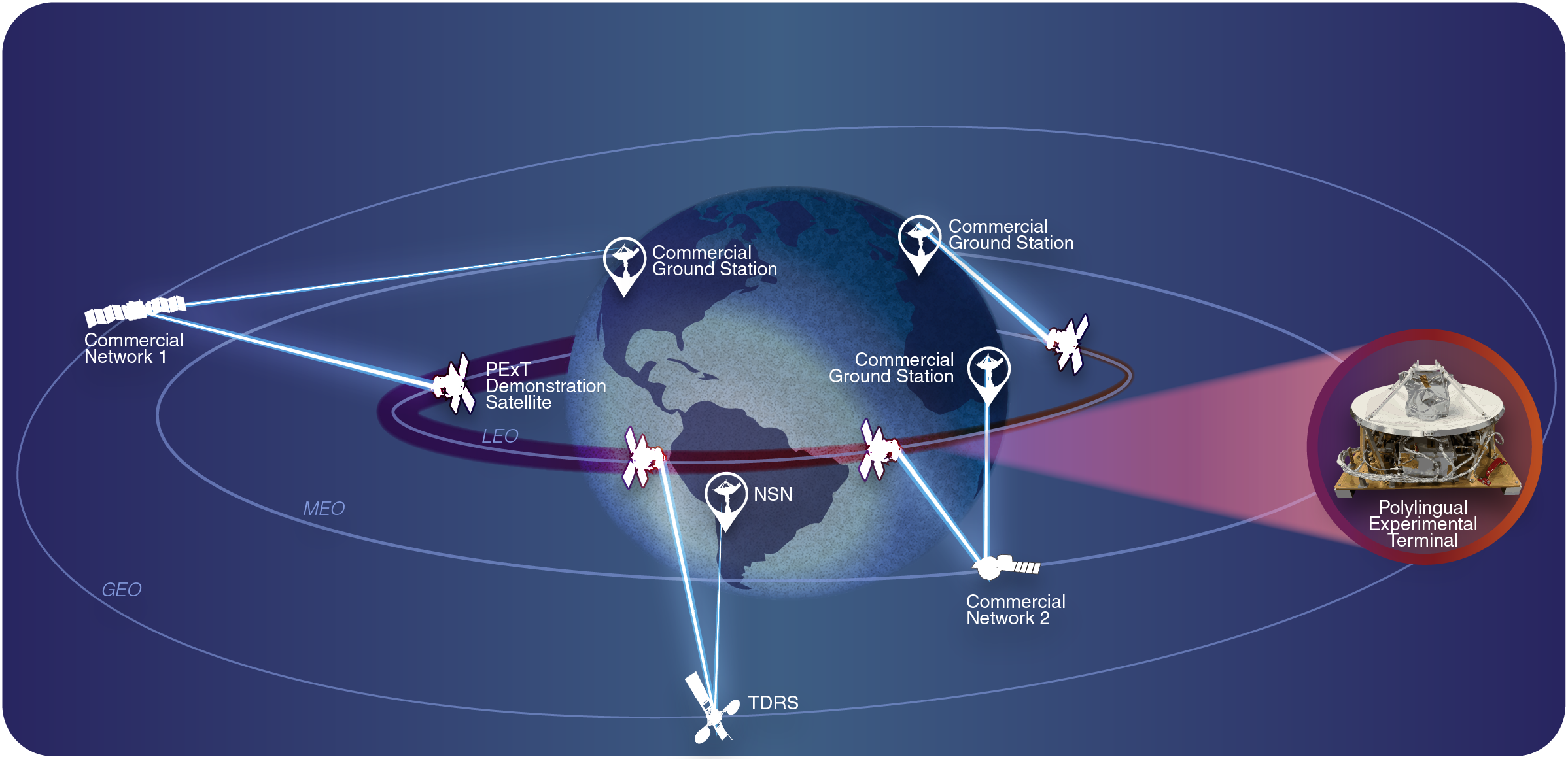
An artist’s rendering of how the Polylingual Experimental Terminal (PExT) will communicate with multiple commercial networks and NASA’s Tracking and Data Relay Satellite constellation. PExT is NASA’s first flight demonstration of a wideband polylingual terminal designed to operate across both government and commercial satellite networks.

Image Credit: NASA/Morgan Johnson
Download