


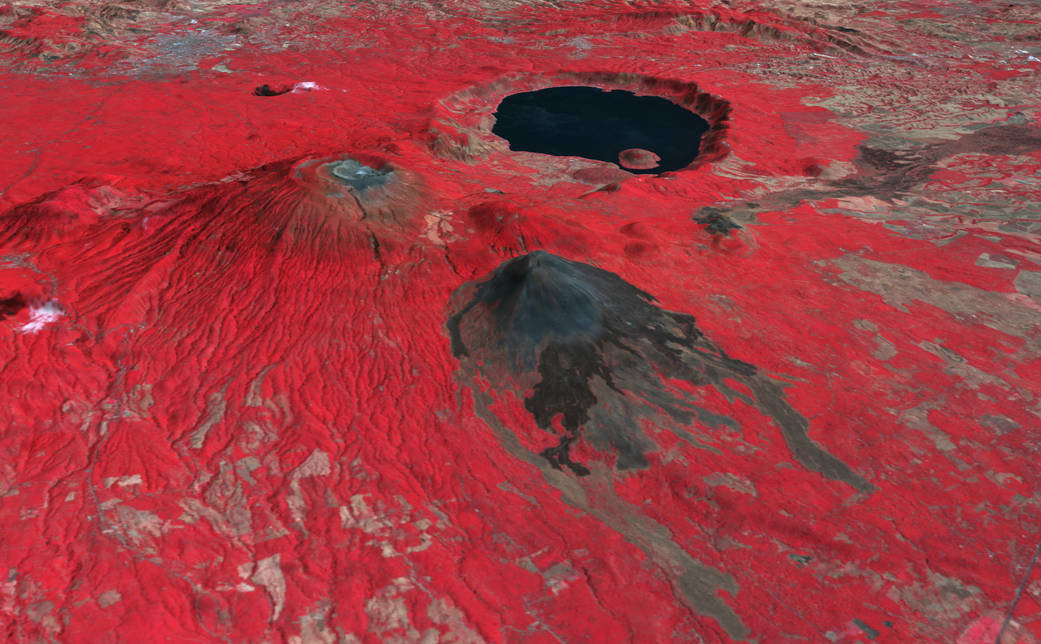
On October 1, 2005, El Salvador’s Santa Ana Volcano, also known as the Ilamatepec Volcano, erupted for the first time since 1904. The eruption reportedly shot out car-sized lava rocks and a flood of boiling mud and water. This false-color image was made from data collected by the Advanced Spaceborne Thermal Emission and Reflection Radiometer (ASTER) on NASA’s Terra satellite on February 3, 2001, well before the 2005 eruption. The Santa Ana volcano rises on the left side of the image, forming a large flat-topped mound and sports several crescent-like craters at its summit and a 20-kilometer-long system of fissures. A tiny blue spot in the center of the inner-most crater is a crater lake, the likely source of the boiling water flood.
Behind Santa Ana is a large caldera lake inside the Coatepeque Caldera, created when a series of volcanoes collapsed in explosive eruptions between 57,000 and 72,000 years ago. In the foreground is El Salvador’s newest volcano, Izalco, which sprang up in 1770 and erupted frequently until 1966. The young volcano isn’t covered in vegetation (red in this image), but remains black with recent lava flows.
Santa Ana is the highest point in El Salvador. The volcano is 2,381 meters (7,812 feet) above sea level and is 65 kilometers (40 miles) west of the country’s capital, San Salvador.Image Credit: NASA/GSFC/METI/ERSDAC/JAROS/U.S./Japan ASTER Science Team/ Robert Simmon