


![Request for Information – Potential [Placeholder for Prize]](https://assets.science.nasa.gov/dynamicimage/assets/science/psd/solar/2023/09/s/solarsystem_0.jpg?w=1024)


On February 19, 2000, Space Shuttle Endeavour passed over the highly active and dangerous volcanic zone of the Andes in Ecuador. Endeavour mapped elevations on most of the Earth's land surface during the Shuttle Radar Topography Mission (SRTM).
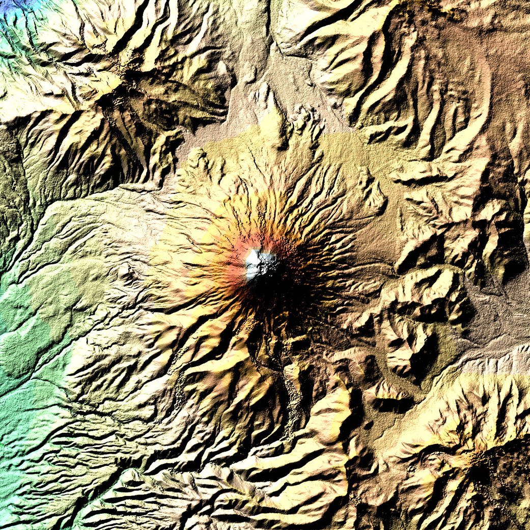
On February 19, 2000, Space Shuttle Endeavour passed over the highly active and dangerous volcanic zone of the Andes in Ecuador. Endeavour mapped elevations on most of the Earth’s land surface during the Shuttle Radar Topography Mission (SRTM). There have been more than 50 eruptions of Mt. Cotopaxi alone since 1738.
The digital elevation model acquired by SRTM, with its resolution of 25 m x 25 m, is so rich in detail that you can even make out an inner crater with a diameter of 120 m by 250 m inside the outer crater (800 m x 650 m). Blue and green correspond to the lowest elevations in the image, while beige, orange, red, and white represent increasing elevations.Image Credit: NASA Earth Observatory