


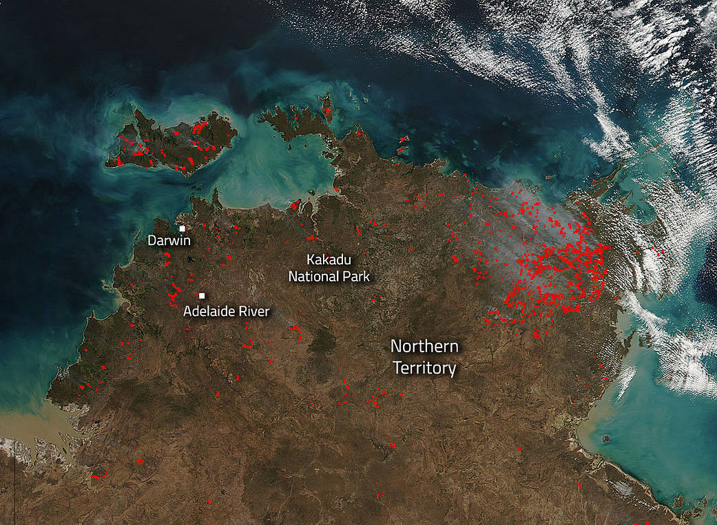
Bushfires in the Northern Territory of Australia are dotting the landscape in this image captured by the Suomi NPP satellite’s VIIRS (Visible Infrared Imaging Radiometer Suite) instrument on July 28, 2016. The Australian Government Bureau of Meteorology issued this warning on July 28, 2016. “A high pressure system moving into South Australia extends a ridge over central Australia and is bringing dry, moderate southeasterly winds to much of the Territory, tending fresh and gusty during the day.” This weather tends to increase fire activity and spread fire throughout the area. For Friday, July 29, 2016, the Bureau of Meteorology is forecasting severe fire danger for both Darwin and Adelaide River which is just one step below catastrophic.
Actively burning areas, detected by MODIS’s thermal bands, are outlined in red. NASA image courtesy Jeff Schmaltz LANCE/EOSDIS MODIS Rapid Response Team, GSFC. Caption by Lynn Jenner.
Suomi NPP is managed by NASA, NOAA and the U.S. Department of Defense.