


Altair Unmanned Aerial Vehicle Technology Demonstrator
Encyclopedia
Updated Aug 2, 2023
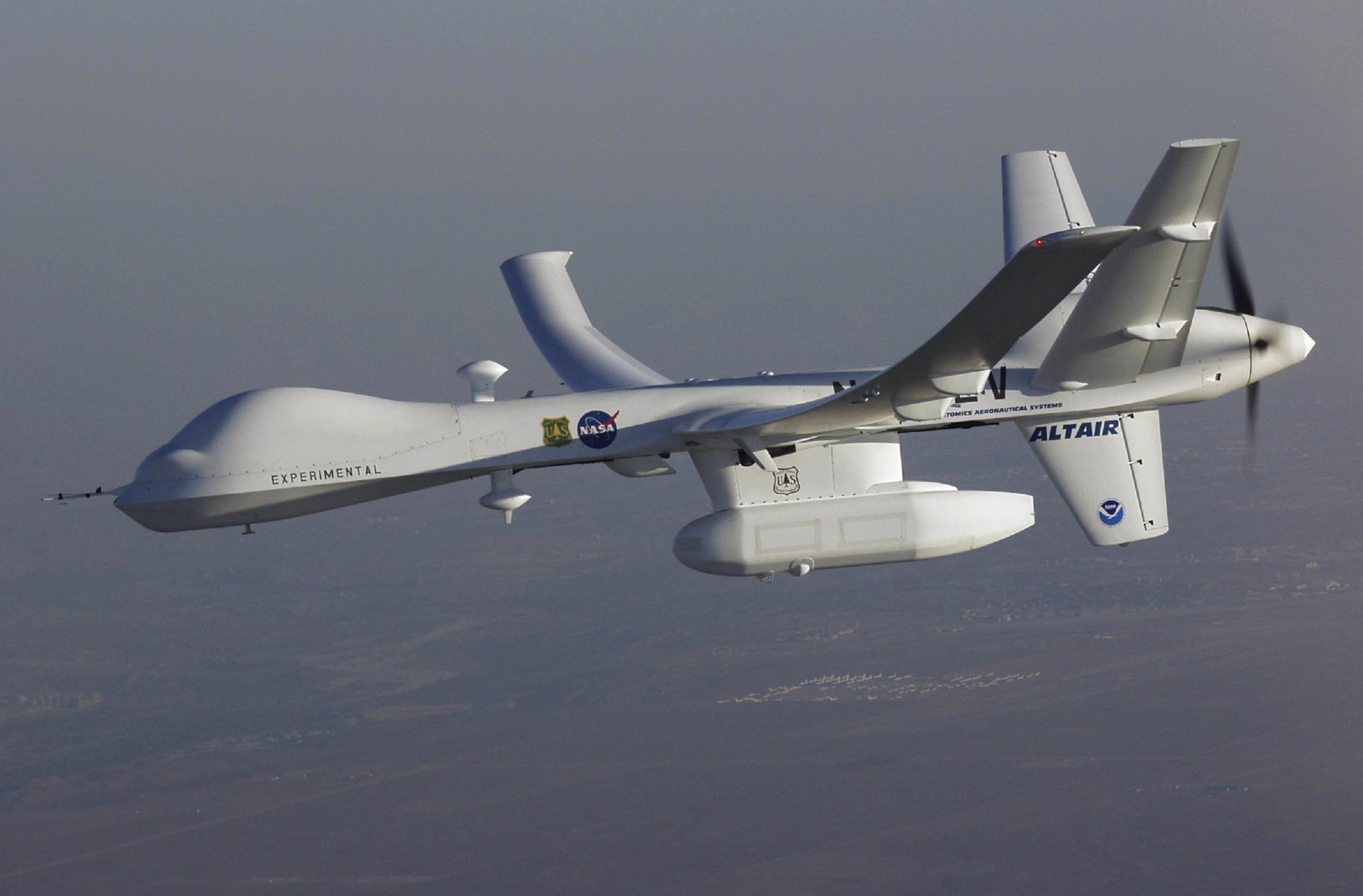
General Atomics' uninhabited Altair flew a NOAA/NASA coastal mapping, mammal observation and marine monitoring mission off the California coast in late 2005.
NASA’s Dryden (now Armstrong) Flight Research Center in Edwards, California, partnered with General Atomics Aeronautical Systems Inc. (GA-ASI) in the early 2000s to demonstrate technologies to expand the capabilities of remotely operated aircraft to perform high-altitude Earth science missions. To accomplish the task, GA-ASI developed an enlarged version of its Predator A reconnaissance aircraft, the Predator B, including an extended-wingspan Altair version for NASA.
Begun as a company-funded effort in 1999, the Predator B development program became a jointly-funded effort by GA-ASI and NASA in January 2000, after NASA selected the Altair variant from several competing proposals for development to meet the agency’s unmanned aerial systems (UAS) requirements for Earth science missions.
With a high-tech infrared imaging sensor in its underbelly pod, the Altair UAS flew repeated passes over the Esperanza wildfire to aid firefighting efforts in October 2006.
General Atomics Aeronautical Systems Inc.
GA-ASI’s task under a Joint Sponsored Research Agreement under NASA’s now-concluded Environmental Research Aircraft and Sensor Technology (ERAST) program called for the San Diego firm to develop and demonstrate technical performance and operational capabilities to meet the needs of the science community. As joint partners in the project, which covered flight validation as well as development of the aircraft, NASA’s Office of Aerospace Technology invested about $10 million, while GA-ASI contributed additional funds, with about $8 million earmarked for the Altair project.
NASA’s Office of Earth Science (now the Science Mission Directorate) established a stringent set of requirements for the conventionally powered, remotely or autonomously operated aircraft. Among these requirements was a mission endurance of 24 to 48 hours at a primary altitude range of 40,000 to 65,000 feet with a minimum payload of 660 pounds (300 kilograms). Another key requirement was to develop the capability and operational procedures to allow operations from conventional airports without conflict with piloted aircraft. This latter issue was subsequently addressed by the AFRC and FAA in a series of tests to integrate UAVs in the National Air Space (NAS).
The Altair had to demonstrate “over-the-horizon” command and control beyond line-of-sight radio capability via a satellite link, “see-and-avoid” operation in unrestricted airspace and the ability to communicate with Federal Aviation Administration (FAA) controllers. And the aircraft had to meet all FAA airworthiness and maintenance standards.
The Predator B prototype UAS logged its first flight Feb. 2, 2001, from GA-ASI’s flight operations facility at El Mirage, California. The prototype reached a maximum sustainable altitude of 48,300 feet during a follow-on flight test over the nearby Edwards Air Force Base test range.
The Altair technology-demonstration variant for NASA was designed to fly as long as 32 hours at up to 52,000 feet altitude. Eleven-foot extensions were added to each wingtip, giving the Altair an overall wingspan of 86 feet with an aspect ratio of 23.5. The aircraft is powered by the same Honeywell TPE331-10 turboprop engine as the Predator B.
The Altair was designed to perform a variety of Earth science missions specified by NASA’s Earth Science Enterprise, now the Science Mission Directorate’s Airborne Science Program. GA-AS
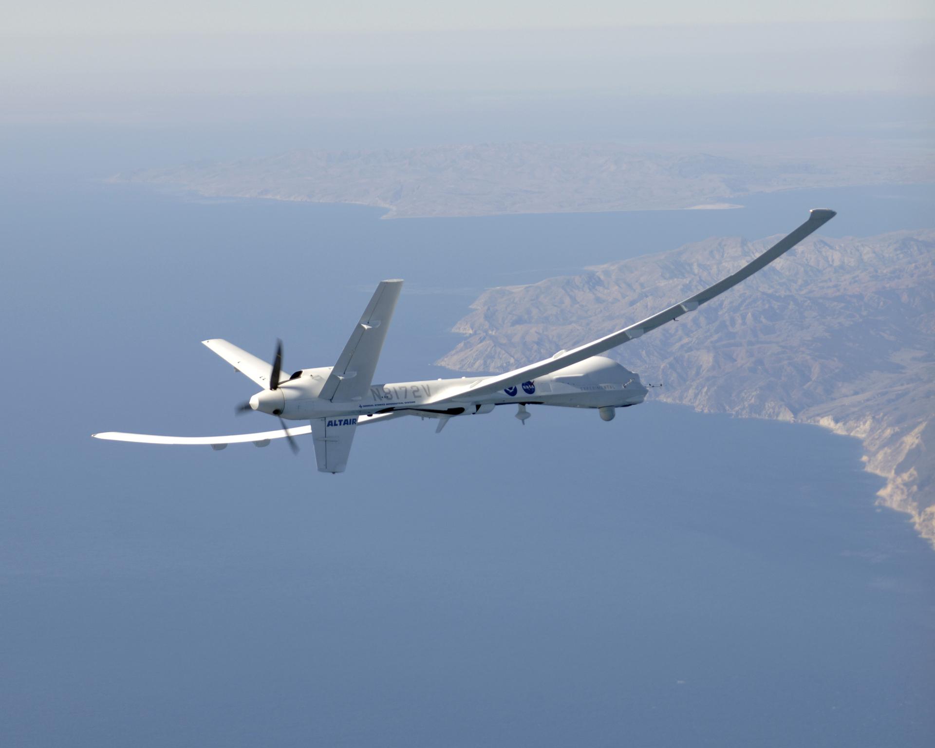
The long wings of General Atomics Aeronautical Systems’ Altair UAS are in evidence during a series of environmental monitoring missions for NOAA and NASA in the spring of 2005.
NASA/Tom Tschida
NASA, the National Oceanic and Atmospheric Administration (NOAA), the U.S. Forest Service and GA-ASI cooperated in several environmental science demonstrations missions with the Altair in 2005 and 2006.
During a flight over the Channel Islands off the Southern California coast in late 2005, sensors on the aircraft gathered ocean color and atmospheric chemistry measurements and observed marine mammals and their environment. The flight also conducted low-tide coastal mapping and NOAA law enforcement surveillance of the Channel Islands National Marine Sanctuary. An earlier mission the same week saw the Altair collect similar data during an 18.5-hour flight off the coast of northern and central California.
Equipped with an infrared imaging sensor, the Altair UAS aided fire mapping efforts over wildfires in central and Southern California for the U.S. Forest Service in late 2006.
Changing mission requirements eventually led NASA to purchase a production version of the MQ-9 Predator B in 2006, which it named “Ikhana” (Choctaw for intelligent, conscious, or aware), as well as a ground control station, in place of the prototype Altair. The MQ-9 was modified and instrumented for use in multiple civil research roles, including Earth science missions and advanced aeronautical technology development. The aircraft also acts as a test bed to develop capabilities and technologies to improve the utility of unmanned aircraft systems.
Unlike the Altair, Ikhana / Predator B had triple-redundant avionics and control systems and a 33 percent greater fuel capacity than the Altair. It can also carry a greater payload of sensors.
GA-ASI retains ownership and control of the Altair prototype.
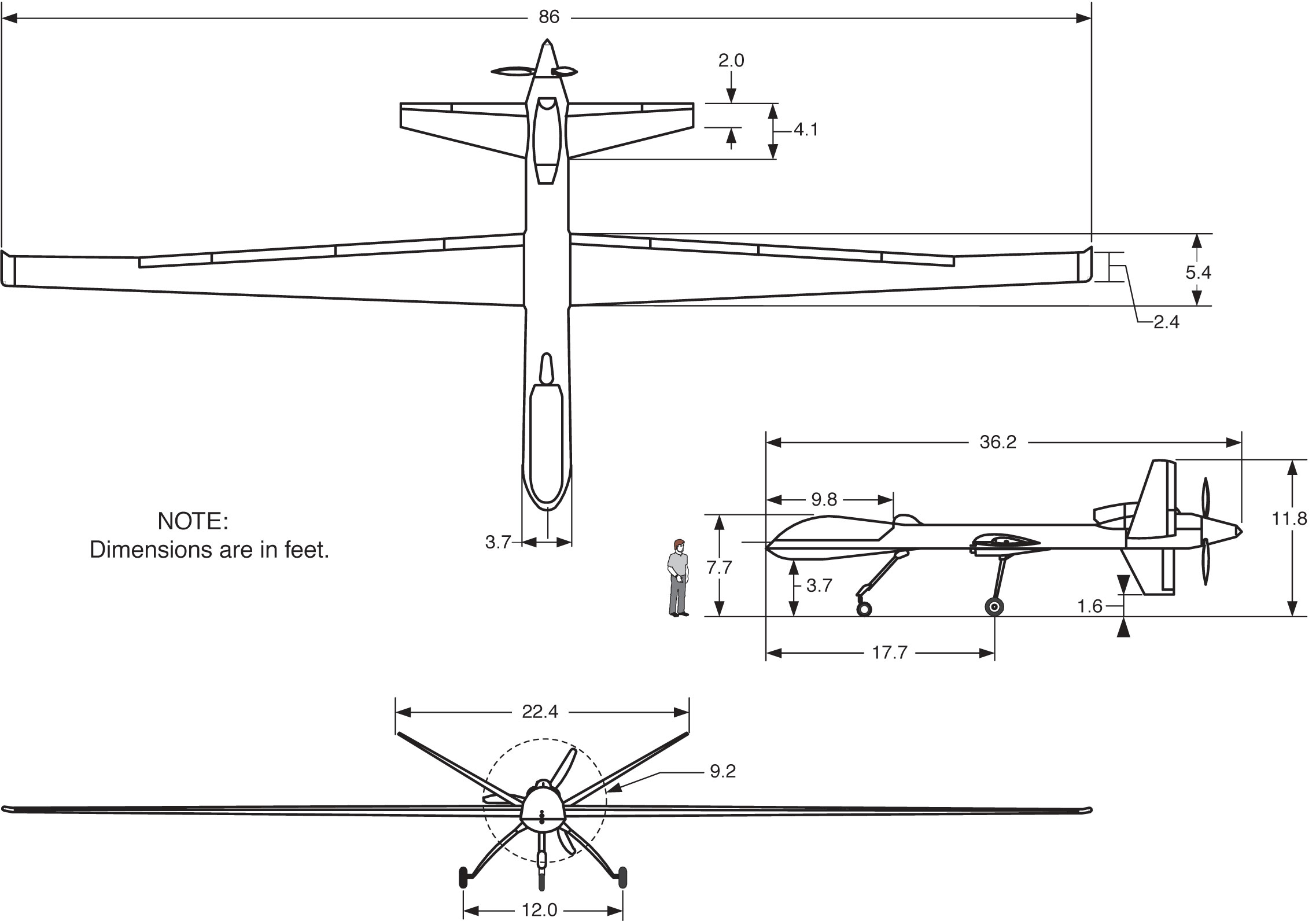
Three-view drawing of GA-ASI’s Altair UAS.
NASA Graphics
Altair Specifications
- Profile: Low-wing monoplane with narrow fuselage and high aspect-ratio wing, large V-shaped tail with ventral fin, rear-mounted turboprop engine. Enlarged fuselage nose to accommodate various payloads. Retractable tricycle landing gear. Dual-redundant flight controls.
- Wingspan: 86 feet with wingtip extensions
- Length: 36 ft.
- Wing Aspect Ratio: – 23.5
- Gross weight: 7,000 lbs.
- Payload: Up to 750 lbs. of sensors, radar, communications and imaging equipment
- Airspeed: 210 knots indicated air speed (KIAS)
- Altitude (maximum): 52,000 ft.
- Propulsion: Allied-Signal TPE-331-10T turboprop, flat-rated at 700 shp, driving a three-blade constant-speed propeller
- Fuel system/capacity: Six tanks in fuselage and wings, 3,000 lb. capacity, JP-8, Jet-A or similar fuels
- Endurance: – 32 hrs.
- Manufacturer: General Atomics Aeronautical Systems Inc., San Diego, California
- Primary materials: Molded lightweight uni- and bi-directional graphite composites with Nomex honeycomb stiffening panels