Due to the lapse in federal government funding, NASA is not updating this website.

Suggested Searches

2 min read

New Horizons’ Top 10 Pluto Pics

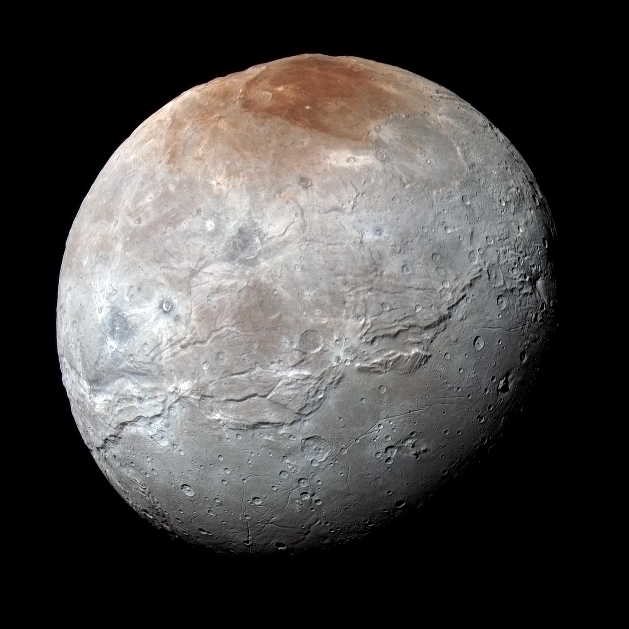
One year ago, NASA’s New Horizons mission made history by exploring Pluto and its moons – giving humankind our first real look at this fascinating world on the frontier of our solar system.

Since those amazing days in July 2015 the New Horizons spacecraft has transmitted numerous images and many other kinds of data home for scientists and the public alike to study, analyze, and just plain love. From Pluto’s iconic “heart” and sweeping ice‐ mountain vistas to its flowing glaciers and dramatic blue skies, it’s hard to pick just one favorite picture. So the mission team has picked 10 – and in no special order, placed them here.

Click the titles for more information about each image. You’ve seen nine of them before, and the team added a 10th favorite, also sure to become one of New Horizons’ “greatest hits.”

What’s your favorite image? Tag @NASANewHorizons and #plutoflyby on Twitter, and let us know! 

Vast Glacial Flows

New Horizons discovers flowing ices in Pluto’s heart-shaped feature.

Jagged Ice Shorelines and Snowy Pits

NASA’s New Horizons spacecraft zooms in on the southeastern portion of Pluto’s great ice plains, where at lower right the plains

Blue Skies

Blue haze around Pluto.

Charon Becomes a Real World

Pluto

The Vistas of Pluto

Pluto's mountains, frozen plains and foggy hazes

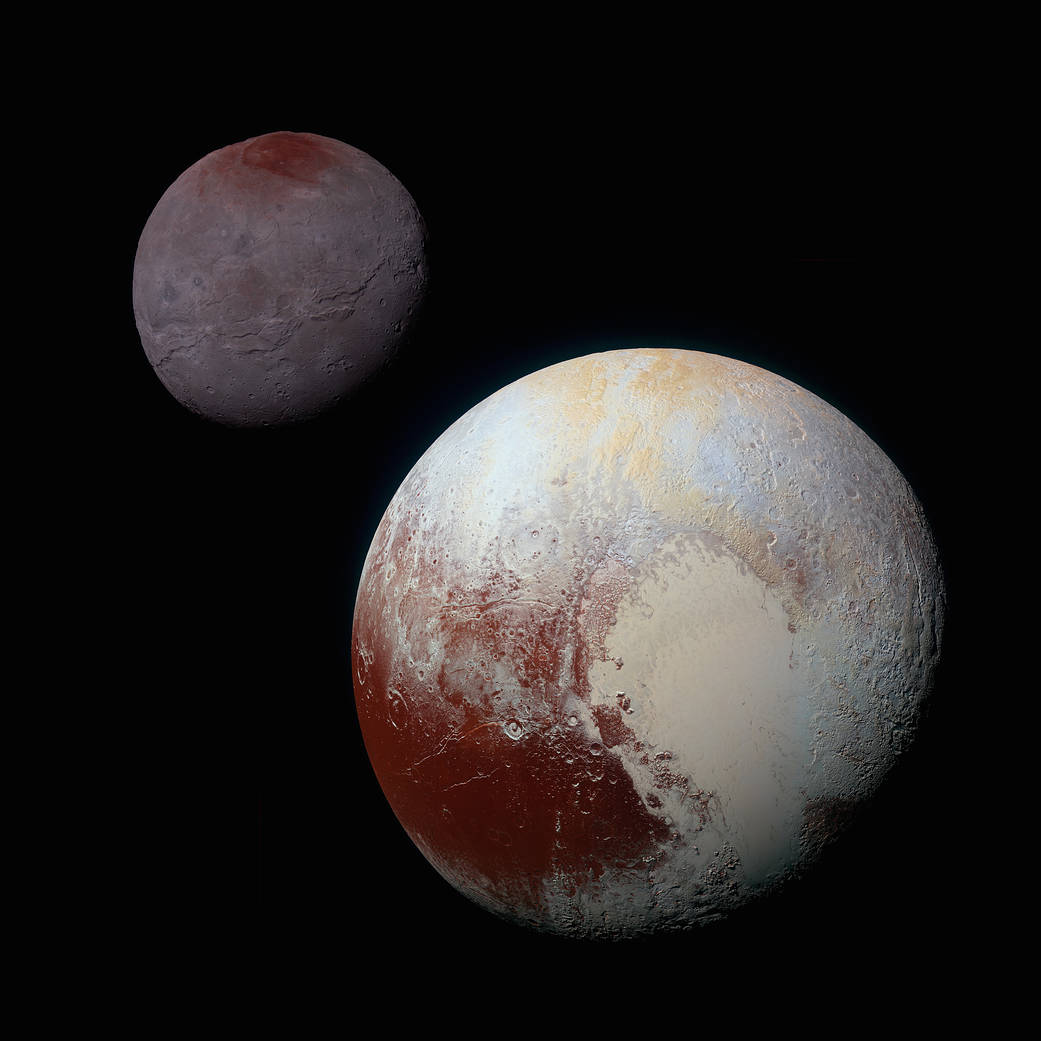
A Dynamic Duo: Pluto and Charon in Enhanced Color

Pluto and it's moon Charon

Strange Snakeskin Terrain

Terrain of Pluto in closeup

Pluto’s Heart

Pluto

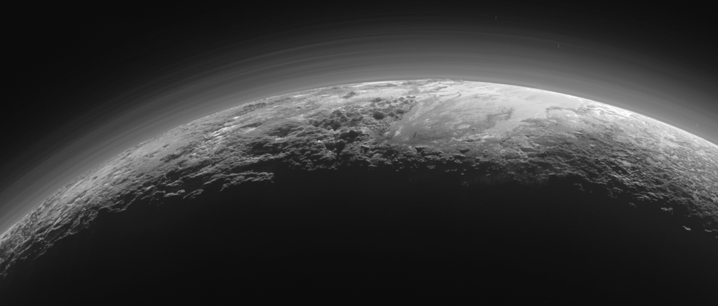
Far Away Snow‐Capped Mountains

Pluto’s Snowcapped Methane Peaks

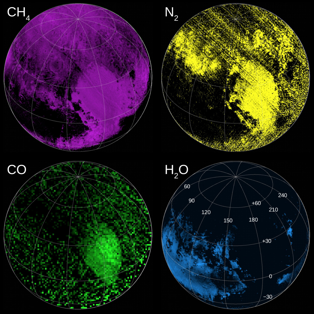
Colorful Composition Maps of Pluto 

These compositional maps indicate the regions rich in ices of methane, nitrogen and carbon monoxide, and water ice.
The powerful instruments on New Horizons not only gave scientists insight on what Pluto looked like, their data also confirmed (or, in many cases, dispelled) their ideas of what Pluto was made of. These compositional maps – assembled using data from the Linear Etalon Imaging Spectral Array (LEISA) component of the Ralph instrument – indicate the regions rich in ices of methane (CH4), nitrogen (N2) and carbon monoxide (CO), and, of course, water ice (H2O).