The phrase “a picture is worth a thousand words” has never been truer than when it comes to the photographs and imagery produced by crew aboard the International Space Station. Orbiting around Earth every 90 minutes at an altitude of approximately 400 kilometers (250 miles), the International Space Station provides a spectacular vantage point to take pictures of our planet. From this setting, crew members aboard the space station have taken more than 3.5 million photographs of Earth. These photos have added to long-running image capture programs reaching back to the 1960s for both the Russian and U.S. space programs. The State Space Corporation ROSCOSMOS (ROSCOSMOS) Uragan-Vizual (Hurricane-Visual) and NASA’s Crew Earth Observations investigations task crews aboard the station with capturing photographs of significant features on Earth’s surface. After completing scientific observation training provided by specialists, crew members use hand-held cameras to regularly take photographs of features such as volcanic eruptions, urban areas, bodies of water, and meteorological phenomena. The information gathered by crew photographs supports global-scale investigations related to the composition, health, and future of Earth.
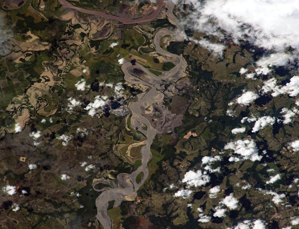
Flooding in Colombia: The mighty Orinoco River serves as a boundary between the countries of Colombia and Venezuela. Four major rivers in Colombia’s Oroniquia region drain into the Orinoco. Significant flooding in this region in early July 2020 affected more than 1,200 families and destroyed an estimated 1,600 hectares (almost 4,000 acres) of crops.
The Colombia Institute of Hydrology, Meteorology and Environmental Studies asked NASA’s Earth Applied Sciences Disasters Program to help determine the extent and impacts of the flooding. The program’s tools include Crew Earth Observations, consisting of photographs taken by astronauts on the space station. Later in the month, NASA astronaut Chris Cassidy was able to capture images of the flooding as the space station passed over Colombia. NASA’s Earth Science and Remote Sensing Unit at Johnson Space Center matched the photos with locations on the ground, and the Disasters Program then sent them to Colombian authorities.
“The information was essential in supporting quick and remote analysis of flood zones,” said Johan Naranjo, a Geographic Information System expert with Colombia’s National Unit for Disaster Risk Management. Officials used the images to carry out an analysis of flooded areas over multiple days, which helped them identify those sites most critical for direct emergency response by national, departmental, and municipal authorities. The photograph helped fulfill the purpose of the International Disaster Charter, which states that it strives to provide Earth observation data to aid in rapid disaster response efforts.
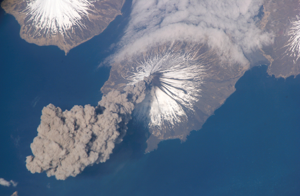
Volcano spotting: When NASA astronaut Jeff Williams looked out the space station window in 2006, he saw something unexpected: a volcanic eruption. What he did not realize is that he was the first person to witness this eruption of the Cleveland Volcano in Alaska. Cleveland Volcano, situated on the western half of Chuginadak Island, is one of the most active volcanoes in the Aleutian Islands, which extend west-southwest from the Alaska mainland. His unique vantage point allowed him to be the first human to alert the Alaska Volcano Observatory that the volcano had produced a plume of ash. Shortly after the activity began, he took this photograph.
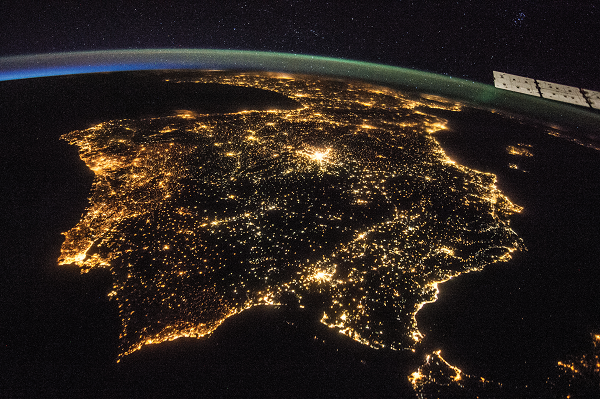
Gazing through the darkness: From their unique setting in low-Earth orbit, station crew members regularly generate nighttime imagery that captures twinkling light sources on the surface. This photo of the Iberian Peninsula taken by ESA (European Space Agency) astronaut Alexander Gerst and composite image taken by NASA astronaut Christina Koch as station traveled from Namibia toward the Red Sea show just how bright nighttime lights can be. This type of imagery can help researchers track light pollution and conduct studies of urbanization.
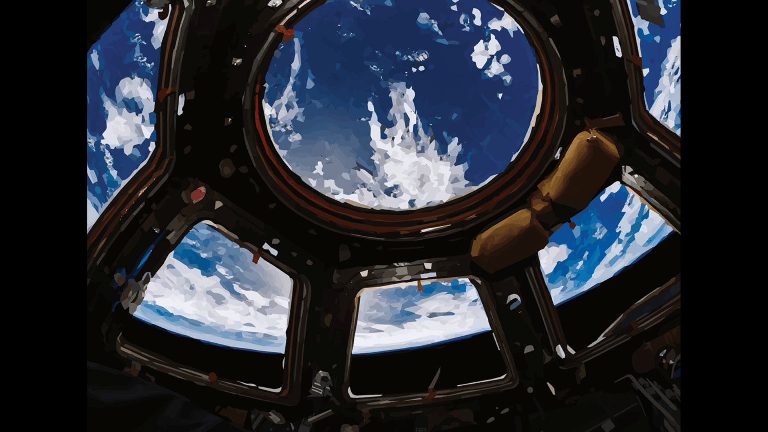
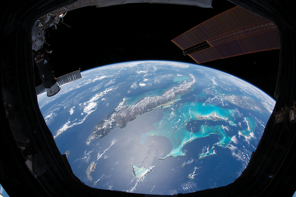
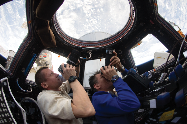
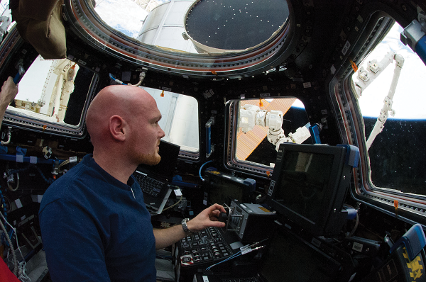
The view from the cupola: The space station’s cupola is a research module with seven viewing windows, making it a great location to take pictures of Earth. Gazing outside one of the cupola’s side windows, NASA astronaut Andrew Morgan captured this image of the Caribbean Sea. The largest land mass featured in this photograph is Cuba, and to the right of it is the Bahamas. The Bahama Banks, submerged hills comprised of limestone and sediments formed from the biological processes of ancient and current sea life, can also be seen just below the surface of the blue waters. Numerous images like this make up NASA’s Gateway to Astronaut Photography database that scientists can pull from for their studies.
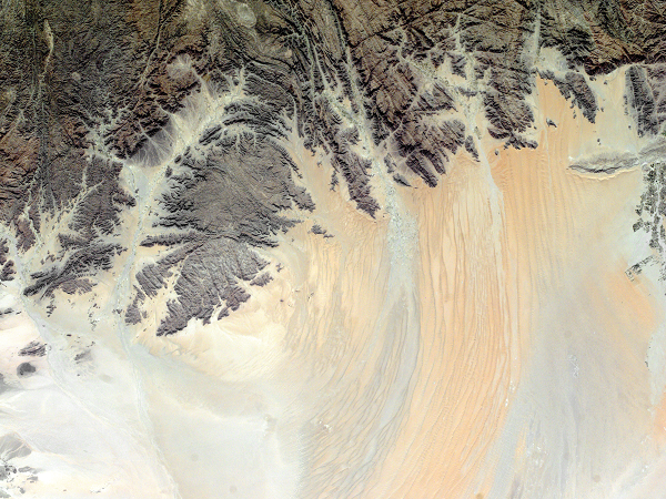
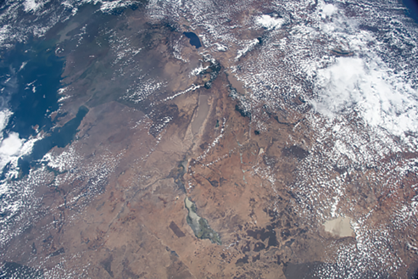
Student space photos: Can you spot the rivers in this photograph of the Arabian Desert’s Deerat Valley? Near the southwestern edge of the Red Sea lies a collection of rivers that frequently vanish due to the severe dryness of the region. The darker surfaces are comprised of ancient Precambrian rocks that are more than 540 million years old, while the lighter expanse is a mixture of younger sediments forming sand dunes. In 2017, the Sally Ride EarthKAM captured this scene in which eroded sediments from the Precambrian rock exposures highlight the peaks of the silicate sand dunes.
The Sally Ride EarthKAM is an educational outreach program that has enabled more than 1 million students to participate in taking photographs from space by requesting images from a designated camera. “It is an elegantly elaborate, yet very practical program that allows school children access to real time science on the space station,” said Vice President of Education at the U.S. Space and Rocket Center, Dr. Kay Taylor.
A higher-than-birds-eye view: The AMASS investigation is a collaborative effort between NASA, the Canadian Space Agency (CSA), and the Bondar Foundation. The AMASS investigation began in 2016 with a focus on photographing migratory locations of the whooping crane, highlighting along those routes habitat changes caused mainly by human activities. It expanded its breadth when CSA astronaut David Saint-Jacques boarded the space station in 2018. The project’s expansion included surveying the migratory locations of six additional avian species. “One of the challenges of taking photos of Earth from the space station is that we are going pretty fast. You know, we are going around the world in about an hour and a half,” Saint-Jacques says. “Chasing the right frame is a bit of an art because you only have one chance.”
This image contributed to the AMASS investigation by photographing a significant habitat for lesser flamingos near Africa’s Lake Victoria to the left and Lake Natron in the upper center.
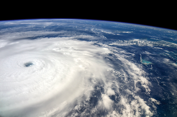
A swirling storm: Cosmonaut Sergey Ryazansky photographed Hurricane Irma as the space station flew over the storm in 2017. Growing to a Category 5 storm, Hurricane Irma is among the strongest Atlantic hurricanes ever observed. Images like this can support disaster response on the ground. After receiving notification that a natural disaster is occurring or has occurred, scientists on the ground determine whether the crew will be able to see the affected area while orbiting overhead. If so, the crew captures and sends imagery back to Earth. The pictures are then georeferenced for use by hazard teams on the ground. Astronaut imagery has been useful for wildfire events, for example, showing responders where the smoke plume is going.
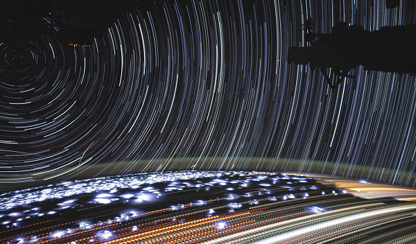
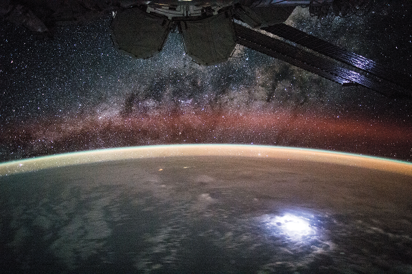
A glimpse of the Milky Way over the Pacific Ocean: In this 2015 image taken by NASA astronaut Kjell Lindgren aboard the space station, the scene is illuminated by multiple light sources. Countless stars within our galaxy, the Milky Way, stand out among the encroaching dust clouds. Orange, green, and red airglow layers can be seen, highlighting Earth’s curvature. In the lower right of the foreground, a lightning flash illuminates a large cloud mass over the Pacific Ocean. With dense cloud cover over a majority of this scene, the light sources make for a stunning sight.
For more information, listen and watch:
Houston We Have a Podcast Episode 218: Eye to the Earth