


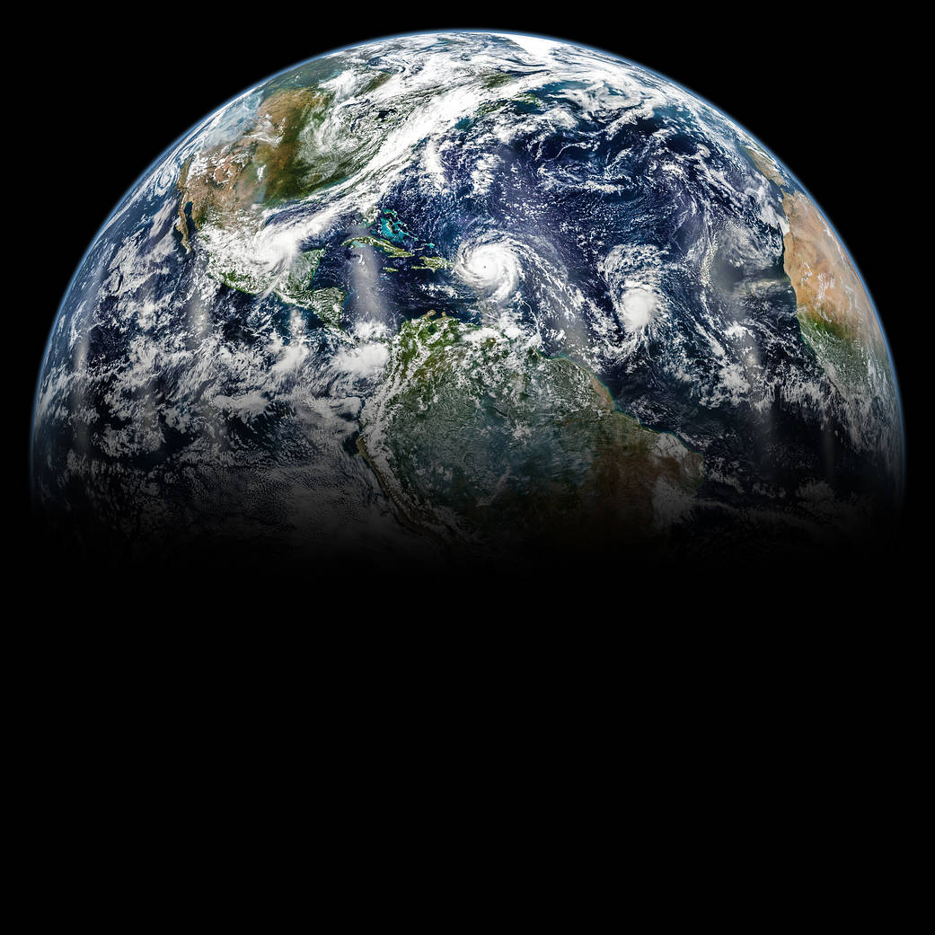
In September 2017, the Atlantic Ocean was brewing with several large hurricanes. This view of the hurricanes, and our home planet, was created by assembling images acquired throughout Sept. 6, 2017 by the Visible Infrared Imaging Radiometer Suite (VIIRS) instrument on the joint NASA/NOAA Suomi-NPP.
For six decades, NASA has used the vantage point of space to better understand our home planet and improve lives. A new interactive website called Space for U.S. highlights some of the many ways that NASA’s Earth observations help people strengthen communities across the United States and make informed decisions about public health, disaster response and recovery, and environmental protection.
This Earth Day, NASA is asking the public to share their view of our home planet on social media, using #PictureEarth.
Image Credit: NASA/Joshua Stevens; Caption by Kathryn Hansen