


It’s been a rough week at the Rough Fire in California with unhealthly air quality and evacuations in the area. Inciweb reports that the Rough Fire has grown to 97,884 acres making it currently the largest active fire in California. There are 1,960 personnel currently assigned to the Rough Fire and containment increased to 31%, probably the only good news coming out of that situation. The biggest obstacle to overcome in fighting this fire is the weather. Hot, dry conditions continue in the area making it difficult to suppress the blaze. Air quality is poor with some areas actually listed as hazardous. The winds continue to bring the smoke uphill by day and downhill by night. The terrain also affects the smoke and inversion at night keeps the smoke close to the ground rather than allowing it to drift upwards into the higher elevations.
An evacuation warning was issued by the National Parks Department for the Grant Grove area of Kings Canyon National Park. The Fresno County Sheriff’s Office also issued evacuation warning notices to the communities of Pinehurst, Miramonte and Dunlap, and areas north of Highway 180 that stretch from Hopewell Road to the west, to the Armenian Church Camp Western and Happy Gap / Sequoia Lake to the east. Such warnings are issued so that residents are prepared to leave at a moment’s notice. Mandatory evacuation notices were issued on Monday, September 7 for areas north of Dunlap and on Tuesday the 8th, the Sheriff’s Office also expanded the mandatory evacuation to include as follows: Summit Meadow, Fresno County; Goins Ranch, Fresno County; Marvin Pass, Fresno County.
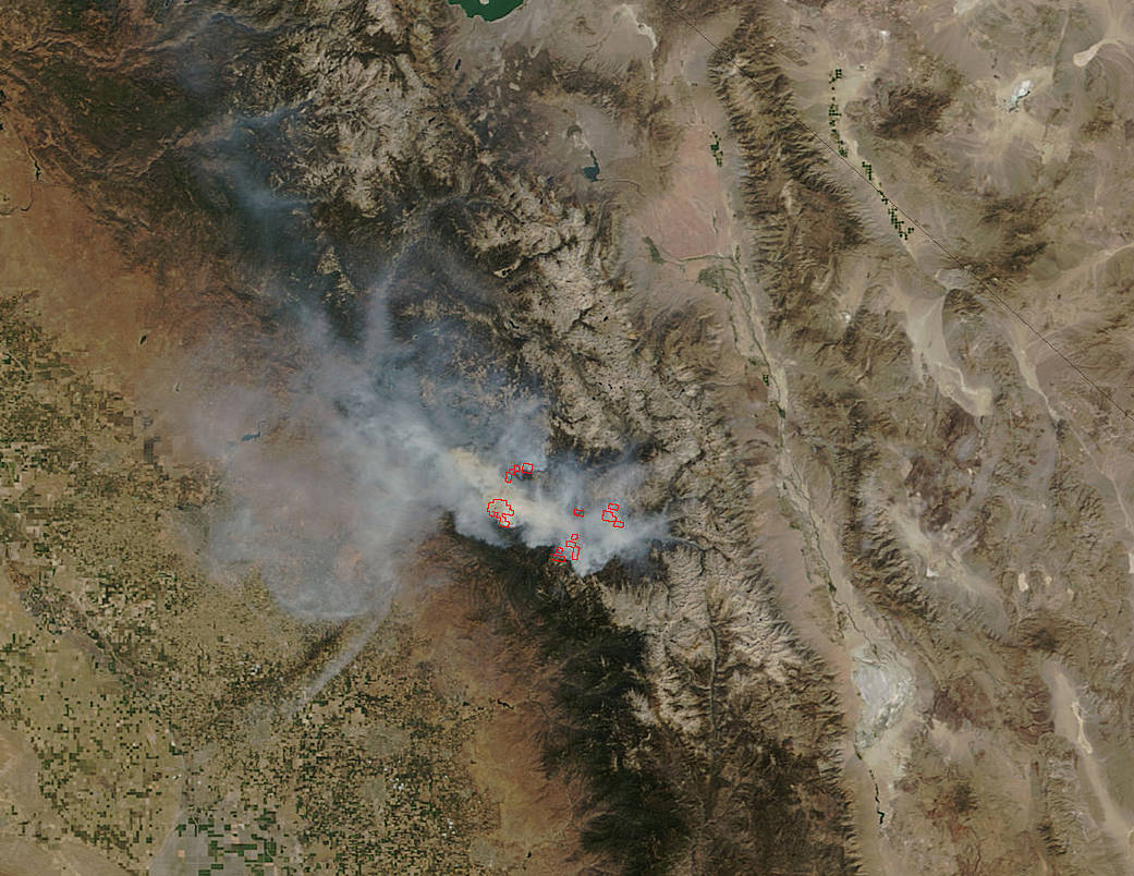
This natural-color satellite image was collected by the Moderate Resolution Imaging Spectroradiometer (MODIS) aboard the Terra satellite on September 07, 2015. Actively burning areas, detected by MODIS’s thermal bands, are outlined in red. NASA image courtesy Jeff Schmaltz, MODIS Rapid Response Team. Caption: NASA/Goddard, Lynn Jenner