


Wildfires have been ravaging large parcels of land in the West and there seems to be no end in sight for the weary Westerners.
In Washington State last Wednesday, three firefighters were killed and four others injured battling a fire that began near the towns of Twisp and Winthrop. The tragedy occurred when the winds shifted unexpectedly. This was just one of the more than 100 fires burning in the state and 390,000 acres affected to date. No imminent relief is expected, however, as the National Weather Service projected stronger winds and extreme fire danger through Friday.
In Oregon a complex of fires near the community of John Day has already ravaged almost 100 miles in the Malheur National Forest. It began on August 12 with a lightning strike and strong winds pushed it up a canyon in a run that ruined more than 36 homes. Warnings about winds that could rapidly spread flames remained in effect through Friday.
In California, more than 12,000 firefighters are battling at least 17 wildfires in the Golden State including a fire that has already been burning for nearly three weeks near Kings Canyon National Park. It has grown to 60 square miles and is bearing down on Hume Lake. The Command post for the fire had to evacuate to a ranger station in Sequoia National Forest due to the rate and direction that the fire was moving.
These are just three of the hundreds of individual fires blazing across at least 1.1 million acres in the West. Both the military and foreign firefighting crews have been called in to help the beleaguered firefighters in the West.
InciWeb, the interagency all-risk incident information management system that coordinates with federal, state and local agencies to manage wildfires is providing updates on all fires. For updates, visit the Inciweb website: http://inciweb.nwcg.gov.
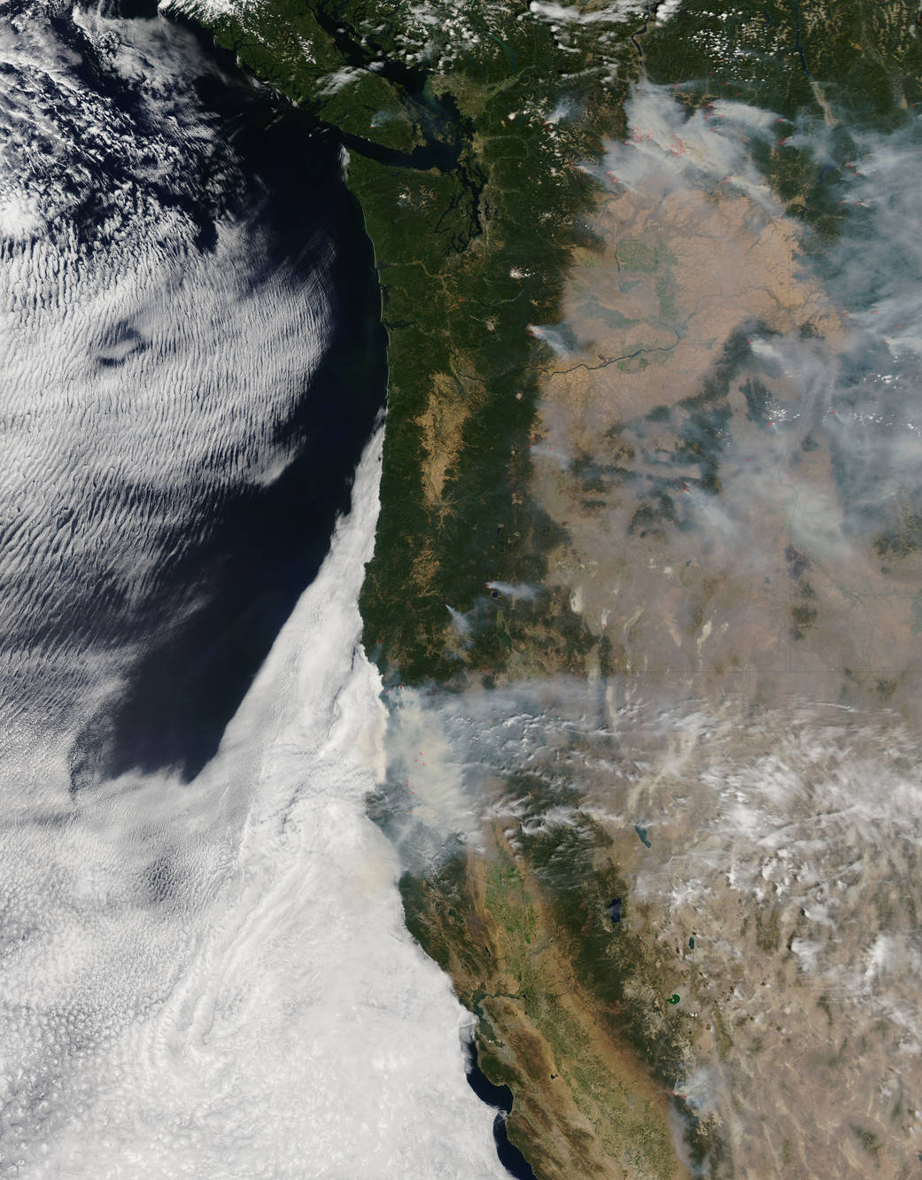
NASA’s Aqua satellite collected this natural-color image with the Moderate Resolution Imaging Spectroradiometer, MODIS, instrument on August 19, 2015. Actively burning areas, detected by MODIS’s thermal bands, are outlined in red. NASA image courtesy Jeff Schmaltz LANCE/EOSDIS MODIS Rapid Response Team, GSFC. Caption by Lynn Jenner