


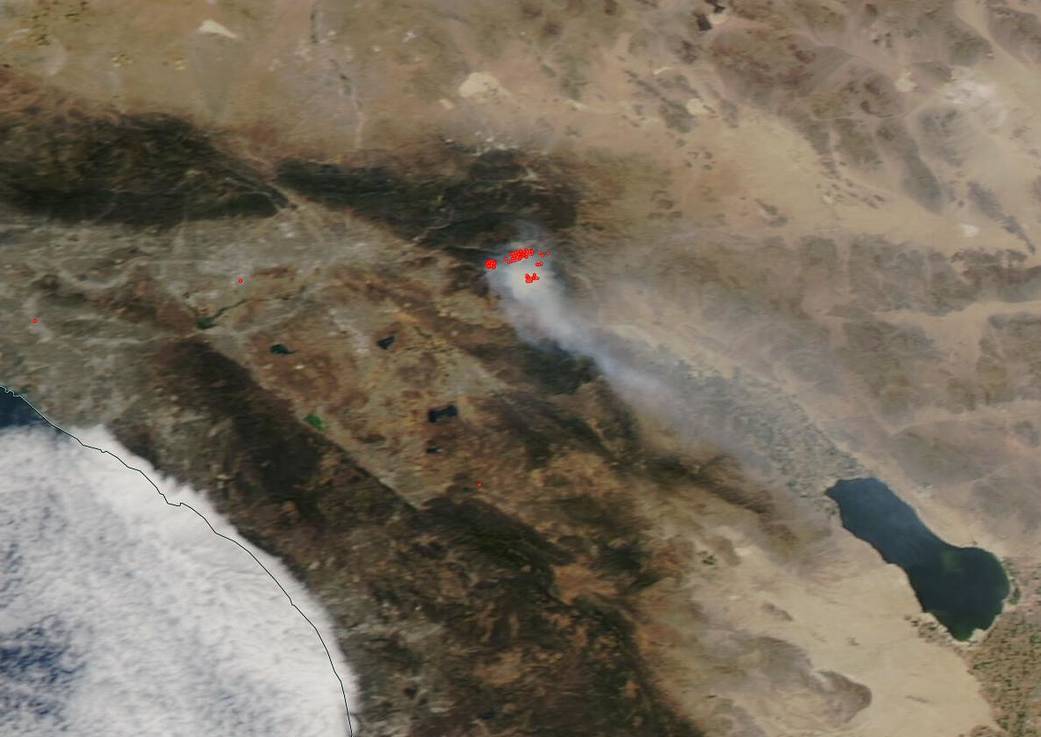
NASA’s Aqua satellite took images of the Apple Fire as it continued to spread north across the head of the Mill Creek Canyon, and east into the San Gorgonio Wilderness near San Bernardino, Calif. on Aug. 03, 2020. The fire is now burning into more wilderness (where vegetation is sparse) than wooded area limiting the intensity of the fire due to a lack of fuel. Continued fire activity is due to the record low moisture content of the vegetation fuel, high temperatures and low humidity throughout the area. The fire has grown to 26,850 acres and is 15% contained. The smoke from the fire has traveled almost 400 miles south affecting air quality. The smoke from the Apple fire is also commingling with the smoke from the Cassadore Springs and the Blue River 2 fires in Arizona. The cause of the fire which had been under investigation is now listed as “human caused.” Several areas around the fire have been evacuated. Contact local officials for more details or go to the Inciweb page for the fire.
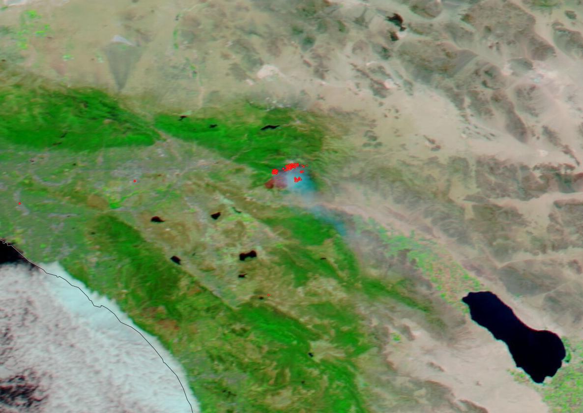
NASA’s Aqua satellite was able to provide two images of the fire. On the left side of the slider is the true color image of the Apple fire and the right side of the slider shows the corrected reflectance bands that help distinguish the areas of the ground that have been burned. This combination of bands is most useful for distinguishing burn scars from naturally low vegetation or bare soil and enhancing floods. It can also be used to distinguish snow and ice from clouds.
Weather concerns continue in the area. Warm and dry conditions are ongoing with winds gusting to 20 mph. Mid-week the conditions will persist with slightly cooler temperatures and a slight increase in relative humidity.
NASA’s satellite instruments are often the first to detect wildfires burning in remote regions, and the locations of new fires are sent directly to land managers worldwide within hours of the satellite overpass. Together, NASA instruments detect actively burning fires, track the transport of smoke from fires, provide information for fire management, and map the extent of changes to ecosystems, based on the extent and severity of burn scars. NASA has a fleet of Earth-observing instruments, many of which contribute to our understanding of fire in the Earth system. Satellites in orbit around the poles provide observations of the entire planet several times per day, whereas satellites in a geostationary orbit provide coarse-resolution imagery of fires, smoke and clouds every five to 15 minutes. For more information visit: https://www.nasa.gov/mission_pages/fires/main/missions/index.html
NASA’s Earth Observing System Data and Information System (EOSDIS) Worldview application provides the capability to interactively browse over 700 global, full-resolution satellite imagery layers and then download the underlying data. Many of the available imagery layers are updated within three hours of observation, essentially showing the entire Earth as it looks “right now.” Actively burning fires, detected by thermal bands, are shown as red points. Image Courtesy: NASA Worldview, Earth Observing System Data and Information System (EOSDIS). Caption: Lynn Jenner with information from Inciweb.