


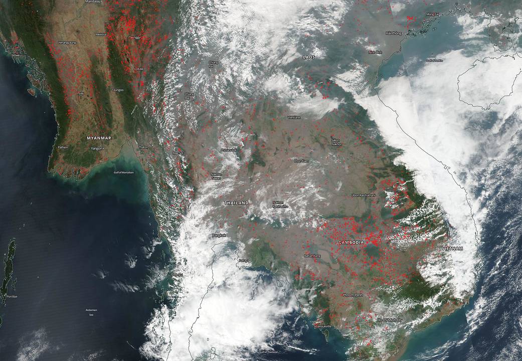
NOAA/NASA’s Suomi NPP satellite captured this image of the hundreds of fires burning across large swaths of land in both Myanmar and Cambodia on Feb. 18, 2020. There are many reasons that fires start including weather related ones such as lightning which will ignite dry trees and grasses. But in this instance the most likely reason for the fires is agricultural in nature. At this time of year farmers in southeast Asia light their fields on fire in order to clear them of detritus for the next growing season.
According to Adam Voiland of NASA’s Earth Observatory in an article from March 1, 2018, “People light fires in Southeast Asia for several reasons. In some forested areas, small-scale subsistence farmers practice swidden agriculture (also called slash-and-burn). The technique involves cutting down trees and shrubs, letting the wood dry out for a few months, and then burning it to clear fields. Hunters sometimes start fires to drive reclusive animals into view. Likewise, people collecting mushrooms sometimes burn the forest floor to make it easier to forage. Loggers use fire to clear roads and to clear the land after harvesting the most desirable species. In non-forested areas, farmers set fires to dispose of plant debris after harvesting rice, wheat, and other crops. Discarded cigarettes, sparks from vehicles, and problems with electrical systems also spark fires.”
NASA’s satellite instruments are often the first to detect wildfires burning in remote regions, and the locations of new fires are sent directly to land managers worldwide within hours of the satellite overpass. Together, NASA instruments detect actively burning fires, track the transport of smoke from fires, provide information for fire management, and map the extent of changes to ecosystems, based on the extent and severity of burn scars. NASA has a fleet of Earth-observing instruments, many of which contribute to our understanding of fire in the Earth system. Satellites in orbit around the poles provide observations of the entire planet several times per day, whereas satellites in a geostationary orbit provide coarse-resolution imagery of fires, smoke and clouds every five to 15 minutes. For more information visit: https://www.nasa.gov/mission_pages/fires/main/missions/index.html
NASA’s Earth Observing System Data and Information System (EOSDIS) Worldview application provides the capability to interactively browse over 700 global, full-resolution satellite imagery layers and then download the underlying data. Many of the available imagery layers are updated within three hours of observation, essentially showing the entire Earth as it looks “right now.” This satellite image was collected on Feb. 18. 2020. Actively burning fires, detected by thermal bands, are shown as red points. Image Courtesy: NASA Worldview, Earth Observing System Data and Information System (EOSDIS). Caption: Lynn Jenner with information from the Earth Observatory.