


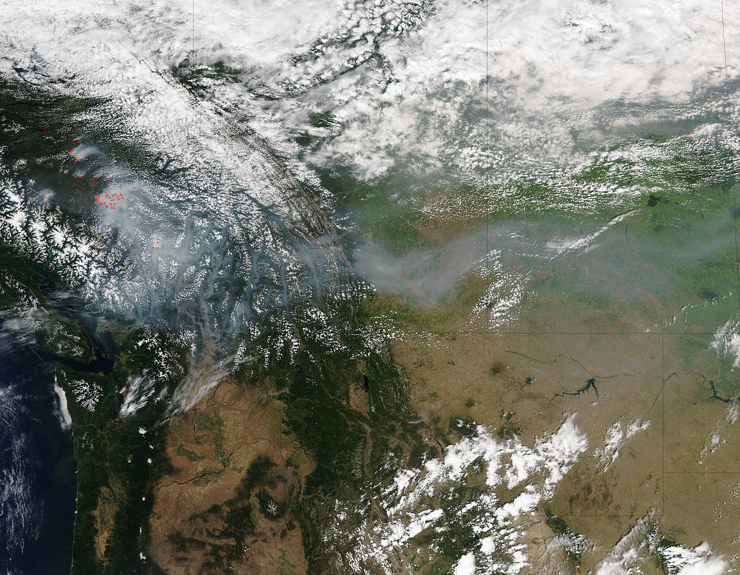
NASA’s Aqua satellite spotted smoke from a large area of wildfires burning in southern British Columbia, Canada.
This natural-color satellite image taken at 4:40 p.m. EDT (2040 UTC) on July 17, 2017 was collected by the Moderate Resolution Imaging Spectroradiometer or MODIS instrument that flies aboard NASA’s Aqua. The MODIS instrument can detect the heat signatures from the fires, and actively burning areas are outlined in red in the image. A large plume of smoke from the fires is seen blowing east over the southern part of the province of Alberta
There are many wildfires burning in British Columbia including near Tingley Lake and Williams Lake. Several large wildfires are raging just west of Kleena Kleene, an unincorporated settlement and recreational community on the western end of the Chilcotin Plateau. On July 17 Monday, July 17, 2017 at 4:10 p.m. EDT, the British Columbia Wildfire Service noted that the fires were located west of Highway 20, approximately 200 km west of Williams Lake. The fire is estimated at 5,000 hectares (12,360 square acres or 19.31 square miles).
The Cariboo Regional District has issued an evacuation order for affected areas: http://www.cariboord.bc.ca/services/emergency-and-protective-services/emergency-operations-centre-eoc.
For updates from the British Columbia Wildfire Service, visit: http://www2.gov.bc.ca/gov/content/safety/wildfire-status/wildfire-situation
NASA image courtesy NASA MODIS Rapid Response Team. Caption: NASA/Goddard, Rob Gutro