


In late May 2015, the highest volcano in the Galapagos Islands erupted for the first time in 33 years. The explosive eruption at Wolf volcano on Isabela Island sent volcanic gases and ash roughly 15 kilometers (50,000 feet) into the sky, while lava flowed through a fissure, down eastern and southeastern slopes, and eventually reached the sea. In early June, the sulfur-rich lava flows on the slopes appeared to subside.
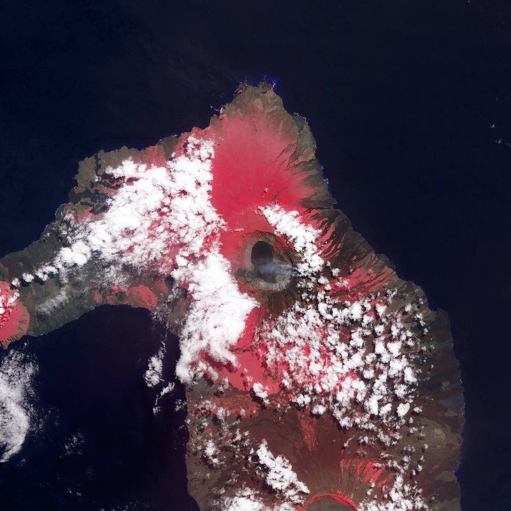
This image of Wolf was acquired on June 11, 2015, by the Advanced Spaceborne Thermal Emission and Reflection Radiometer (ASTER) on the Terra satellite. The false-color image combines near-infrared, red, and green light (ASTER bands 3-2-1), with vegetated areas appearing in red and lava generally appearing charcoal or black.
From June 12-16, seismologists from Ecuador’s Instituto Geofisico-Escuela Politécnica Nacional (IG) detected increased activity inside the caldera near the southern rim. The 7-kilometer (4 mile) wide caldera is nearly 700 meters deep. New lava is paving over deposits that were laid down in a 1982 eruption. Wolf is a shield volcano, with relatively broad but gentle slopes (like a Polynesian warrior’s shield) where one lava flow tend to spread out across previous flows. The volcano rises 1,710 meters (5,609 feet) above sea level, sitting near the equator and atop a volcanic hot spot.
In the early days of the 2015 eruption, conservation groups feared for the safety of a rare species of pink iguanas, which are only found on Isabela Island, and for the local population of giant tortoises and yellow iguanas. Neither species has been endangered so far by the eruption because ash and lave have tended to flow east and southeast, while the animals live mostly to the north and west of the summit.
More: NASA’s Earth Observatory
Image Credit: NASA Earth Observatory image by Jesse Allen, using data from NASA/GSFC/METI/ERSDAC/JAROS, and U.S./Japan ASTER Science Team
Caption: Mike Carlowicz