


![Request for Information – Potential [Placeholder for Prize]](https://assets.science.nasa.gov/dynamicimage/assets/science/psd/solar/2023/09/s/solarsystem_0.jpg?w=1024)


Earth observations taken from Space Shuttle Columbia during STS-78 mission
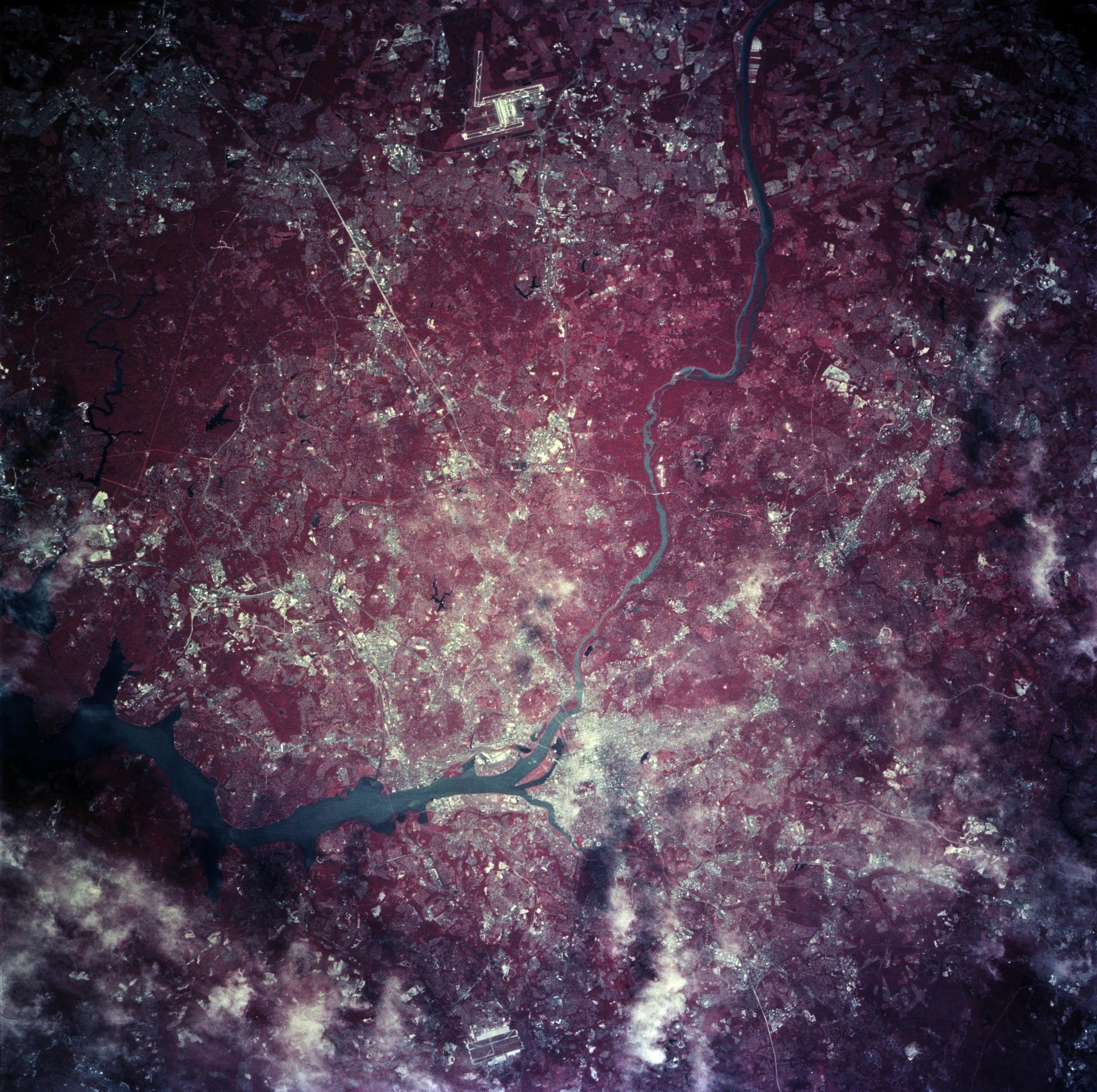
STS078-760-010 (20 June - 7 July 1996) --- As photographed with color infrared film by the crew of the Space Shuttle Columbia, the capital of the United States of America (the right of center) is located at the head of the navigable portion of the Potomac River. The Potomac separates the capital from Virginia to the southwest. It covers an area of 68-square-mile (177-square-kilometers). Andrews Air Force Base is seen east southwest of Washington D.C. at the right edge of the photo. Dulles International Airport is located west of the city on the left edge of the photo. Green vegetation shows up as red in the color infrared image.
- X
https://www.nasa.gov/image-detail/amf-sts078-760-010/
TakenJune 28, 1996
ProducerJSC
Size1920x1912px
PIA Numbersts078-760-010
