


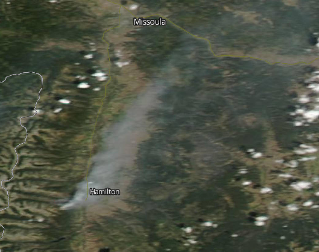
Montana’s Roaring Lion Fire has caused evacuations in western Montana, where it is raging in the Bitterroot National Forest, Darby Ranger District, 5 miles southwest of Hamilton. Smoke from the fire was seen by NASA’s Terra satellite.
Inciweb, an interagency all-risk incident information management system that coordinates with federal, state and local agencies to manage wildfires reported on Aug. 3 that the fire was zero percent contained and have covered 7,130 acres.
This natural-color satellite image was collected by the Moderate Resolution Imaging Spectroradiometer (MODIS) aboard the Terra satellite on Aug. 2, 2016. Actively burning areas, detected by MODIS’s thermal bands, are outlined in red. Roaring Lion Fire Information Sources: Inciweb: http://inciweb.nwcg.gov.
NASA image courtesy Jeff Schmaltz, MODIS Rapid Response Team
Caption: NASA/Goddard, Rob Gutro with information from Inciweb