


![Request for Information – Potential [Placeholder for Prize]](https://assets.science.nasa.gov/dynamicimage/assets/science/psd/solar/2023/09/s/solarsystem_0.jpg?w=1024)


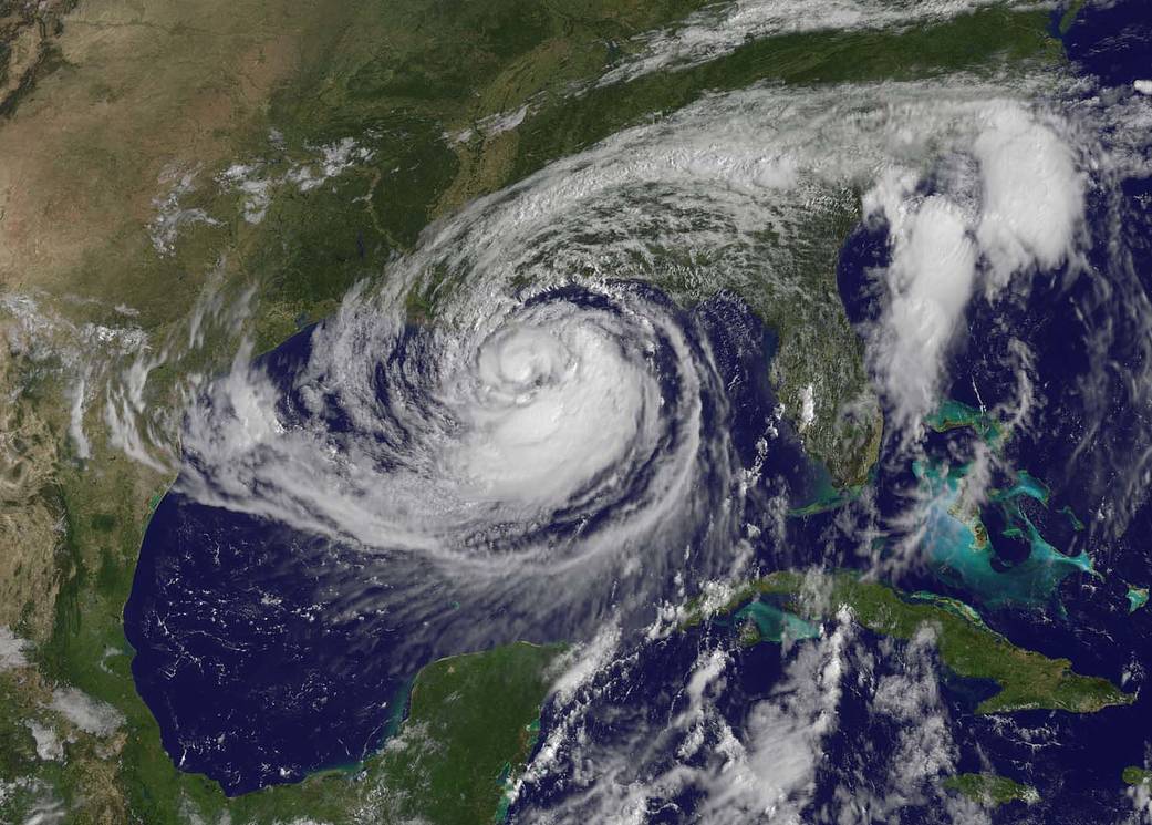
This visible image of Tropical Storm Isaac taken from NOAA's GOES-13 satellite shows the huge extent of the storm, where the eastern-most clouds lie over the Carolinas and the western-most clouds are brushing east Texas. The image was captured on Tuesday, Aug. 28, 2012 at 10:25 a.m. EDT.
NASA GOES Project
This visible image of Tropical Storm Isaac taken from NOAA’s GOES-13 satellite shows the huge extent of the storm, where the eastern-most clouds lie over the Carolinas and the western-most clouds are brushing east Texas.