


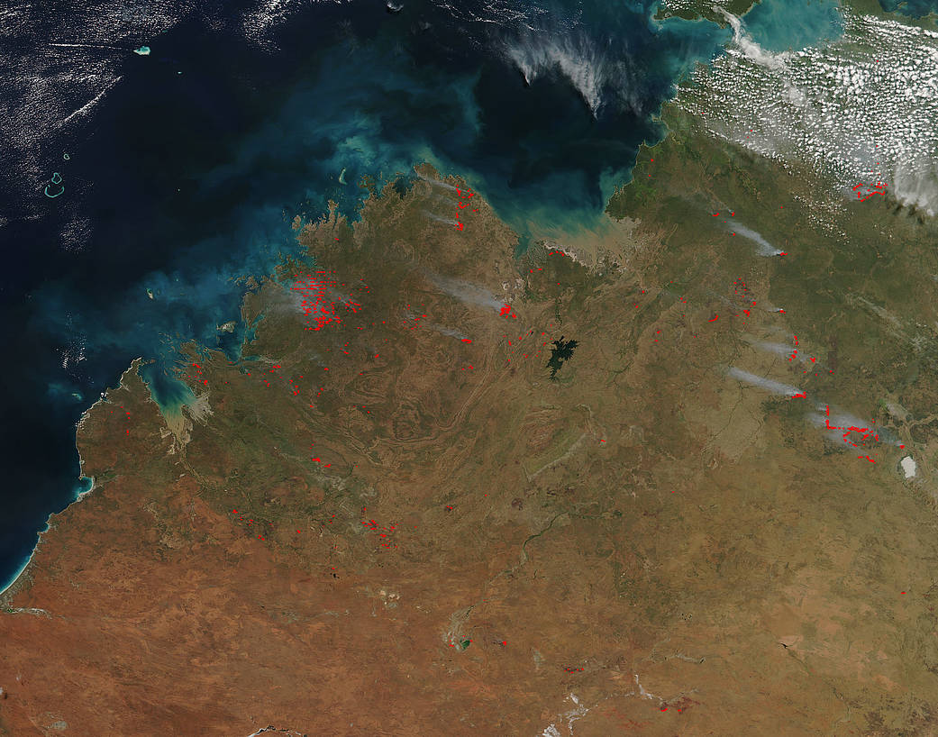
Bushfires crisscross the landscape in the Northern Territory of Australia. Winter and spring are times of increased fire danger in this area of the world and this satellite image shows the number of fire that are occurring in the Northern Territory. Most are caused by lightning strikes, and coupled with dry grassland, and low humidity they are given the right conditions to grow. As evidenced in this natural-color image captured by NASA’s Suomi NPP satellite, bushfires are on the rise in this Australian territory. The Suomi NPP satellite collected this image using the VIIRS (Visible Infrared Imaging Radiometer Suite) instrument on May 04, 2017. Actively burning areas, detected by MODIS’s thermal bands, are outlined in red. NASA image courtesy Jeff Schmaltz LANCE/EOSDIS MODIS Rapid Response Team, GSFC. Caption by Lynn Jenner
Suomi NPP is managed by NASA and NOAA.