


![Request for Information – Potential [Placeholder for Prize]](https://assets.science.nasa.gov/dynamicimage/assets/science/psd/solar/2023/09/s/solarsystem_0.jpg?w=1024)


Download PDF: Spacecraft Proximity Analysis Using the Exploration Visualization Environment
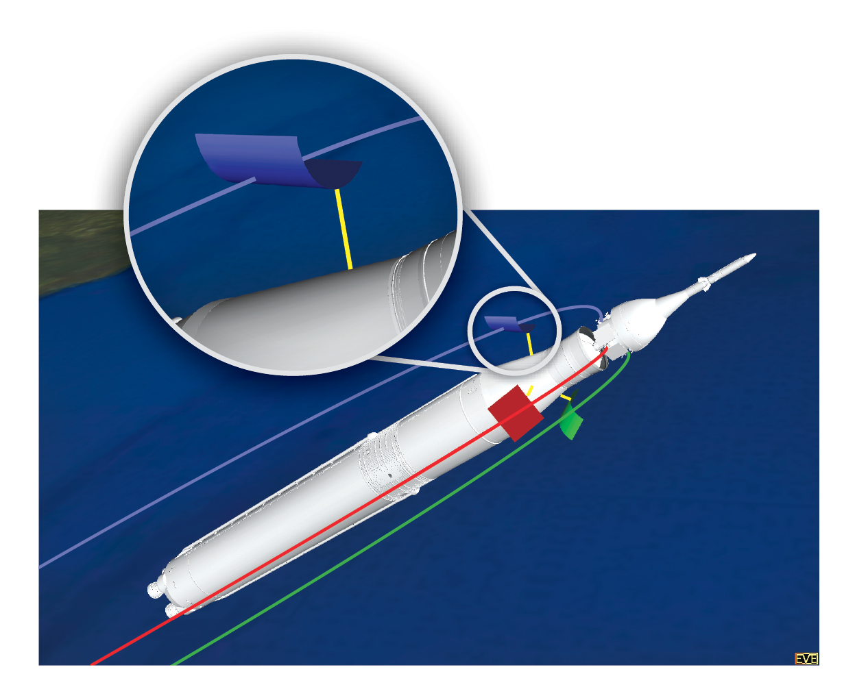
A graphical proximity analysis tool has been developed to aid in the study of spacecraft separation events. The NESC has been tasked with the requirement to analyze the separation events of numerous spacecraft operational scenarios, including the launch sequence of the Space Launch System (SLS), the separation of the launch abort system for the Commercial Crew Program, and the jettison of debris from the International Space Station (ISS). In each case, the complex relative motions between all spacecraft components are analyzed. The spacecraft and component trajectories are first simulated in the Program to Optimize Simulated Trajectories II (POST2). POST2 provides a generalized framework for simulating six degree-of-freedom masses for powered or unpowered vehicles near arbitrary rotating oblate planets. Obtaining and understanding the proximities between vehicle parts down to the closest point of approach for clearance analysis requirements, however, requires accurate geometric representations of the vehicles driven by the point mass dynamics. To that end, the Exploration Visualization Environment (EVE) tool, has been introduced. EVE has been used extensively to support space mission analysis requirements for programs and projects such as ISS assembly and operations, ISS payload operations, Mars Exploration Rovers, Ares 1X, Lunar Habitats and Landers, the Asteroid Redirect Missions, and human exploration of Mars.

EVE is a simulation, visualization, and analysis system designed to integrate time-dependent engineering data with detailed graphical models within a full-scale virtual environment. A useful EVE capability is that of proximity analysis. By taking the detailed engineering data provided by POST2 and integrating it with very detailed geometric models, EVE can analyze the system to determine the closest point of approach between objects. An extension was created for POST2 to enable a more formalized transfer of data between POST2 and EVE. Using EVE’s interactive virtual environment, the user obtains almost immediate feedback for a given POST2 analysis run by viewing the simulation in real time, visualizing proximity results in context of the mission scenario and events. The user also has the option to analyze thousands of POST2 simulation runs, such as those performed through Monte Carlo analysis, using an offline batch analysis mode. The results of the analyses are stored in report files, providing proximity distance data as a function of time for all analysis runs. Specific runs can be brought back into EVE and visualized as required. Using the built in media capture system, the user may export images and animations showing points of closest approach. The flexibility of EVE and POST2 are continually improved through regular maintenance and updates. In addition, EVE is adaptable to any trajectory program. EVE is available to all NASA programs and projects.
More information on EVE and POST2 can be found at eve.larc.nasa.gov and post2.larc.nasa.gov.