


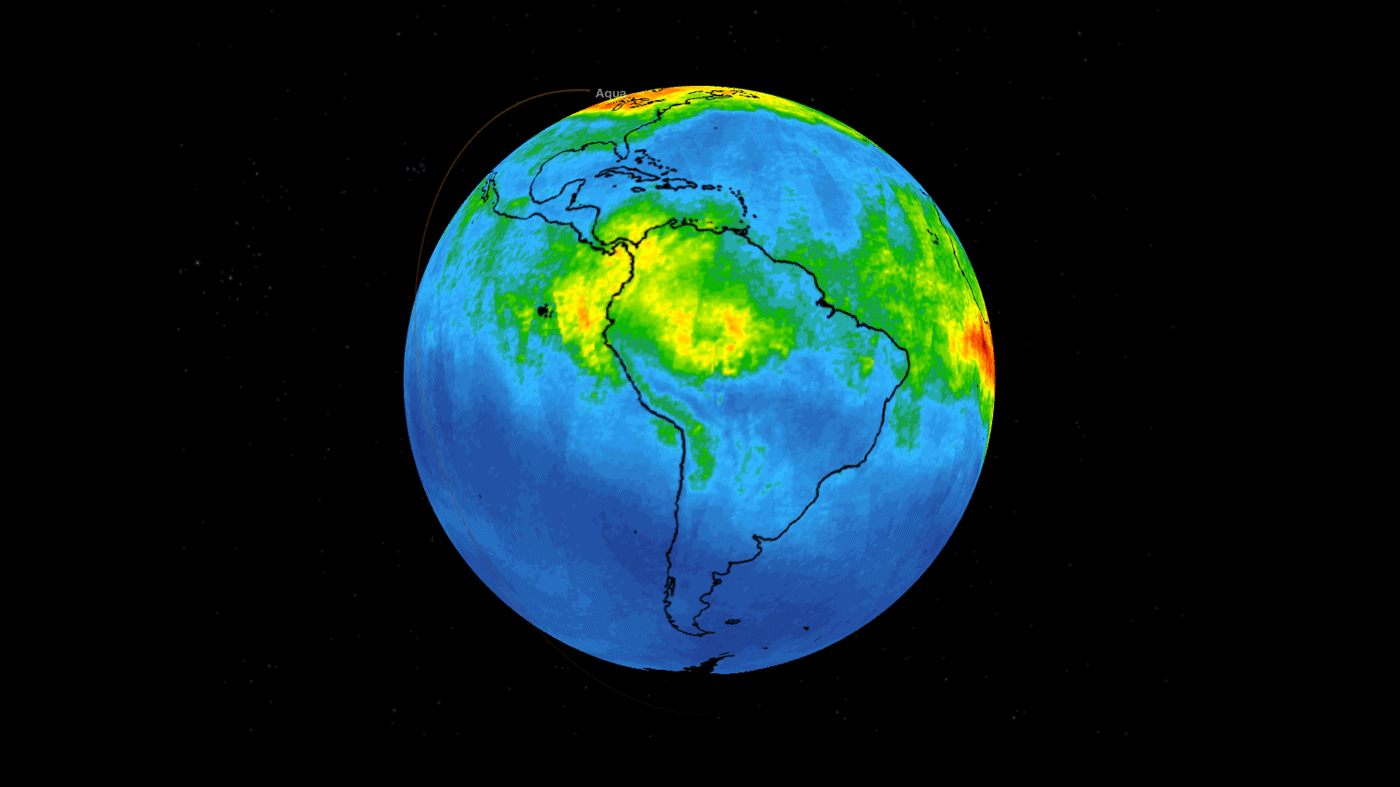
New data from NASA’s Atmospheric Infrared Sounder (AIRS) instrument, aboard the Aqua satellite, shows the movement high in the atmosphere of carbon monoxide associated with fires in the Amazon region of Brazil.
This time series maps carbon monoxide at an altitude of 18,000 feet (5,500 meters) from Aug. 8-22, 2019. As the series progresses, the carbon monoxide plume grows in the northwest Amazon region then drifts in a more concentrated plume toward the southeastern part of the country.
Each “day” in the series is made by averaging three days’ worth of measurements, a technique used to eliminate data gaps. Green indicates concentrations of carbon monoxide at approximately 100 parts per billion by volume (ppbv); yellow, at about 120 ppbv; and dark red, at about 160 ppbv. Local values can be significantly higher.
A pollutant that can travel large distances, carbon monoxide can persist in the atmosphere for about a month. At the high altitude mapped in these images, the gas has little effect on the air we breathe; however, strong winds can carry it downward to where it can significantly impact air quality. Carbon monoxide plays a role in both air pollution and climate change.
AIRS, in conjunction with the Advanced Microwave Sounding Unit (AMSU), senses emitted infrared and microwave radiation from Earth to provide a three-dimensional look at Earth’s weather and climate. With more than 2,000 channels sensing different regions of the atmosphere, the instruments create a global, three-dimensional map of atmospheric temperature and humidity, cloud amounts and heights, greenhouse gas concentrations and many other atmospheric phenomena.
The AIRS and AMSU instruments are managed by NASA’s Jet Propulsion Laboratory in Pasadena, California, under contract to NASA. JPL is a division of Caltech.
More information about AIRS can be found at:
Esprit Smith
Jet Propulsion Laboratory, Pasadena, Calif.
818-354-4269
esprit.smith@jpl.nasa.gov
2019-173