Editor’s Note, Aug. 5, 2022: This story has been updated with a clarification regarding Landsat 7’s instrumentation.
On a warm July day in 1972, NASA launched a new Earth-imaging satellite called the Earth Resources Technology Satellite. “ERTS” was the first satellite of what later became NASA and the U.S. Geological Survey’s Landsat Program, an ambitious effort with a vision of documenting the entirety of Earth from space. The first Landsat was so successful it led to a series of satellites that have created the longest contiguous record of Earth’s surface from a space-eye view – that continues growing to this day, 50 years later.
“The early Landsats revolutionized the way we observed the Earth from space,” said Jim Irons, director emeritus of the Earth Sciences Division at NASA’s Goddard Space Flight Center in Greenbelt, Maryland.
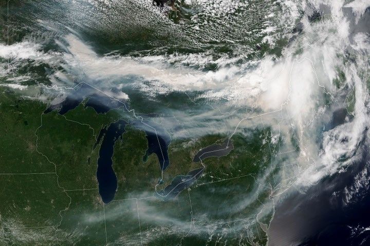
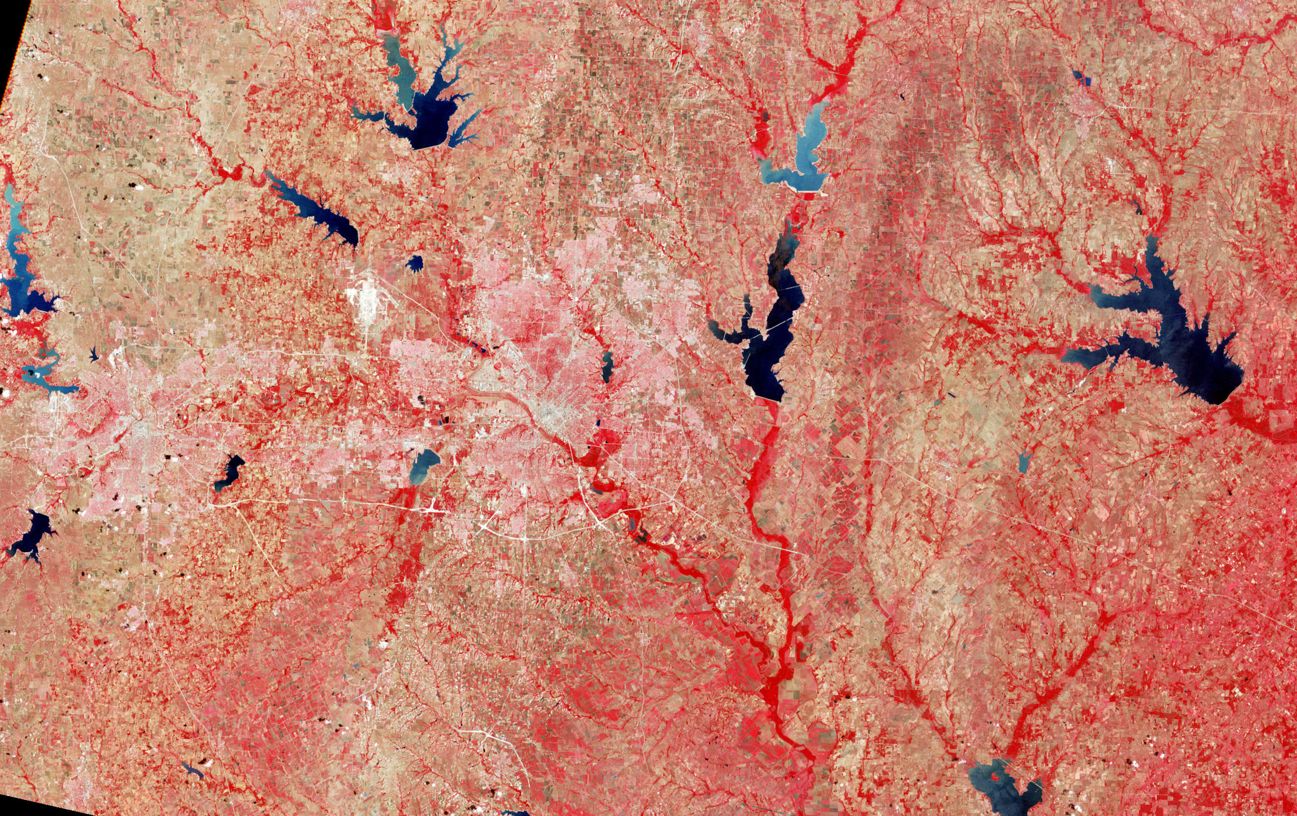
Since its debut, Landsat has amassed over 10 million images. These images, also called scenes, show current snapshots of land and coasts, but pair with images of years past and they also reveal changes through time – glaciers slowly disappearing, or urban spaces sprawling across the landscape.
These scenes and time series have myriad applications around the globe: Hydrologists use them to track how rivers change; ecologists use them to determine the extent of deforestation; farmers and agricultural organizations use them to analyze crop health.
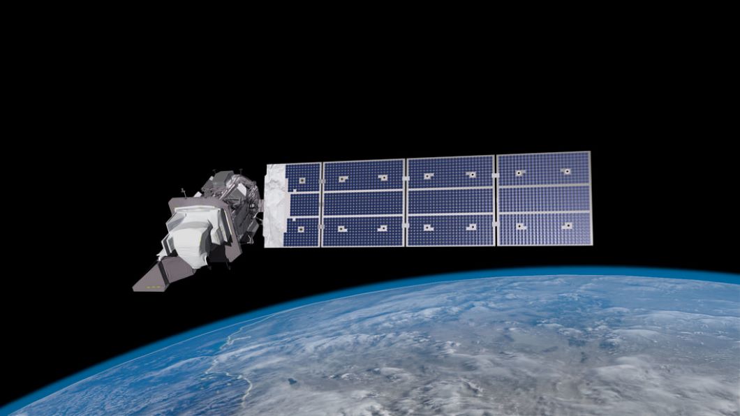
During Landsat’s five decades, eight different Landsat satellites have circled the planet. Currently, three continue to collect global observations from space: Landsats 7, 8, and 9. (Landsat 6 was lost shortly after launch.) Landsat 9, the newest of the bunch, entered orbit in fall of 2021. While Landsat 9 shares similarities with its predecessors, the Landsat satellite design has evolved immensely since the program’s emergence.
Early Days
The first two Landsats could see in four spectral bands, or wavelengths of light: visible light in red and green, and two near-infrared bands. The near-infrared allowed the satellites to distinguish vegetation from other land cover and assess plant health, while the visible wavelengths differentiated bright surfaces, like snow, deserts and clouds, from dark surfaces like water. Each scene encompassed a roughly square area of around 115 miles to a side.
Credits: NASA’s Goddard Space Flight Center
Download this video in HD formats from NASA Goddard’s Scientific Visualization Studio
The first Landsats’ data transmitted to Earth were recorded on magnetic tapes, the same basic tech as music cassettes – but much bigger: The bulky wideband video tape recorders that flew on the first three Landsats each had 1,800 feet of tape and weighed in at 76 pounds apiece.
From this data, scientists generated and printed out photographic images. These photos gave a general space-eye view of an area, but the real power of the data came after computer algorithms helped scientists and resource managers to more efficiently identify the categories of land cover they represented. Printers spat out paper maps with letter, number, and symbol combinations, where each character represented a land cover category, such as cropland or forest.
“You’d get out colored pencils or magic markers and you’d color the different characters, each with its own color,” Irons said. “That would give you an early version of a color-coded land cover map.”
Goddard was NASA’s home for Landsat going back to the program’s inception. Irons served as the deputy project scientist on Landsat 7 and project scientist on Landsat 8, helping to further shape the program and playing a pivotal role in the satellites’ development. In his 43 years working with Landsat, he’s watched the satellites grow into what they are today.
Landsat data in the ’80s and ’90s were critical to many projects, such as understanding the extent of tree loss in rainforests, Irons said. Likewise, Chris Neigh, Landsat 9’s project scientist at Goddard, uses time series to watch the slow northward creep of boreal forests, as the trees progressively inch toward the pole in response to global warming. The long pedigree of Landsat data is essential for this kind of research, Neigh added: there are few other records to reference, and none as comprehensive.
2000s: Free Access to the Landsat Archive
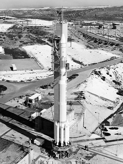
After a failed launch of Landsat 6, Landsat 7 embarked successfully in 1999, equipped with an improved instrument. NASA deliberated for seven years between the launches of Landsat 7 and Landsat 8, trying to decide how to move forward with the program before beginning another seven-year process of building and launching the next satellite.
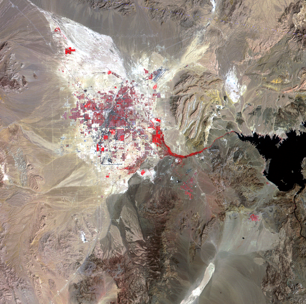
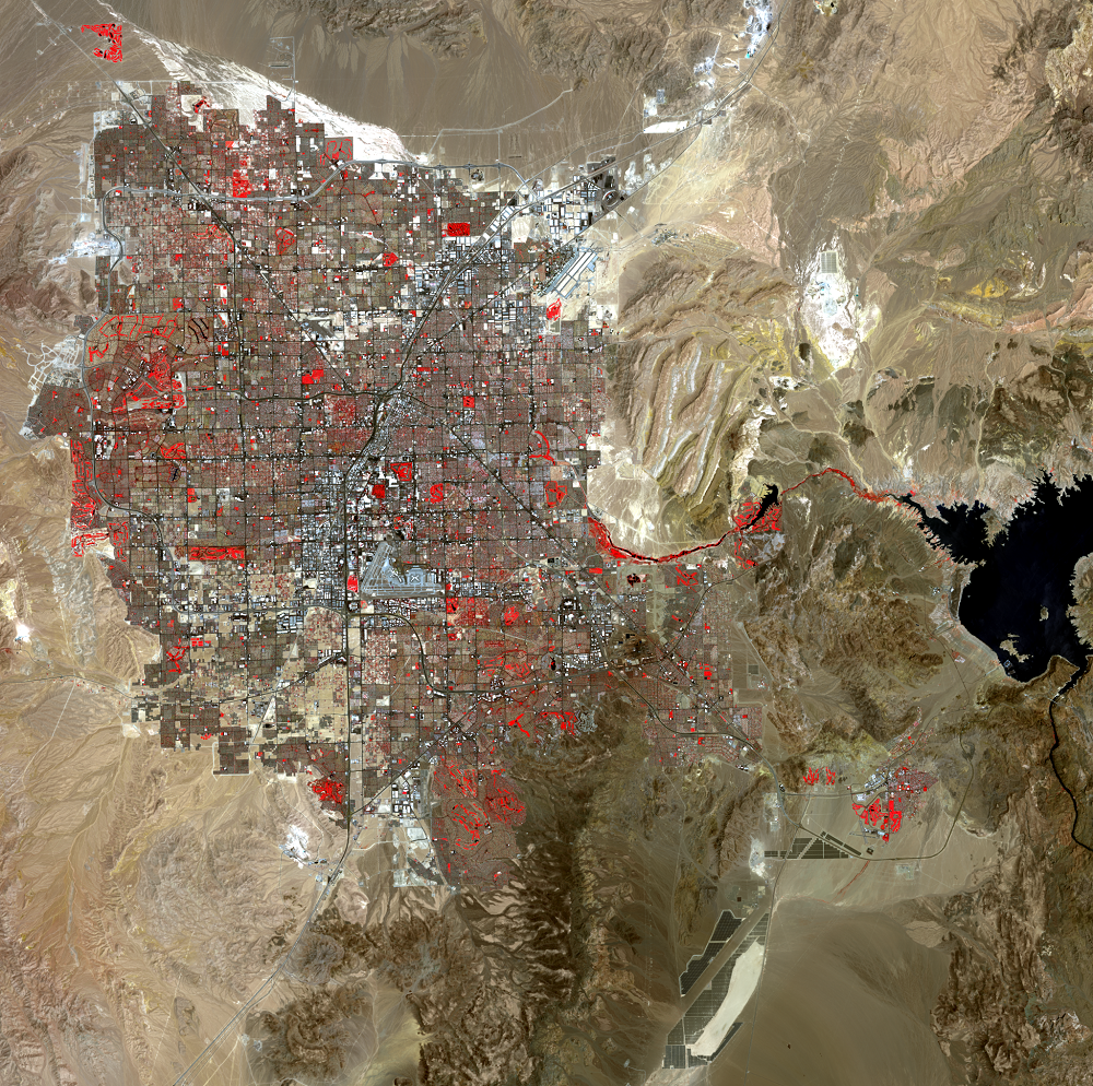
In that time, image management returned from commercial providers to USGS, which made the entire Landsat archives freely available in 2008. Image requests skyrocketed. Landsat all-time downloads topped 100 million scenes in 2020, and the number continues to rise.
As Landsat continues to transform, the people and projects that use it grow too: The United States Department of Agriculture relies on Landsat to guide farmers in watering practices and land management; climate scientists watch glaciers retreat as temperatures rise; in the drought-stricken West, water managers monitor reservoir levels.
Landsat’s Next Adventure
With a data user community that keeps growing, scientists and engineers are already looking forward to the next mission. NASA and USGS are developing options for the next iteration of Landsat, currently called Landsat Next.
Landsat’s eyes in space have granted new opportunities for understanding our changing planet, but the simple awe of seeing Earth is sometimes forgotten, Irons said.
“We can’t all be astronauts,” Irons said. “But if we look at Landsat images, we can understand what the Earth would look like if we were orbiting the Earth in space.”
Banner Image: Artist’s conception of the Landsat 9 spacecraft, the ninth satellite launched in the long-running Landsat program, high above the U.S. Credit: NASA
By Jude Coleman
NASA’s Goddard Space Flight Center, Greenbelt, Md.
Media Contact: Jake Richmond,
NASA’s Goddard Space Flight Center, Greenbelt, Md.