


Remnant Clouds of Former Tropical Storm Emily over Atlantic
Former Tropical Storm Emily appeared as swirl of clouds on imagery from NOAA’s GOES-East satellite on August 2.
At 11 p.m. EDT on August 1, the National Hurricane Center issued their final advisory on Post Tropical Cyclone Emily. At that time NHC said that the center of Emily had become exposed again and that the system had not produced any organized thunderstorms in the previous 24 hours. Emily had also become embedded within a frontal zone, and no analysis showed Emily with a warm core. As a result, Emily had lost the requisite characteristics of a tropical cyclone, and was declared post-tropical. At that time, Emily was located near 30.9 degrees north latitude and 78.0 degrees west longitude, about 235 miles northeast of Cape Canaveral, Florida.
At 8:30 a.m. EDT (1230 UTC) on August 2, NOAA’s GOES-East satellite captured a visible image of Emily’s remnant clouds far off the coast of South Carolina. NOAA manages the GOES series of satellites and the NASA/NOAA GOES Project creates images and animations from the data.
NHC expects dissipation of the low pressure area within two days as it opens up into an elongated area of low pressure or trough.
By Rob Gutro
NASA’s Goddard Space Flight Center
Aug. 01, 2017 – NASA Tracks Tropical Depression Emily Across Florida into Atlantic
Just after Tropical Storm Emily made landfall in west central Florida, NASA’s Terra satellite passed overhead. As Emily was weakening and tracking east across the Sunshine State, NASA used data from NOAA’s GOES-East satellite to create an animation that showed Emily’s progression toward the Atlantic Ocean.
On July 31 at 11:55 a.m. EDT (1555 UTC) the Moderate Resolution Imaging Spectroradiometer or MODIS instrument aboard NASA’s Terra satellite captured a visible-light image of Tropical Storm Emily over west central Florida. The image showed that the storm had consolidated and appeared rounded in visible imagery.
By 5 a.m. EDT (0900 UTC) on August 1, Emily had already tracked east across Florida and slid into the Atlantic Ocean. The center of Tropical Depression Emily was located near 28.3 degrees north latitude and 80.1 degrees west longitude. That’s about 50 miles (85 km) north-northeast of Vero Beach, Florida. Maximum sustained winds were near 30 mph (45 kph) with higher gusts.
The National Hurricane Center (NHC) said that some slight strengthening is possible during the day or so, but Emily is also forecast to lose its tropical characteristics within a day or two. The estimated minimum central pressure is 1011 millibars.
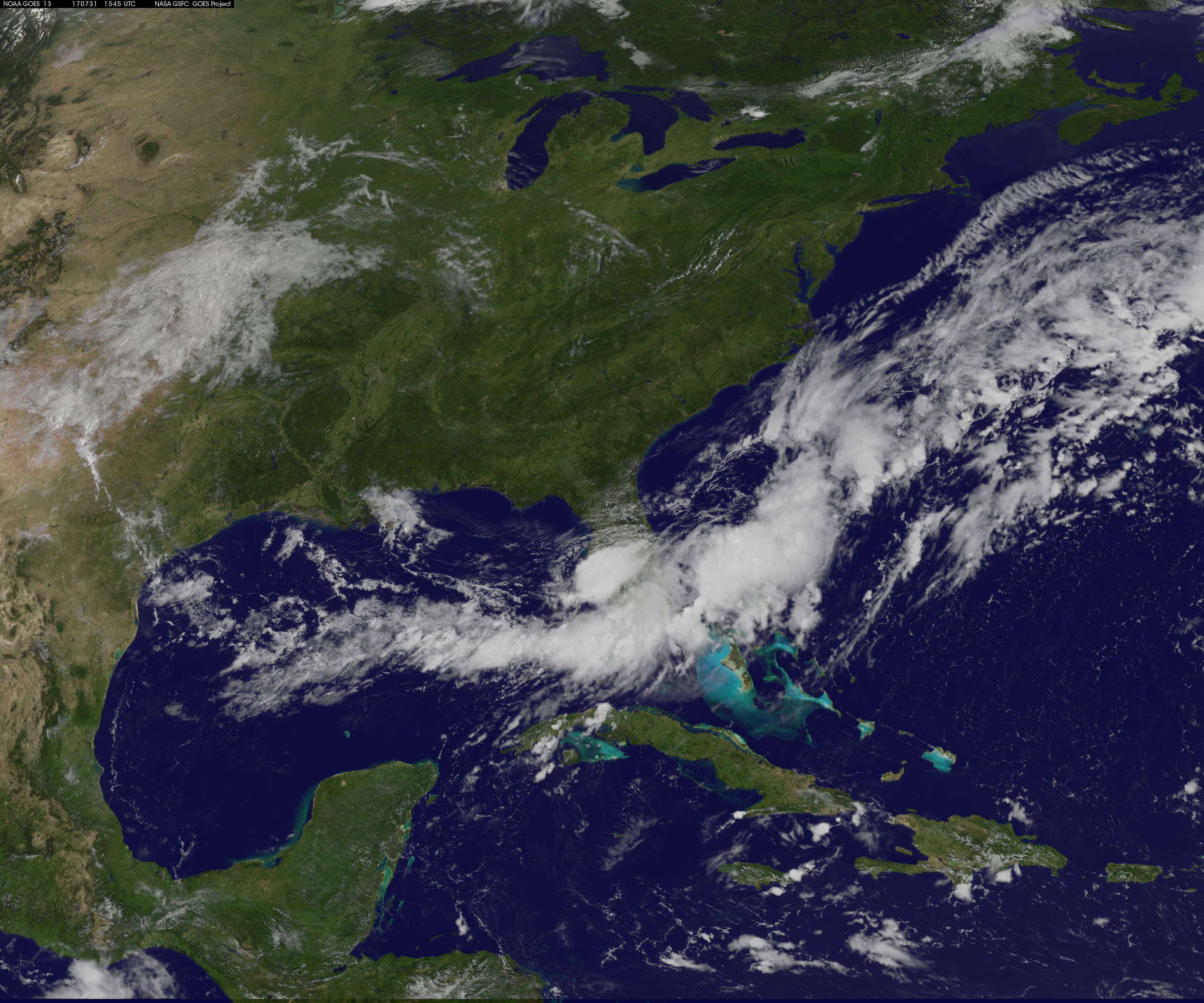
Infrared and visible imagery of Emily from July 30 to August 1 was captured by NOAA’s GOES-East satellite captured and made into an animation from NASA/NOAA’s GOES Project at NASA’s Goddard Space Flight Center in Greenbelt, Maryland. NOAA manages the GOES series of satellites, and NASA uses the satellite data to create images and animations. The animation showed the storm really consolidated on July 31 along the central west coast of Florida, then tracked east over the state and exited into the Western North Atlantic Ocean on August 1. Clouds seen in the animation as a line south of Emily’s center are associated with a stationary front.
Credits: NASA/NOAA GOES Project
On August 1, NHC said that radar and surface observations over east-central Florida indicate that Emily’s circulation has become quite elongated. Water vapor imagery also shows that drier mid-level air has moved over the northwestern portion of the circulation, which has limited the amount of convection near the center overnight. Some deep convection is noted along a trough axis well to the northeast of Emily.
The depression was moving toward the east-northeast near 12 mph (19 kph) and a turn toward the northeast with an increase in forward speed is expected later in the day on August 1. On the forecast track, the center of Emily will move away from the east-central coast of Florida today and remain well off the southeast U.S. coast during the next couple of days.
For updated forecasts on Emily, visit: www.nhc.noaa.gov
By Rob Gutro
NASA’s Goddard Space Flight Center
July 31, 2017 – NASA Sees Tropical Storm Emily Before and After Landfall
NASA has captured infrared and visible imagery before and after Tropical Storm Emily formed in the Gulf of Mexico and made landfall in Florida.
On July 31, a Tropical Storm Warning was in effect for Anclote River to Bonita Beach, Florida.
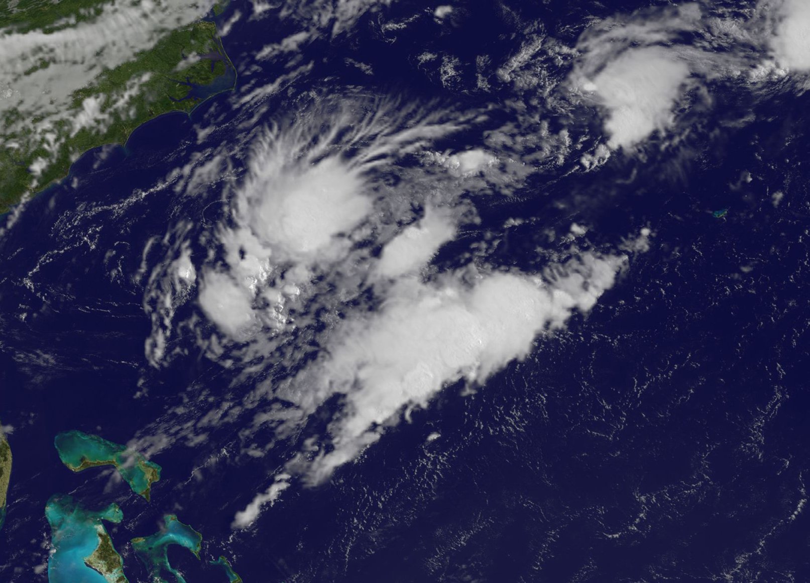
The Atmospheric Infrared Sounder or AIRS instrument aboard NASA’s Aqua satellite captured infrared data on the cloud top temperatures as Tropical Storm Emily was developing on July 30 at 0723 UTC (3:23 a.m. EDT) in the northeastern Gulf of Mexico along the Florida coast. The AIRS data showed a small area of strong thunderstorms with cloud top temperatures as cold as minus 63 degrees Fahrenheit (minus 53 degrees Celsius). NASA research has shown that storms with cloud tops that high in the troposphere have the potential to create heavy rainfall.
On July 31, that rainfall potential was part of the forecast from the National Hurricane Center (NHC). NHC noted that Emily is expected to produce total rain accumulations of 2 to 4 inches through Monday night along the west coast of central Florida between the Tampa Bay area and Naples, with isolated amounts up to 8 inches possible.
Tropical Depression Six formed on July 31 at 6 a.m. EDT near the west-central coast of Florida.
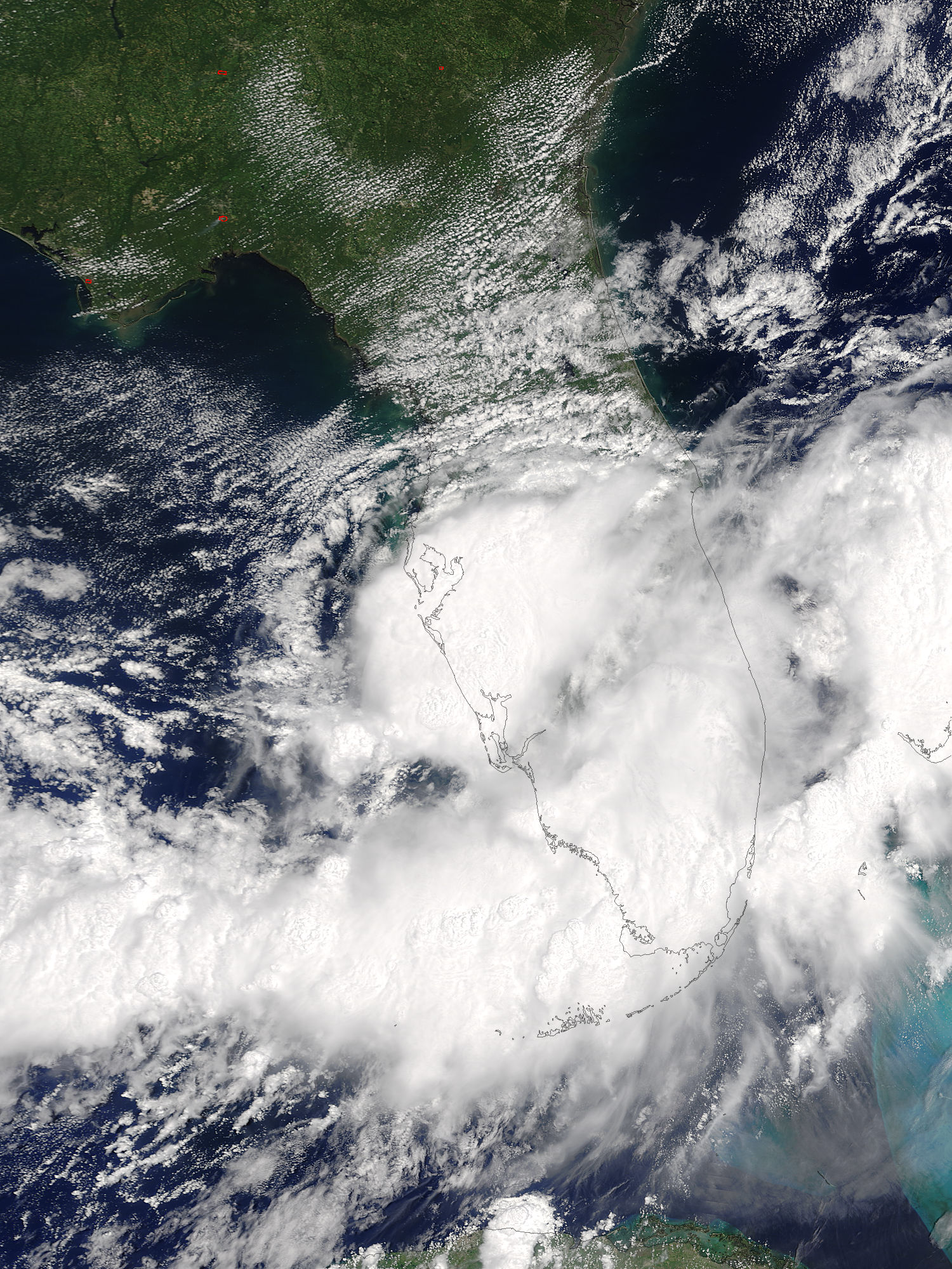
At 10:45 a.m. EDT on Monday, July 31, Tropical Storm Emily made landfall. The NHC said NOAA Doppler weather radar data and surface observations indicate that Tropical Storm Emily made landfall at 10:45 a.m. EDT (1445 UTC) on Anna Maria Island, just west of Bradenton, Florida.
The center of Tropical Storm Emily was located near 27.5 degrees north latitude and 82.7 degrees west longitude. Emily was moving toward the east near 9 mph (15 kph), and this general motion is expected to continue today. NHC forecasters said “a turn toward the northeast with an increase in forward speed are expected by tonight and Tuesday. On the forecast track, the center of Emily is expected to move inland over the the west-central Florida peninsula this afternoon, and move across central Florida through tonight. Emily is forecast to move offshore of the east-central Florida coast Tuesday morning.”
Maximum sustained winds are near 45 mph (75 kph) with higher gusts. Little change in strength is forecast until landfall occurs this afternoon.
At 11:45 a.m. EDT (1545 UTC) NOAA’s GOES-East satellite captured a visible image of Emily that showed the storm’s center over the west coast of central Florida, with clouds extending to the Atlantic.
NOAA manages the GOES series of satellites. NASA/NOAA’s GOES Project at NASA’s Goddard Space Flight Center in Greenbelt, Maryland uses the satellite data to create imagery.
Emily is expected to weaken to a tropical depression while it moves across the Florida peninsula later today and tonight.
For forecast updates on Emily, visit: www.nhc.noaa.gov.
By Rob Gutro
NASA’s Goddard Space Flight Center