


![Request for Information – Potential [Placeholder for Prize]](https://assets.science.nasa.gov/dynamicimage/assets/science/missions/a-step/FFR_Earth_Background_20251120%20.png?w=1024)


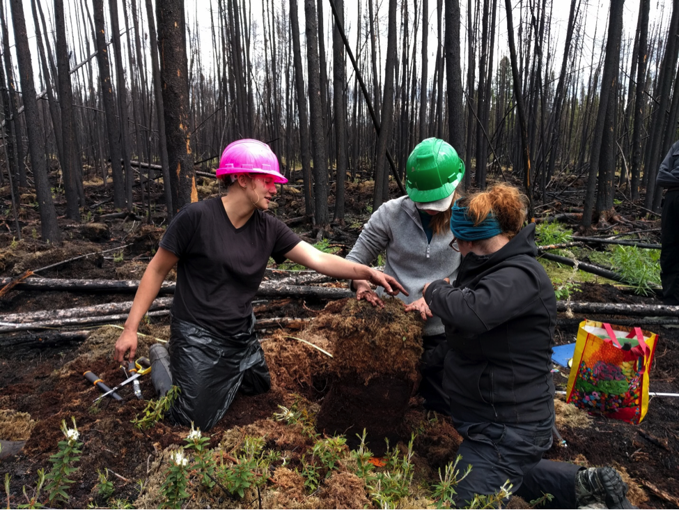
Sampling charred soils in Saskatchewan, outfitting robins with GPS backpacks in Alberta, and measuring the growth rates of trees in northern Alaska – scientists with a decade-long NASA project are in the field this summer to study the impacts of a rapidly warming climate.
The Arctic Boreal Vulnerability Experiment, or ABoVE campaign, which started field work in Alaska and northwestern Canada this spring, continues this month with more research into the region’s changing forests, carbon cycle, thawing permafrost, shifting wildlife habitat and more.
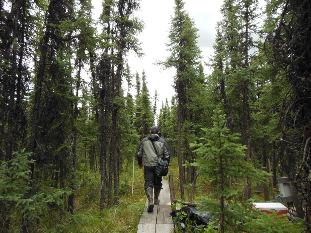
“There are people scattering to the four winds, measuring all sorts of things – the impact of wildfires on the carbon cycle, the structure and health of boreal forests, and depth of permafrost thaw,” said Scott Goetz, ABoVE science team lead and deputy director at Woods Hole Research Center in Falmouth, Massachusetts. While the locations and types of measurements vary, the work is all part of a highly coordinated effort to study the vulnerability of northern ecosystems and society to environmental change.
As part of the ABoVE project, these field measurements gathered over the next decade will be added to data collected by NASA airborne instruments, satellites and other agency programs. More than three dozen research groups, led by scientists from NASA, universities and other agencies and institutions, are taking part in the effort.
Natalie Boelman, an ABoVE researcher with the Lamont-Doherty Earth Observatory of Columbia University in New York, is just beginning to get data back from her April field campaign to northern Alberta. She and her colleagues netted American robins and then outfitted them with GPS backpacks.
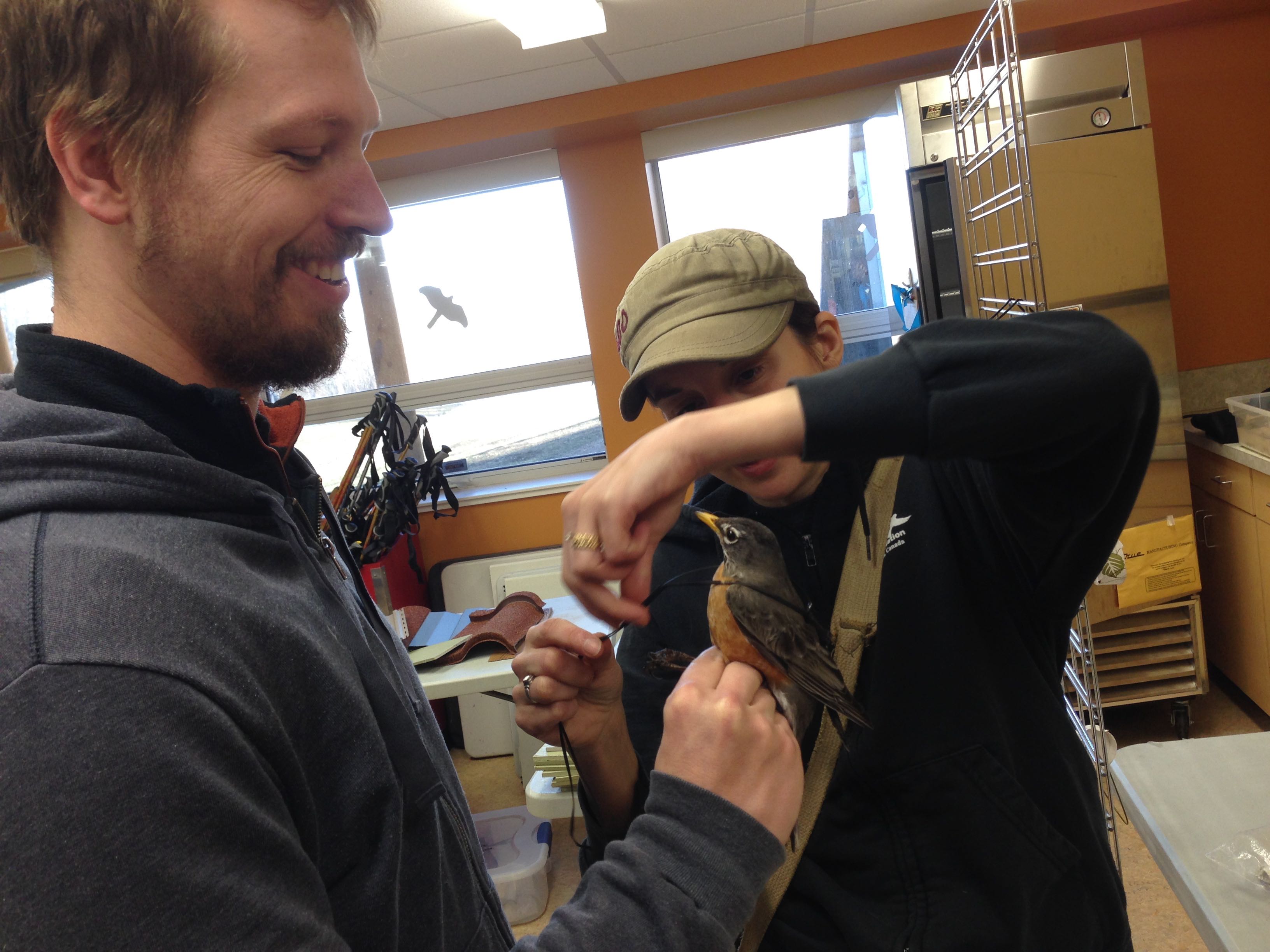
“It definitely took a lot of patience, there were days when we didn’t catch any birds and days when we caught a bunch,” Boelman said. “Now their data have just started to come in.” The backpack tags record where each bird was every other day for two months, then transmit the data back. It will take a while to properly analyze and understand the data, she said, but a first glance at the data reveals that a few of the American robins caught in Alberta migrated to locations in northern Alaska to breed.
As part of her ’Animals on the Move’ project, Boelman and her team are investigating how warming temperatures in boreal regions are affecting the habitat, migration patterns and other behavior of animals. The data will then be studied along with information about how climate change is impacting habitat, migration patterns and general movements of not only robins, but a whole suite of iconic northern wildlife, including caribou, bears, golden eagles and moose.. Researchers will also use other measurements and data collected by their colleagues from other sites to investigate how the larger ecosystem is changing.
ABoVE field research this season is all on-the-ground, although airborne campaigns will play a key part in the 2017 and 2019 campaigns. Research gathered this summer, however, will help scientists analyze images and data already gathered by satellites and airplanes. Bruce Cook, a scientist with NASA’s Goddard Space Flight Center in Greenbelt, Maryland, has partnered with the U.S. Forest Service to use historic aerial photographs and ground measurements from the 1980s to evaluate changes over the last three decades.
“We’ve long had indications from satellites that portions of the boreal and tundra zones are responding to climate change,” Cook said, noting that some areas are “greening” due to plant growth and shrinking wetlands in a warmer and drier climate, while other areas are “browning” as drought, insects or wildfires kill plant communities. “But these characteristics and processes that give rise to a greening or browning trend are unclear – we need to dig further.”
A Forest Service crew will re-survey those plots in July, taking samples of soils and trees, measuring depth to permafrost, and quantifying the composition and size of trees, shrubs and ground cover. With these field data – along with data from contemporary aerial photographs, Goddard’s Lidar, Hyperspectral & Thermal (G-LiHT) airborne imager, and satellite time series – Cook and his colleagues will document the many different types of changes that are occurring across a vast and expansive landscape.
Other research groups this summer are studying how fires impact the carbon cycle, Goetz said, and looking at whether shrubs are encroaching into tundra. About a third of the carbon stored on land is in arctic and boreal regions worldwide, making the ecosystems key sites for studies. They’ll examine where and how fast permafrost is thawing, and how these frozen soils respond to wildfires. Scientists in the field will also be taking measurements of the carbon dioxide and methane moving between the atmosphere and the land surface of these ecosystems.
“We’re off to a very strong start, and now we’ve got people in the field for the first field season,” he said. “It’s exciting.”
For more information about ABoVE and other current NASA field campaigns, visit: