After being delayed over a year due to the pandemic, a NASA field campaign to study the role of small-scale whirlpools and ocean currents in climate change is taking flight and taking to the seas in May 2021.
Using scientific instruments aboard a self-propelled ocean glider and several airplanes, this first deployment of the Sub-Mesoscale Ocean Dynamics Experiment (S-MODE) mission will deploy its suite of water- and air-borne instruments to ensure that they work together to show what’s happening just below the ocean’s surface. The full-fledged field campaign will begin in October 2021, with the aircraft based out of NASA’s Ames Research Center in Mountain View, California.
“This campaign in May is largely to compare different ways of measuring ocean surface currents so that we can have confidence in those measurements when we get to the pilot in October,” said Tom Farrar, associate scientist at the Woods Hole Oceanographic Institution in Massachusetts and principal investigator for S-MODE.
The S-MODE team hopes to learn more about small-scale movements of ocean water such as eddies. These whirlpools span about 6.2 miles or ten kilometers, slowly moving ocean water in a swirling pattern. Scientists think that these eddies play an important role in moving heat from the surface to the ocean layers below, and vice versa. In addition, the eddies may play a role in the exchange of heat, gases and nutrients between the ocean and Earth’s atmosphere. Understanding these small-scale eddies will help scientists better understand how Earth’s oceans slow down global climate change.

A Self-Powered Surfboard, for Science!
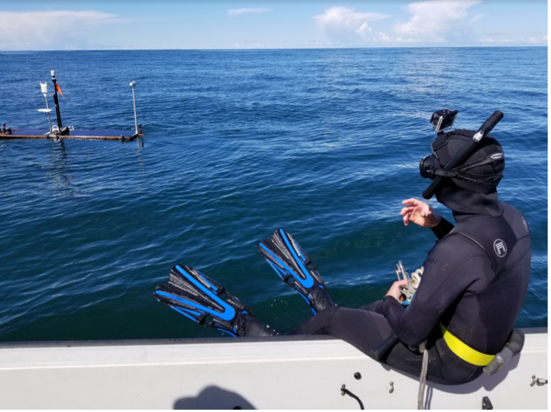
The team is using a self-propelled commercial Wave Glider decked out with scientific instruments that can study the ocean from its surface. The most important gadgets aboard are the acoustic Doppler current profilers, which use sonar to measure water speed and gather information about the how fast the currents and eddies are moving, and in which direction. The glider also carries instruments to measure wind speed, air temperature and humidity, water temperature and salinity, and light and infrared radiation from the Sun.
“The wave glider looks like a surfboard with a big venetian blind under it,” said Farrar.
That “venetian blind” is submerged under the water, moving up and down with the ocean’s waves to propel the glider forward at about one mile per hour. In this way, the wave glider will be deployed from La Jolla, California, collecting data as it travels over 62 miles (100 kilometers) out into the ocean offshore of Santa Catalina Island.
The new data will allow the scientists to estimate the exchange of heat and gases between Earth’s atmosphere and the ocean, and consequently better understand global climate change.
“We know the atmosphere is heating up. We know the winds are speeding up. But we don’t really understand where all that energy is going,” said Ernesto Rodriguez, research fellow at NASA’s Jet Propulsion Laboratory in Pasadena, California, and deputy principal investigator for the airborne parts of S-MODE. It’s likely that this energy is going into the ocean, but the details of how that process works are still unknown. The team thinks that small-scale eddies may help move heat from the atmosphere to the deeper layers of the ocean.
Eyes and Scientific Instruments in the Skies
While the Wave Glider continues its slow trek across the ocean’s surface, several airplanes will fly overhead to collect data from a different vantage.
“In an airplane, we can get a snapshot of a large area to see the context of how the bigger- and smaller-scale ocean movements interact,” said Rodriguez.
For example, a ship or wave glider travels slowly along a straight line, taking precise measurements of sea surface temperature at specific times and places. Airplanes move faster and can cover more ground, measuring the sea surface temperature of a large swath of ocean very quickly.
“It’s like taking an infrared image rather than using a thermometer,” explained Farrar.
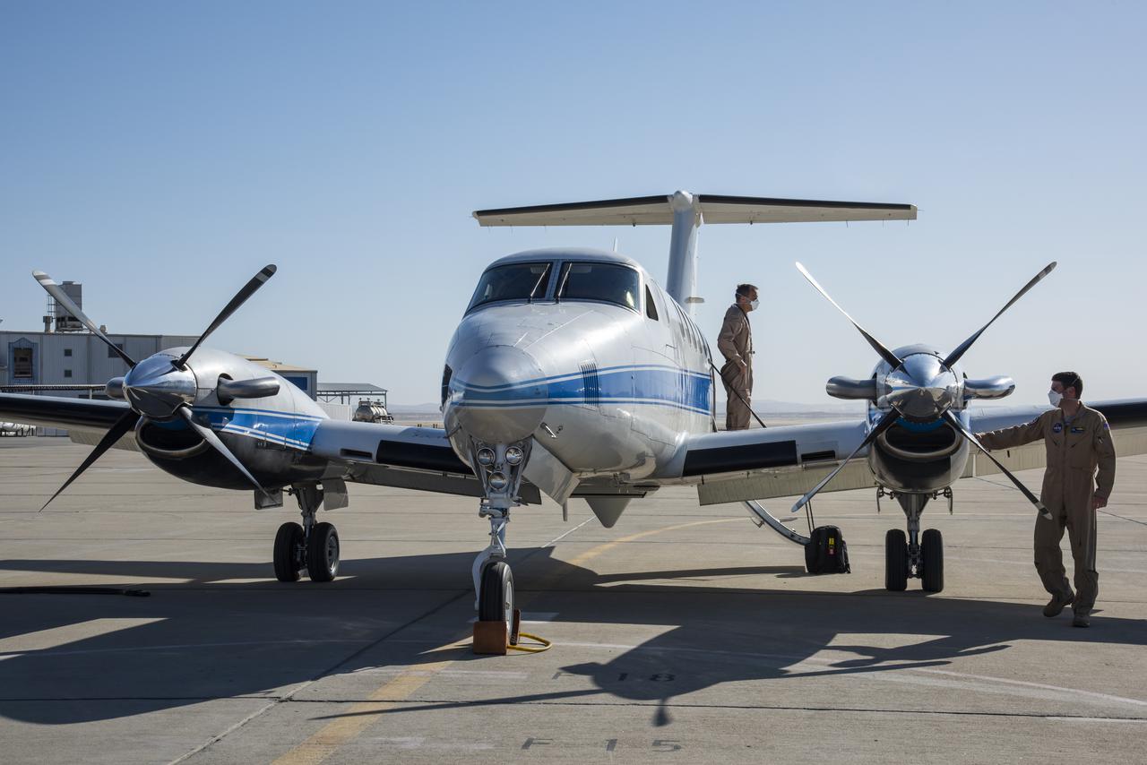
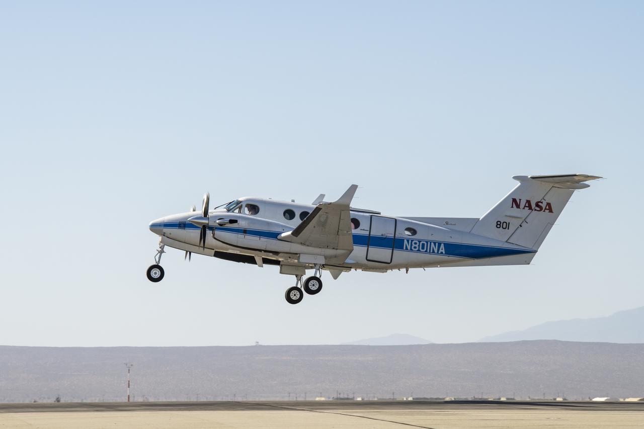
Two planes will be used in the May test flights: a B200 plane from NASA’s Armstrong Flight Center in Edwards, California and a commercial plane from Twin Otter International. The B200 is carrying an instrument from NASA JPL called DopplerScatt to measure currents and winds near the ocean surface with radar. The Multiscale Observing System of the Ocean Surface (MOSES) instrument from the University of California, Los Angeles is also aboard to collect sea surface temperature data. On the Twin Otter plane is the Modular Aerial Sensing System (MASS) from the Scripps Institution of Oceanography at the University of California, San Diego, which is an instrument capable of measuring the height of waves on the surface of the ocean.
The fleet will gain a third member for the October experiments: NASA’s Langley Research Center Gulfstream III plane with JPL’s Portable Remote Imaging SpectroMeter (PRISM), an instrument to measure phytoplankton and other biological material in the water. The October deployments will also use a large ship and some autonomous sailing vessels, called Saildrones, in addition to planes and Wave Gliders.
After nearly a year and a half of delays due to the pandemic, the S-MODE team is excited to get their planes in the sky and the gliders in the water. “It was frustrating,” Rodriguez said, “but the science team hasn’t slowed down. The science keeps progressing.”
S-MODE is NASA’s ocean physics Earth Venture Suborbital-3 (EVS-3) mission, funded by the Earth System Science Pathfinder (ESSP) Program Office at NASA’s Langley Research Center in Hamtpon, Virginia, and managed by the Earth Science Project Office (ESPO) at Ames Research Center.