


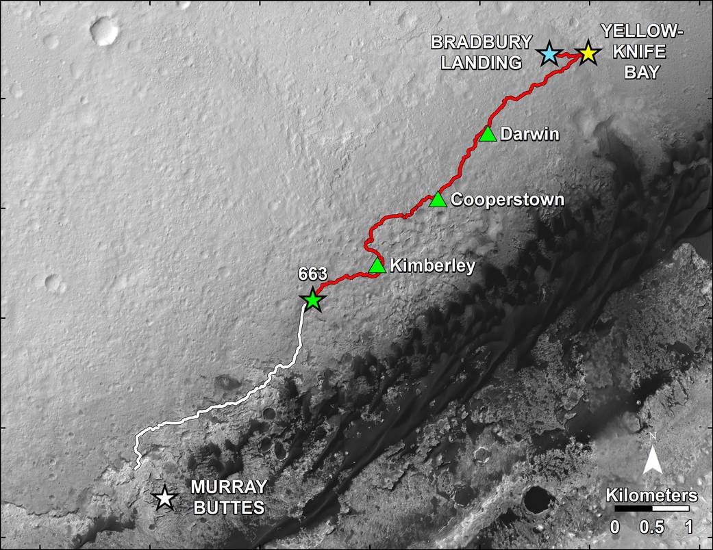
This map shows in red the route driven by NASA’s Curiosity Mars rover from the “Bradbury Landing” location where it landed in August 2012 (blue star at upper right) to nearly the completion of its first Martian year. The white line shows the planned route ahead.
Curiosity departed a waypoint called “The Kimberley” on the 630th Martian day, or sol, of the rover’s work on Mars (May 15, 2014) and drove more than three-fourths of a mile (1.2 kilometers) between then and the Sol 663 (June 18, 2014) position marked on the map by the green star at the western end of the red line. The rover will have completed a mission goal of working for a full Martian year on Sol 669 (June 24, 2014). A Martian year is 687 Earth days.
A major destination for the mission remains geological layering exposed on the lower slope of Mount Sharp, with “Murray Buttes” chosen as the entry point because of a gap there in a band of dark-toned dune fields edging the base of the mountain. The white line indicates a planned route to Murray Buttes chosen in spring 2014 as the safest path for the rover’s wheels. Embedded, sharp rocks on the route driven between the “Cooperstown” and “Kimberley” waypoints marked on the map caused the pace of wear and tear on the wheels to accelerate unexpectedly in late 2013. The white-line route avoids some stretches of similar terrain on a more northerly route previously planned for getting to Murray Buttes.
The base image for this map is from the High Resolution Imaging Science Experiment (HiRISE) camera on NASA’s Mars Reconnaissance Orbiter. North is up. The scale bar at lower right represents one kilometer (0.62 mile). For broader-context images of the area, see PIA16064 and PIA16058 .
At Yellowknife Bay, the Mars Science Laboratory Project that built and operates Curiosity achieved its main science objective of determining whether Mars ever offered environmental conditions favorable for microbial life. Rock-powder samples drilled from two mudstone rocks there and analyzed onboard yielded evidence for an ancient lakebed with mild water, the chemical elements needed for life and a mineral source of energy used by some Earth microbes.
NASA’s Jet Propulsion Laboratory, a division of the California Institute of Technology, Pasadena, manages the Mars Science Laboratory Project and Mars Reconnaissance Orbiter Project for NASA’s Science Mission Directorate, Washington.
Credit: NASA/JPL-Caltech/Univ. of Arizona/USGS