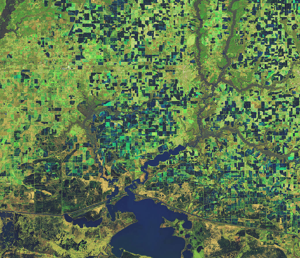
This Feb 3, 2023, enhanced-color image from Landsat 9 highlights a green and blue patchwork pattern in flooded rice fields in southwestern Louisiana.
This Feb 3, 2023, enhanced-color image from Landsat 9 highlights a green and blue patchwork pattern in flooded rice fields in southwestern Louisiana. Raised levees used for water management form the grid pattern between the fields, which appear dark blue.
As it flowed through several southern states over tens of thousands of years, the Mississippi River left a valuable layer of fertile soil in its wake. This low-lying floodplain and the flat coastal prairies of Louisiana and Texas are now home to most of the rice farms in the United States. In 2021, Arkansas, Louisiana, Mississippi, and Texas—collectively known as the Rice Belt—produced about 73 percent of all rice in the United States.
Image Credit: NASA


