


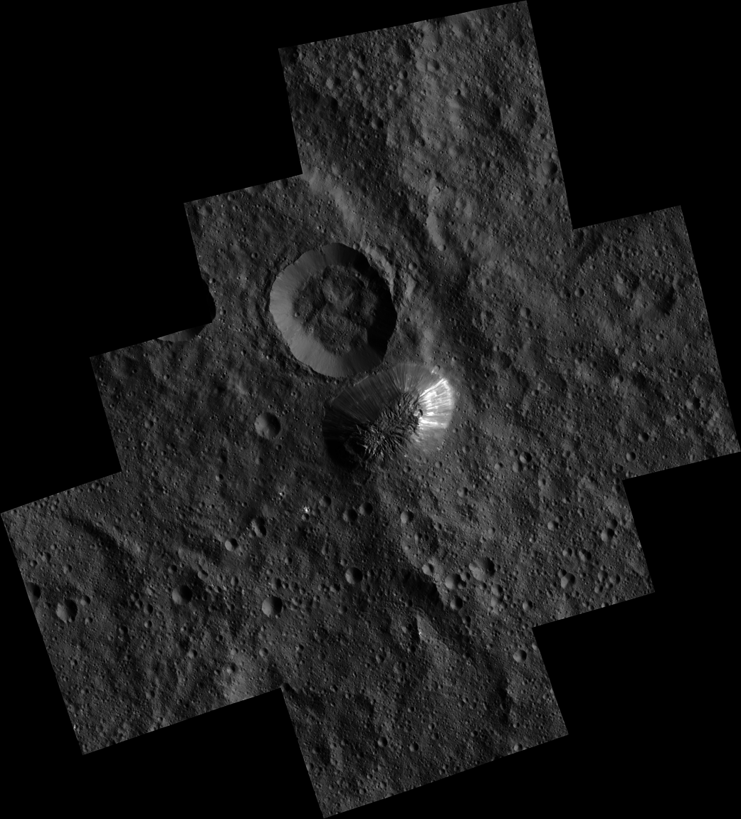
The mysterious mountain Ahuna Mons is seen in this mosaic of images from NASA’s Dawn spacecraft. Dawn took these images from its low-altitude mapping orbit, from an altitude of 240 miles (385 kilometers) in December 2015. The resolution of the component images is 120 feet (35 meters) per pixel.
On its steepest side, this mountain is about 3 miles (5 kilometers) high. Its average overall height is 2.5 miles (4 kilometers). These figures are slightly lower than what scientists estimated from Dawn’s higher orbits because researchers now have a better sense of Ceres’ topography.
The diameter of the mountain is about 12 miles (20 kilometers). Researchers are exploring the processes that could have led to this feature’s formation.
Dawn’s mission is managed by the Jet Propulsion Laboratory for NASA’s Science Mission Directorate in Washington. Dawn is a project of the directorate’s Discovery Program, managed by NASA’s Marshall Space Flight Center in Huntsville, Alabama. UCLA is responsible for overall Dawn mission science. Orbital ATK, Inc., in Dulles, Virginia, designed and built the spacecraft. The German Aerospace Center, the Max Planck Institute for Solar System Research, the Italian Space Agency and the Italian National Astrophysical Institute are international partners on the mission team. For a complete list of acknowledgments, see http://dawn.jpl.nasa.gov/mission.
For more information about the Dawn mission, visit http://dawn.jpl.nasa.gov.
Image Credit:
NASA/JPL-Caltech/UCLA/MPS/DLR/IDA