Imagery Acquisition & Analysis
Johnson Space Center (JSC) offers capabilities and expertise in camera systems, imagery acquisition and assessment, and imagery analysis. Analysis of spaceflight imagery can quantify distances, sizes, motion and hardware conditions, critical information not easily deduced from other sources of mission data. JSC also provides computer graphics and model development for engineering visualization as well as state-of-the-art facilities for testing advanced simulation environments, allowing integration of multiple models into a single simulation.
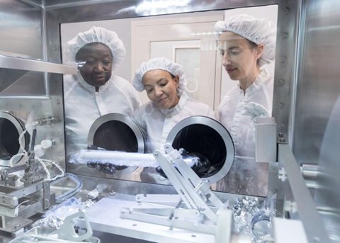
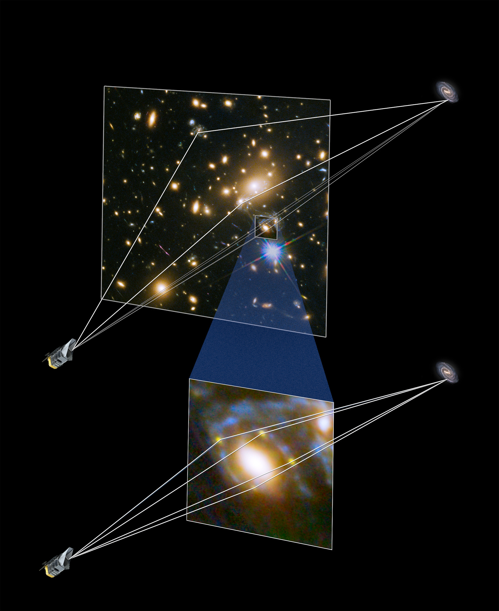
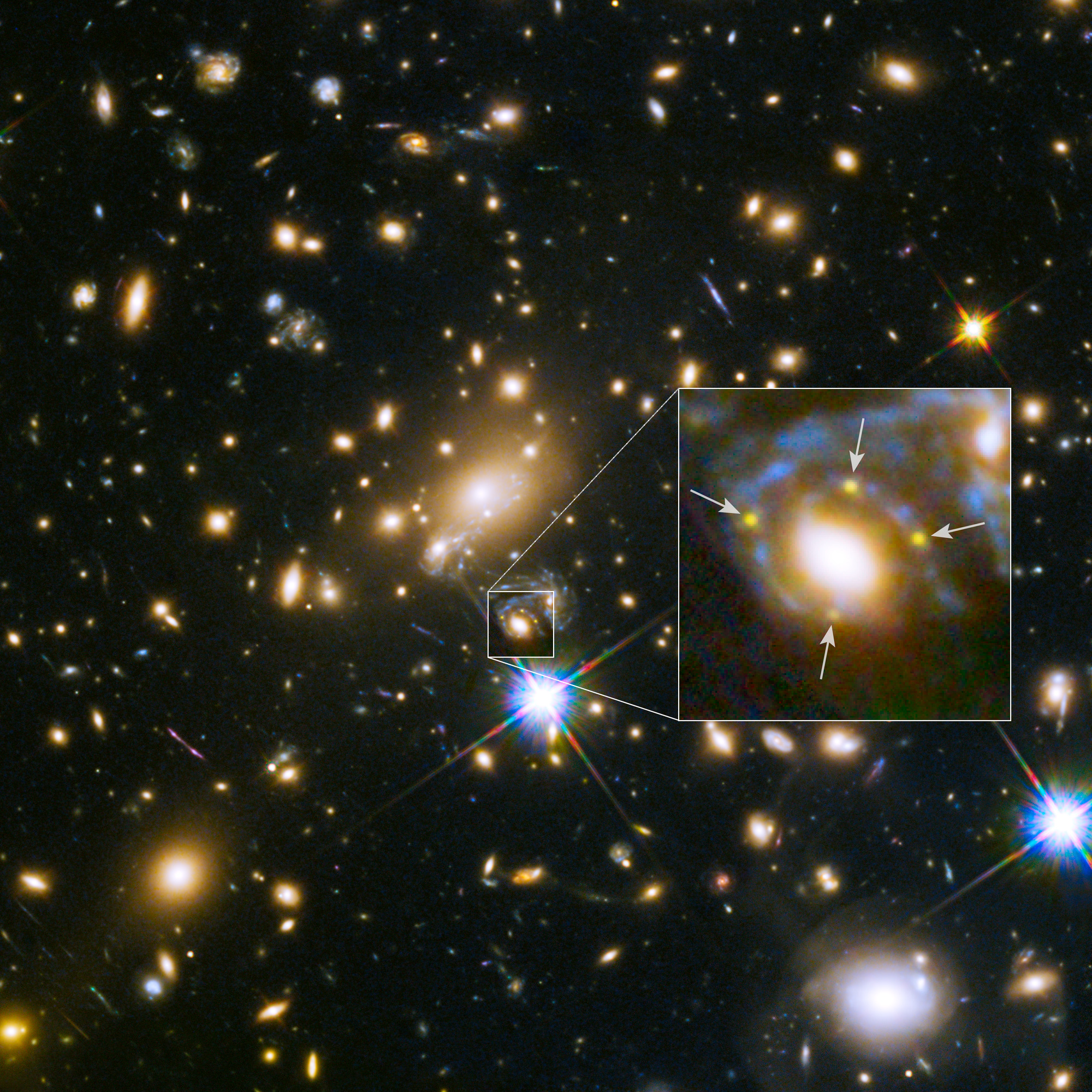
The Image Science and Analysis Laboratory (ISAL) is a leader in the application of imagery expertise contributing to successful mission execution and crew safety. ISAL specializes in delivering 2-D and 3-D analysis to improve flight control team understanding of a mission’s status. The lab focuses on the interpretation and analysis of images acquired from various spacecraft, satellites, and telescopes and utilizes advanced image processing techniques, computer vision, and scientific analysis to extract valuable information from visual data captured in space. Researchers at ISAL also contribute to understanding planetary surfaces, atmospheric conditions, and celestial bodies by analyzing images to gain insights into geological, climatic, and astronomical phenomena. Overall, ISAL plays a vital role in advancing our understanding of the universe through the detailed analysis of visual data collected during space missions. Join us in advancing human spaceflight into the cosmos by harnessing our unique expertise and capabilities in image science.
Imagery Analysis
Image Science and Analysis Laboratory (ISAL)
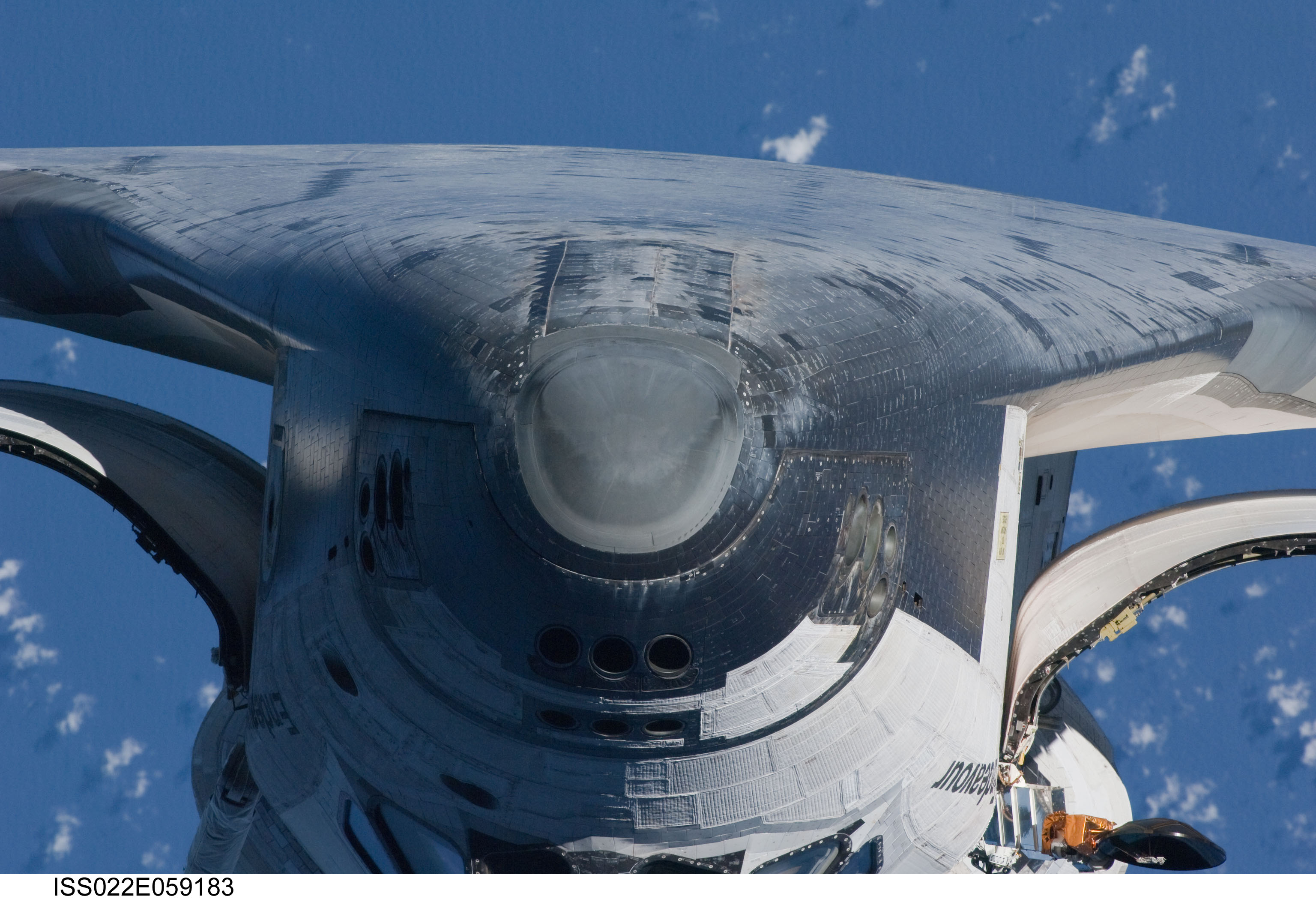
NASA JSC Image Science and Analysis Laboratory (ISAL) is a leader in the application of imagery expertise contributing to successful mission execution and crew safety. The image analysis team provides real-time support to the International Space Station (ISS) to assess vehicle condition, configurations, performance, and mission events.
In addition to the ISS, the team leads the vision for Orion imaging capabilities to provide real-time insight into vehicle performance. We specialize in in-flight spacecraft inspections as well as integration of imagery acquisition and assessment, from launch through Earth return. NASA JSC Imagery Science and Analysis Laboratory (ISAL) helps spacecraft and mission teams design camera systems through visualization tools, laboratory testing and computations to establish camera placements, selections, and settings. ISAL coordinates detailed visual inspections of spacecraft to identify features that might indicate an unsafe situation. Imagery integration services provided by ISAL utilize unique reporting tools to track imagery acquisition, screening/analysis progress and analysis findings. The team also assists mission engineers in interpreting imagery findings. Imagery Acquisition Planning Photogrammetry Imagery Inspection and Surveys Data visualization
Integrated Graphics Operations and Analysis Laboratory (IGOAL)
The Integrated Graphics Operations and Analysis Laboratory (IGOAL) provides computer graphics services for organizations throughout NASA and other institutions. These services include: highly realistic visualizations of space systems and conceptual design concepts; custom graphics programming for simulations, visualizations, training, education and outreach; and 3D graphics model creation, reduction, verification and validation.
Computer graphics services
- 3-D engineering visualization, modeling, and graphics custom software development
- Animated Graphics for Engineering Analysis (AGEA)
- Mobile applications for phones and tablets
- SATERN-style training modules (NASA’s internal training platform)
- IGOAL software programming supports many platforms including iOS, Android, Windows, Linux, and the web
- IGOAL graphics models can be output in many popular formats including FBX, Blender, AutoCAD, OBJ, and Inventor
- IGOAL software products include Space Station Research Explorer (mobile devices on iTunes and Google Play), Visual ISS Communication tool, AGEA, EMU Explorer, and Counter Measure Systems Explorer
Imagery Acquisition
Launch/Landing Imaging
Launch and/or landing imagery of space vehicles. Imagery objectives can provide verification of in-flight critical component performance.
Mission examples include stage separation events, parachute inflation, etc.
NASA Airborne Science Program
The Gulfstream aircraft supports the NASA Airborne Science Program and provides a reliable, configurable, and comfortable airborne platform to the earth science community and other customers to support scientific research and advanced technology development and testing worldwide.
- An integrated process to support payload design and integration, test readiness, and mission execution
- The aircraft can be modified to meet customer needs
- The cabin can be configured with standard equipment racks and operator consoles
- Up to 14 mission crew/passengers can be accommodated depending on internal cabin configuration
- An external pod for radar, lidar, or other instrumentation is available
WB-57 High Altitude Research Program
The NASA WB-57 Program provides unique, high-altitude airborne platforms to US Government agencies, academic institutions, and commercial customers to support scientific research and advanced technology development and testing at locations around the world. The WB-57 is a mid-wing, long-range aircraft capable of operation for extended periods of time from sea level to altitudes in excess of 60,000 feet.
- The aircraft can fly for 6.5 hours, has a range of 2500 miles, and carry up to 6000 lbs. of payload
- Multiple payload mounting locations, power options, and air-to-ground communication options
- Can support both pressurized and unpressurized payloads
- Mission examples include atmospheric and earth science, ground mapping, cosmic dust collection, rocket launch support, and test bed operations for future airborne and spaceborne systems
- An integrated process to support payload design, integration, test readiness, and mission execution
Science Support
NASA JSC Astromaterials and Exploration Research Division (ARES) pioneered science operations for human missions through support to the Apollo missions, which has been leveraged to all subsequent crewed missions, including International Space Station (ISS) missions, Orion missions, commercial crewed missions, and planned Artemis and Gateway missions.
The Astromaterials and Exploration Science Division (ARES) leads the acquisition of Earth imagery by astronauts. We participate in Mars mission teams, including the Curiosity, Opportunity, and Perseverance rovers. We also integrate into science teams for asteroid missions including Origin’s Spectral Interpretation Resource Identification Security Regolith Explorer (OSIRIS-REx) and Hayabusa2. We lead the geology training of crew for Artemis missions; develop data products for assessment of potential lunar landing sites and surface traverse planning; develop visualization and operational software for crewed mission support; develop engineering and science imagery requirements for current and planned lunar and cis-lunar spacecraft, vehicles, and crew suits; and lead science and sample return planning for lunar landers, rovers, and crew EVAs. We support development of sensors and instruments to enhance the scientific return of planetary exploration, leveraging the International Space Station as a proving ground as needed. We perform routine imagery surveys and analysis of the International Space Station and visiting spacecraft for assessment of vehicle health and safety as well as supporting anomaly investigations when needed. ARES also supports TOPO in assessing the risk from breakups to ISS, EVA, Orion and other crewed missions. Additionally we provide technical assessments supporting spaceflight operations with micrometeoroid orbital debris risk assessments (ISS, EVA, Orion, Gateway, etc.) that directly support design and operations for spacecraft. ARES also curates all astromaterials collected by NASA and international partners. Additional details are available at https://ares.jsc.nasa.gov/
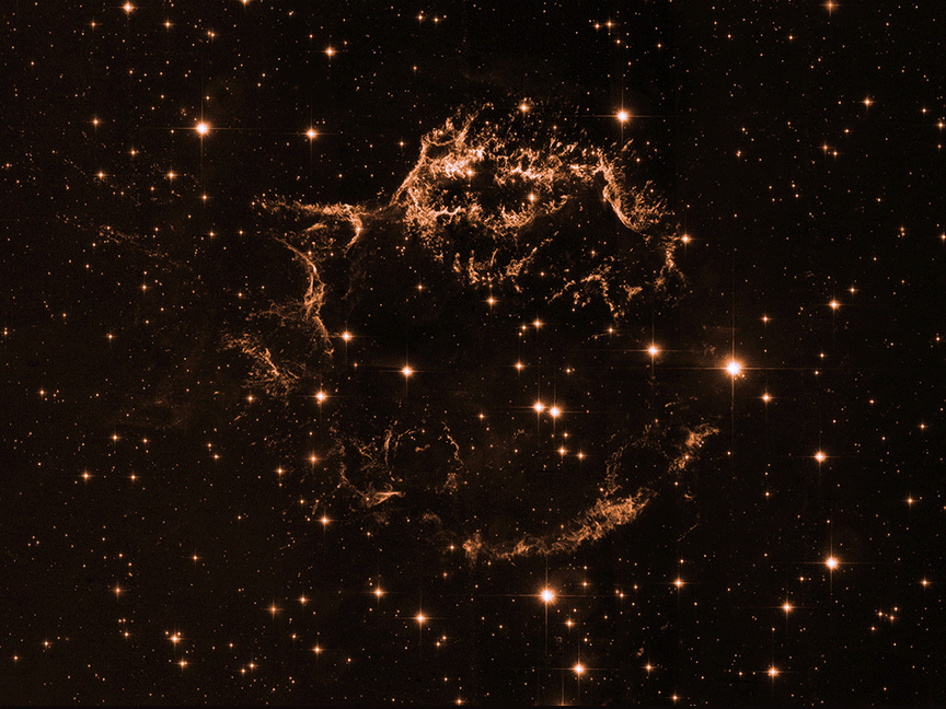
Learn More: https://www.nasa.gov/missions/chandra/nasas-ixpe-helps-unlock-the-secrets-of-famous-exploded-star/
Connect With Us
Whether you are a public agency, private company, or academic institution, we look forward to hearing from you. Fill out the Statement of Interest form to submit your inquiry.