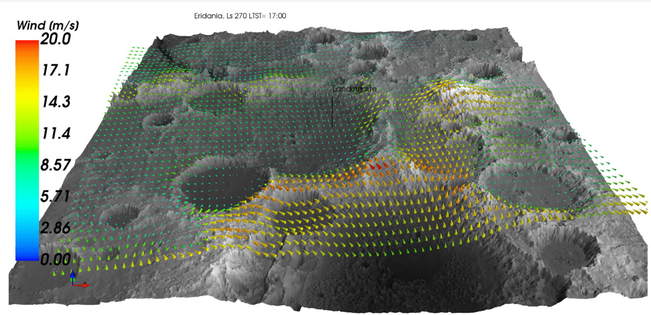
Mesoscale Modeling Using the Mars Regional Atmospheric Modeling System (MRAMS)
Topography-driven flows such as nighttime katabatic winds and daytime anabatic winds in narrow craters and valleys induce local atmospheric circulations that are typically not resolved in multi-annual simulations from Global Climate Models. To investigate these circulations, the Mars Climate Modeling Center can run the NASA Ames MGCM down to a horizontal resolution of ⅛ th of a degree (approximately 7 km), globally. The MCMC also operates the Mars Regional Atmospheric Modeling System (MRAMS), a regional, or “mesoscale” model that uses both the initial state and the boundary conditions from the NASA Ames MGCM at the physical edges of the modeling domain, as well as a set of nested computational grids to allow for a horizontal resolution of less than one kilometer at specific sites of interest (Figure 1).


