![Request for Information – Potential [Placeholder for Prize]](https://assets.science.nasa.gov/dynamicimage/assets/science/missions/a-step/FFR_Earth_Background_20251120%20.png?w=1024)


Marshall Space Flight Center
Science Achievements 2025
Heliophysics and Planetary Science
Neutron Measurements at the Lunar Surface (NMLS) Participation in CP-21 BGM3 Systems Requirement Review
Marshall Planetary Scientist, Heidi Haviland, Heliophysics and Planetary Science Branch, and Jeff Apple and Miguel Rodriguez-Otero, Systems Integration Branch, participated remotely in the Commercial Lunar Payload Services CP-21 BGM3 Systems Requirement Review on May 28, 2025, on behalf of the Neutron Measurements at the Lunar Surface payload. CP-21 will be Firefly’s third mission to the Moon on its Blue Ghost lander
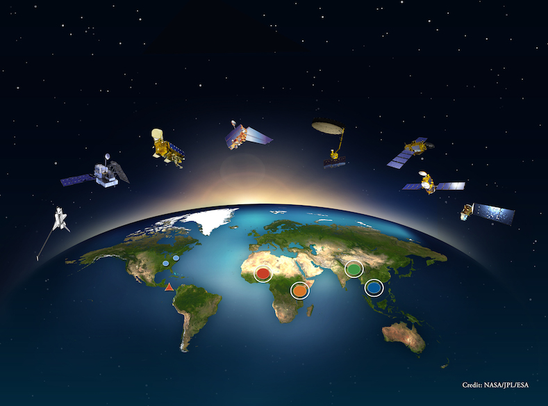
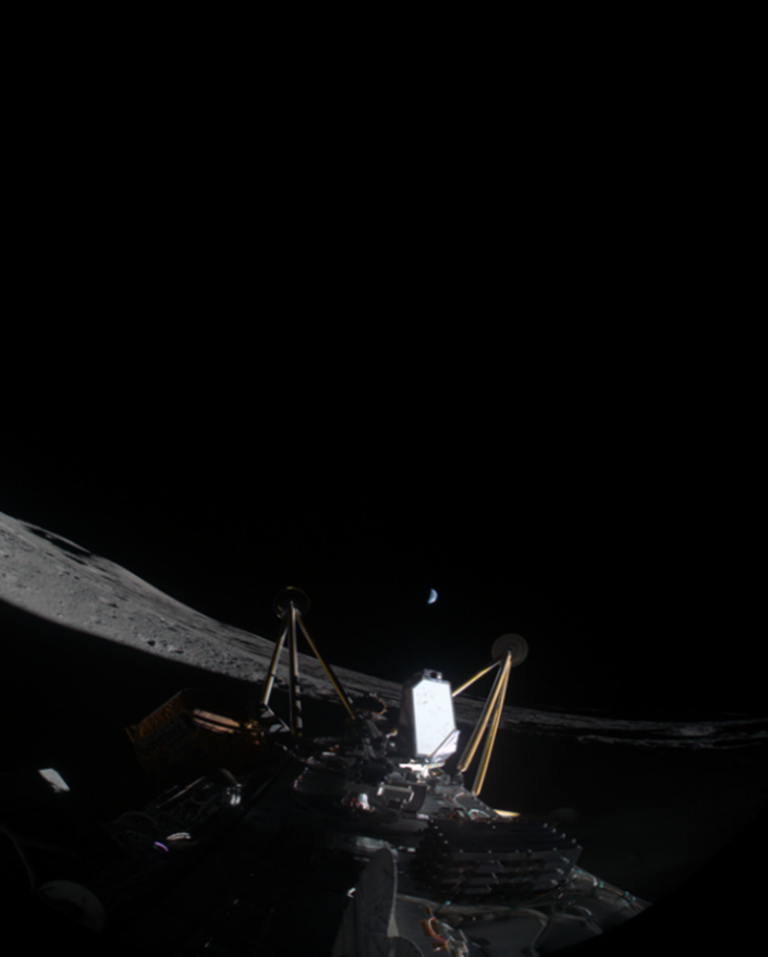
Marshall Planetary Scientist Serves as Commercial Lunar Payload Services Project Scientist for IM-2 Lunar Surface Mission Operations
Marshall Planetary Scientist Heidi Haviland participated in the Intuitive Machines (IM) IM-2 Lunar Surface Mission Operations as a Commercial Lunar Payload Services (CLPS) Project Scientist on console in IM’s Nova Control. The IM-2 mission was operated at IM’s headquarters in Houston. The Athena lander landed 250 meters from its intended landing site at Mons Mouton in the lunar south polar region approximately one week following a successful launch. This is the southernmost lunar landing and surface operations. Athena was inside of a small crater and ended on her side. All payloads were able to be turned on prior to the lander batteries being depleted and several mission objectives were completed. IM and NASA teams will continue analyzing the data obtained from this mission as well as review the causes for the tip over. The lunar landing was attended by NASA leadership, including STMD Director of Technology Maturation Niki Werkheiser, SMD AA Nicky Fox, Deputy AA for Exploration Joel Kearns, Acting Chief of Staff Harold Carlson, and Acting Administrator Janet Petro.
The NASA payloads that flew on the IM-2 delivery included three SMD payloads, the Laser Retroreflector Array (LRA), and the Polar Resources Ice Mining Experiment-1 (PRIME-1) suite, which consists of the TRIDENT drill (The Regolith Ice Drill for Exploring New Terrain) and MSOLO (Mass Spectrometer Observing Lunar Operations), as well as the STMD 2 tipping point payloads, the Micro Nova Hopper, and a Nokia communications test. IM-2 also included a Lunar Outpost Rover. IM-2 had non-NASA customers and three ride share satellites.
Before the launch, Haviland participated in the Intuitive Machines IM-2 Surface Sequence Test (SST) mission simulation on Feb 10-13, 2025. She also participated in IM-3 activities, including the delivery and testing of the CADRE rovers and a technical exchange on thermal analysis. In her role as CLPS Project Scientist, Haviland supports remote daily Payload Operations meetings for the 19D Blue Ghost mission. Listen to the NASA news conference at: https://www.nasa.gov/blogs/missions/2025/03/06/nasa-intuitive-machines-host-lunar-landing-news-conference/.
Hi-C Flare Stray Light Facility (SLF) Beamline Adapter Complete
The High-resolution Coronal (Hi-C) Flare sounding rocket mission, which launched successfully in April 2024, is planning to perform post launch calibration tests at Marshall’s Stray Light Facility (SLF). This will be the first time the integrated Hi-C payload is adapted to this beamline and new hardware is needed to mate the vacuum systems together. A baseline design was developed by collaborators at the Smithsonian Astrophysical Observatory (SAO) and several modifications were made to decrease the fabrication challenge maintain vacuum performance. The hardware is planned to be ready in time for planned calibration work. Marshall Heliophysicist Genevieve Vigil, along with SLF team members, Marshall Astrophysicist Nick Thomas, and Marshall Engineer Stephen Cheney were involved in defining the final design.
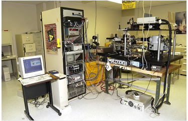
Marshall’s Dusty Plasma Lab Receives Equipment Critical to Testing
The Dusty Plasma Lab at Marshall received a new Faraday Cup substitute aperture plate designed to overcome secondary electron emission when an ion or electron beam is directed onto it. Eliminating secondary electron emission in this situation is critical for accurate measurement of the flux of an ion or electron beam. Without this advancement it is not possible to accurately measure secondary electron emission efficiency from micron sized grain dust brought back from the Apollo 16 lunar mission. The Dusty Plasma Lab also received 2 ¾” conflat machined parts for interfacing a Wein mass filter to be used to separate pure hydrogen ions from an ion beam created from molecular hydrogen gas: H+, H2+, and D+. Without the mass filter it is not possible to accurately simulate hydrogen ions in the solar wind in support of secondary electron emission efficiency charging studies. Accurate efficiencies are required for understanding dust electrostatic charging behavior around astronauts, their equipment, and habitats. Managing dust on planetary bodies is critical for safe and prolonged planetary exploration.
The lab is also setting up a cryogenic experiment in the second dust trap vacuum system to test the cryogenic response of quantum dot scintillation into the visible spectrum upon exposure to ultraviolet light. Temperatures from ambient to liquid helium are sought during the experiment. The measurement of dust grain temperature to understand dust grain properties is critical to predicting the behavior of dust in the low pressure, dry, and cryogenically cold surface environment on Mars and other remote planetary bodies.

Progress on Global Climate Modeling (CGM) for Faint Young Sun Paradox
Marshall Heliophysics Scientist Linda Habash Krause has made progress on running global climate models (GCMs) toward the ultimate goal of investigating the effects of solar-terrestrial interactions on the evolution of the Earth’s atmospheric, oceanic, and space environments 4 billion years ago (~4Ga). Initial runs of the Whole Atmosphere Community Climate Model-eXtended (WACCM-X), which covers the domain from sea level to an altitude ~500km, were performed for two periods: one with low solar activity (LSA) and one with High Solar Activity (HSA), which collectively took three weeks to complete.
A small sample of the results were presented to a Heliophysics Internal Scientist Funding Model (ISFM) meeting led by Principal Investigator (PI) Alexis Rodriguez from Marshall’s Heliophysics and Planetary Science Branch on Mar.19, 2025. The presentation included a brief primer of the architecture of the WACCM-X models and how they are seamlessly coupled to complementary GCMs, including land, sea, and ice models. WACCM-X can calculate Joule heating and other forms of thermal modeling, such as greenhouse gases. The goal is to find the right parameters necessary for liquid water to have existed 4Ga when the solar luminosity was only 70% of today’s value – the so-called “Faint Young Sun Paradox”.
Marshall Scientist Invited to Speak at American Institute of Aeronautics and Astronautics SciTech Forum
Robert Loper of Marshall Space Flight Center’s Heliophysics and Planetary Science Branch participated in the 2025 AIAA SciTech Forum in Orlando, FL, on Jan. 6-10, 2025. Loper delivered the invited talk, “Analysis of the Heliospheric Conditions Leading to the February 2022 Geomagnetic Storm Event.”
Earth Science
Marshall Supports NASA’s Response to Texas Flash Flooding
Members of the NASA Disasters Team at Marshall supported the agency’s response to the tragic flash flooding that occurred in the Hill Country of Texas during the holiday weekend of July 4, 2025. Members of NASA Disasters Response Coordination System at Marshall provided their expertise in creating different remote sensing imagery products to provide situational awareness. This imagery is being distributed through the NASA Disasters Geographic Information System portal to the Federal Emergency Management Agency Region 6, Texas Department of Emergency Management, and a couple of different non-governmental organizations responding to the event. Marshall personnel have also utilized data from the Commercial Satellite Data Acquisition Program to create products that highlight significant vegetation change from flood waters with the goal of understanding the full extent of the flooding.
European Research Council Selects Proposal for New Field Campaign with NASA to Study Gamma Rays from Thunderstorms
The University of Bergen (UIB) in Norway had a proposal selected by the European Research Council (ERC) for a follow-on suborbital mission to the 2023 Airborne Lightning Observatory for Fly’s Eye Geostationary Lightning Mapper (GLM) Simulator (FEGS) and Terrestrial Gamma-ray Flashes (TGFs) campaign, which all shortens to ALOFT. The new campaign is planned for 2028 and will use the NASA ER-2 loaded up with a similar payload to ALOFT, including NASA Marshall’s FEGS and Lightning Instrument Package (LIP) instruments. The campaign will focus on ALOFT’s domain – which included Central America, Florida, and the surrounding ocean – and utilize an innovative gamma-ray imaging instrument to better understand the source regions for TGFs and gamma-ray glows within thunderstorms. Marshall Earth Scientists, Timothy Lang, Mason Quick, and Christopher Schultz, plan to lead Marshall’s contributions to the 2028 campaign. The selected proposal is led by Martino Marisaldi of UIB, who also helped lead ALOFT. Learn more about the new gamma-ray campaign with NASA. https://www.uib.no/en/nt/175892/uib-researcher-revolutionizes-thundercloud-research.

NASA HAQAST Tiger Team Project to Develop Air Quality Platform for Africa
Marshall Earth Scientist, Alqamah Sayeed, who currently leads the Air Quality and Health Thematic Area (HAQAST) at NASA SERVIR (Regional Visualization and Monitoring System), is serving as a co-investigator on a newly accepted NASA HAQAST Tiger Team project, submitted in his individual capacity. Led by Goddard Earth Scientist, Pawan Gupta, he project will develop the African Air Quality Explorer, an open-access, cloud-based platform delivering historical, near-real-time, and forecasted air quality data for African countries using NASA satellite observations and models. Both Gupta and Sayeed co-led the development of the SERVIR Southeast Asia Air Quality Explorer (now AQ tracker), and they bring deep technical expertise to guide this new effort. In partnership with the U.S. Department of State, and its regional network spanning over 30 African nations, the initiative will also strengthen local technical capacity through targeted trainings and workshops. This effort aims to enhance data-driven decision-making, support public health research, and promote environmental resilience across the continent.
Presentation to the Gateway Dust Mitigation Working Group
On Jul. 26, 2025, a virtual presentation was given on Marshall’s Dusty Plasma Laboratory in the National Space Science and Technology Center (NSSTC) and about the secondary electron emission efficiency (SEEE) project being worked in the lab for the Gateway Dust Mitigation Working Group (GWDMWG.) The project specifically is to obtain SEEE for Apollo 16 dust that has been obtained from the Apollo Archive at Johnson. The SEEE results will be used in a numerical model for dust charging upon exposure to the solar wind. These results will be used to understand the risks to the HLS (Human Landing System) and Gateway.
SPoRT Viewer Brings Near-Real-Time TEMPO Air Quality Data to Life
Since May 3, 2024, NASA’s Short-Term Prediction Research and Transition (SPoRT) Viewer has begun displaying near-real time (NRT) NO₂ and formaldehyde data from the Tropospheric Emissions: Monitoring Pollution (TEMPO) mission. The development of these NRT TEMPO data is a Satellite Needs Working Group solution. The system helped visualize air quality impacts from Canadian wildfire smoke and even highlighted lightning-induced pollution over Houston. State air quality managers are already responding, providing feedback for future product refinement. These real-time views of air quality events are enabling faster, more informed public health decisions.
Georgia Uses TEMPO Near-Real-Time NO2 for Ozone Reporting
The near real-time (NRT) version of Tropospheric Emissions: Monitoring of Pollution (TEMPO) provided hourly analysis of Nitrogen Dioxide (NO2) on June 24, 2025, when recommended ozone levels were exceeded. Unhealthy levels of ozone near the surface impact the public and economic sectors of the outdoors. Staff from the state of Georgia’s Environmental Protection Division are charged with monitoring ozone levels, but they are limited by the small number of observation sensors in the area. NO2 is a precursor to ozone production and the TEMPO instrument retrieves this trace gas over a wide area, not just at the observation sensor location. The Short-term Prediction Research and Transition (SPoRT) program, on behalf of the Satellite Needs Working Group, has been iterating with users, such as the state of Georgia, to ensure that the NRT data product – and related data visualizations – will meet needs. Initial feedback was received and is being shared with the mission. According to the Environmental Protection Division staff, they usually saw elevated NO2 over the Hartsfield Jackson Atlanta International Airport on exceedance days, compared with other days. They also say the saw the same trend (in TEMPO NRT) via the SPoRT viewer. This wide view of the distribution of NO2 served as a resource for staff as they reported on conditions and ozone levels.
Publication of Harmonized LandSat Sentinel-2 (HLS-2) Surface Reflectance Dataset Version 2.0 in Remote Sensing of Environment
The Harmonized LandSat Sentinel-2 (HLS-2) version 2.0 dataset has been released across multiple cloud computing environments as well as the Land Processes Distributed Active Archive Center. Updates to the dataset include revisions to several algorithms to enhance the harmonization and consistency between Landsat and Sentinel-2 sensors, addressing known issues. Future research will continue to improve product performance and incorporate user feedback. HLS-2 is currently the most downloaded NASA data product and available through Amazon Web Services, Google Earth Engine, and Microsoft Planetary Computer.
NASA Capacity Building Program Team Presents Hyperspectral Toolkit During Plankton, Aerosol, Cloud, Ocean Ecosystem (PACE) Land Data Users’ Group (PLUG) Meeting
On July 1, 2025, Earth Scientist, Emil Cherrington, of the NASA Earth Action Capacity Building Program team at NASA Marshall presented virtually to the 2nd quarterly meeting of the PACE Land data Users’ Group (PLUG) PACE Summer 2025 PLUG Meeting), a community of practice recently established to promote terrestrial applications of data from NASA’s PACE observatory. Cherrington presented work being done in the context of a PACE Early Adopters project, involving the development of a cloud-based toolkit for analyzing land-related data from PACE’s Ocean Color Instrument (OCI). In addition to having integrated various global PACE OCI products (surface reflectance and vegetation indices) into the Google Earth Engine (GEE) platform, the toolkit also provides users with tools for interacting with the PACE data. This effort is being coordinated with PACE’s Mission Applications Lead, Morgaine McKibben of Goddard, and aimed at strengthening the capacity of the broader science community to use and adopt PACE data. It is anticipated that decision-making related to conservation planning and agricultural monitoring will be strengthened by helping make NASA hyperspectral data available to the large segment of the user community which already uses the GEE platform. Almost 300 people had registered to participate in the PLUG meeting.

Research-to-Operations Team Demonstrates Inference Minimum Viable Product with Finetuned Prithvi Foundation Model
The Research-to-Operations team within the AI for Science project successfully demonstrated a minimum viable product for deploying AI inference workflows using a custom finetuned Prithvi Foundation Model. This prototype highlights how inference services can enhance downstream tasks in NASA’s Applied Knowledge Discovery (AKD), enabling more resilient infrastructure management across cloud and on-premises environments. Built on open-source toolkits, such as Kubernetes and Terratorch, the setup establishes a foundation for future integration with Mission Computing Platform servers and broader AKD adoption.
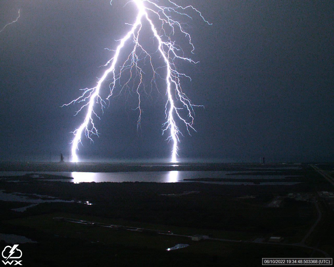
SPoRT Releases Lightning Stoplight Product V2.0 and Training to Enhance Lightning Safety Decision Support
The NASA Short-term Prediction Research and Transition (SPoRT) program officially released the Lightning Stoplight product V2.0 and an associated training module on Jun. 26, 2025, coinciding with Lightning Safety Awareness Week. The Lightning Stoplight product is an easy-to-interpret visualization of the last 30 minutes of lightning that color codes pixels based on lightning recency, enabling a user to quickly identify and communicate lightning hazards for decision-support scenarios. The updated V2.0 incorporates both ground-based and satellite-based lightning data as input. The training module released can be accessed by NASA Center Emergency Managers, enabling them to learn how to use the Stoplight product for their respective centers. An end-user assessment is planned to get feedback and document real-time examples of product impact. This was a group effort involving many SPoRT team members and scientists – Roger Allen, Kevin Full, Kelley Murphy, and Christopher Schultz, Earth Science Branch, and Kris White, NOAA National Weather Service.
NASA Disasters Team Gives Virtual Presentation Ahead of 26th Annual Disaster Response/Geospatial Data Mining Workshop
Earth Branch Scientist, Alex Melancon, and fellow NASA Disasters colleagues from Goddard and Langley gave a virtual presentation to local and state-level stakeholders attending the 26th Annual Disaster Response/Geospatial Data Mining Workshop at the University of Louisiana at Lafayette in Lafayette, Louisiana, on June 5, 2025. Presentations covered blue-sky emergency preparedness and grey-sky emergency response operations in addition to overviews of geospatial data collections, applications, and hosting portals. The NASA Disasters Program presented on its Earth to Action research activities, the Disaster Response Coordination System, and capabilities of the Disasters Mapping Portal, highlighting past response activities in Louisiana. Additionally, specific collaborations between Marshall and Louisiana National Weather Service offices using Earth Observations in damage assessments following severe weather events were also discussed.
CSDA Program Publishes Umbra Data to SDX
Umbra data are now available for download by authorized users through the Commercial Satellite Data Acquisition (CSDA) Satellite Data Explorer (SDX). The CSDA program data management team led by Marshall Scientists, Aaron Kaulfus and Helen Parache, Earth Science Branch, released these data on July 24, 2025. The data available at this time were acquired during the CSDA scientific evaluation period. At a later date, full evaluation reports will be posted to the CSDA website. To request authorization, please select the appropriate vendor and acknowledge the appropriate End User License Agreement in the CSDA Data Authorization Form.
NASA Open Science Essentials – An Agency-Wide Workshop with NASA Interns
The Data and Analysis Services Project (DASP) released a new training course, NASA Open Science Essentials (OSE) on July 21, 2025. The Open Science Essentials course provides introductory knowledge of the principles, practices, and tools necessary to conduct open science. This knowledge empowers learners to make their research more transparent, reproducible, and available to all. The course covers key topics such as open data, open peer review, and collaborative research practices. The course is available as an online, self-paced training in SATERN for learners internal to the agency and via the NASA STEM Gateway for external learners. Learn more. To advance this initiative, a set of open science Champions at each NASA center developed a curriculum that was taught to the science community. A group of former Champions at Marshall has created Marshall Open Science Subject Matter Experts, or MOSSME, to assist the Marshall and NASA communities to adopt open science. On July 22, 2025, Pontus Olofsson, Earth Science Branch, Genevieve Vigil, Heliophysics and Planetary Science Branch, and Fred Kepner, Strategic Management Office, taught an online workshop titled NASA Open Science Essentials to interns from all the NASA Internship Programs.
GOESR-GLM-ORBIT Assessment Report Submitted to NOAA
An On-Orbit Assessment Report to characterize the performance of the Geostationary Lightning Mapper (GLM) instruments onboard the National Oceanic and Atmospheric Agency (NOAA) Geostationary Operational Environmental Satellites-R (GOES-R) series was submitted to the GOES-R program. Researchers and contractors in Marshall Earth Science performed analysis of the precision, accuracy, detection efficiency, and false alarm rate for the GOES-16 and GOES-18 GLM instruments in Year 8 and Year 2 of operation, respectively. Marshall provides critical support and subject matter expertise to the GOES-R program for validation and calibration efforts related to NOAA’s GLM instruments which provide vital information about severe weather to forecasters in the National Weather Service and private industry.
Marshall Scientist’s Contribution to National Hurricane Operations Plan
Marshall Earth Scientist Patrick Duran participated in the annual Tropical Cyclone Operations and Research Forum (TCORF) virtually from March 3-6, 2025. TCORF brings together hurricane researchers, forecasters, and aircraft reconnaissance personnel from The National Oceanic and Atmospheric Administration (NOAA), the U.S. Navy, the U.S. Air Force, and academia to discuss recent research results and plans for operational hurricane forecasting and aircraft reconnaissance during the upcoming hurricane season.
One objective of TCORF is to revise the annual National Hurricane Operations Plan (NHOP), which sets official guidance on the conduct of U.S. government tropical cyclone forecasting and aircraft reconnaissance operations. This year, in collaboration with NASA HQ, Goddard, NOAA NESDIS, the U.S. Joint Typhoon Warning Center, and the National Hurricane Center, Duran proposed adding the NASA Time-Resolved Observations of Precipitation structure and storm Intensity with a Constellation of Smallsats (TROPICS) mission as a satellite resource to NHOP. This proposal received preliminary approval from the working group, with final approval of the text and official publication of NHOP scheduled for April. The addition of TROPICS to NHOP solidifies its utility as a satellite resource in tropical cyclone forecasting.
FireSense Stakeholder Engagement with NOAA/NWS Southern Region Stakeholders
The FireSense Stakeholder Engagement team at Marshall coordinated specialized NASA FireSense datasets for fire mapping and flame extent with the National Oceanic and Atmospheric Administration/National Weather Service Southern Region HQ and five individual weather forecast offices in Austin, Norman, Mobile, Tallahassee, and Birmingham. The team shared real-time flight data from AVARIS and a private sector firm associated with FireTech to map flame fronts, burn extent, and even locate new fire starts which were communicated to the Alabama Forestry Commission and local emergency management. A one-page reference sheet was quickly generated to help practitioners understand the research flight data and apply the data to the mapping of fire.
Marshall Disasters Team’s Tornado Outbreak Response
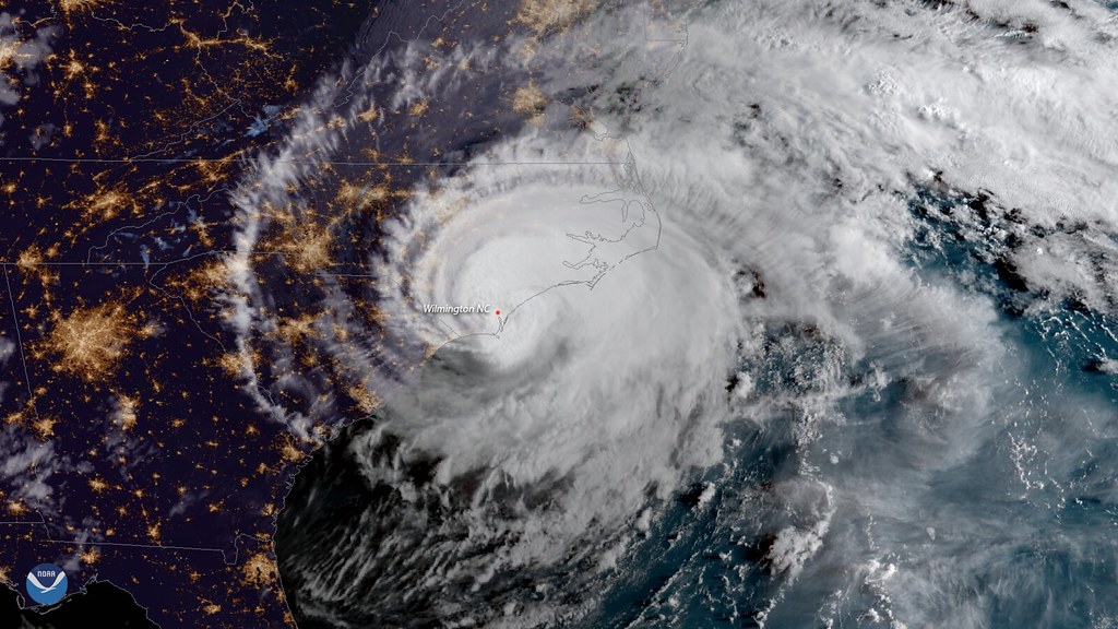
On Mar. 14-15, 2025, severe weather produced numerous tornadoes across the central and southeastern parts of the United States. The Marshall Disasters Team received a request for imagery support from the National Weather Service Southern Region. Marshall has long been collaborating with the National Weather Service (NWS) to supplement damage surveys with remote sensing imagery and derived products. Marshall Disasters Team members worked throughout that week providing imagery from Landsat-8, -9, and the European Space Agency’s Sentinel-2 satellites to support the NWS with their damage surveys. The Disasters team is also leveraging data from the Commercial Satellite Data Acquisition Program (CSDA) for specific areas of interest (AOIs) from the NWS. As of this note over 100 tornadoes have been confirmed from this outbreak.
The CSDA Program Releases DESIS Data through the Satellite Data Explorer
The Commercial Satellite Data Acquisition (CSDA) Program data management team, led by Marshall Earth Scientist Aaron Kaulfus and Helen Parache of Marshall’s Earth Science Branch, made products from the Teledyne Brown Engineering, Inc. hyperspectral sensor DESIS, available through the Satellite Data Explorer (SDX) (https://csdap.earthdata.nasa.gov/explore) on Jan. 30, 2025. This release through the SDX includes data acquired during the contract period that ended at the end of May last year. Hyperspectral images collected between Nov. 21, 2018, and May 31, 2024 are available.
Marshall’s Disasters Team Coordinates Virtual Training
Members of the Marshall Disasters team and the Alaska Satellite Facility (ASF) DAAC organized a training with U.S. Department of Agriculture (USDA) analysts on how to generate Synthetic Aperture Radar (SAR)-derived flood products. OpenScienceLab, a cloud-based JupyterLab environment developed by ASF, was used to practice generating flood products, derived by leveraging an open-source service called HydroSAR. This training provided the USDA analysts with the skills and knowledge to generate flood extent maps without requesting the products to be derived by the MSFC Disasters team. Having the HydroSAR service on the cloud allows for a customizable deployment that fits the needs of the USDA. The flood extent maps generated from HydroSAR can provide information on areas where flooding may impact cropland. The Marshall Disasters team continues to work with ASF and the USDA analysts on ways to make the HydroSAR deployment more efficient for the required needs of the USDA.
Lightning AI Moves Closer to Patent and Licensing
The University of Alabama Huntsville (UAH) and NASA Tech Transfer reached a joint ownership agreement (JOA) on Lightning AI, which is a NASA/UAH developed algorithm from the Short-term Prediction Research and Transition (SPoRT) program that predicts lightning in a 15–30-minute window before lightning occurs. This algorithm provides critical lead time prepare for when lightning strikes. According to Preston Schmauch of the NASA Space Technology Development Branch, the agreement indicates that Marshall will take the lead on marketing and licensing, while UAH will make sure that software developed in support of the algorithm will be available as part of any license.
INDUS-based Content Classification Models for ML-Assisted Curation in the Science Discovery Engine
Content Curation is a critical, resource-intensive task within the Science Discovery Engine (SDE), requiring substantial human effort to organize and classify scientific content. To improve the efficiency of this process, machine learning (ML)-driven approaches are being implemented, starting with content classification. Two machine learning models have been developed by NASA’s Large Language Model (LLM) team to support this effort.
The Division Classifier Model automates the categorization of documents and web pages into the five Science Mission Directorate (SMD) divisions; Astrophysics, Earth Science, Heliophysics, Planetary Science, and Biological and Physical Sciences. Utilizing the INDUS encoder, the model achieves an average classification accuracy of 96%.
The TDAMM Classification Model is designed for Time Domain Multi-Messenger Astronomy (TDAMM) and Astrophysics content and performs multi-class, multi-label classification across 36 astronomy-related categories, such as Neutrinos and Pulsars. The model achieves an average accuracy of 80.6%. The TDAMM model was developed in collaboration with astrophysics subject matter experts at Marshall. Both models were evaluated by the Subject Matter Experts and are being integrated into SDE’s internal curation tool using a common inference pipeline, aiming to simplify future efforts in leveraging ML models for content curation within SDE.
Details on the models and their evaluation metrics are publicly available on Hugging Face – Division Classifier Model: https://huggingface.co/nasa-impact/division-classifier and TDAMM Classification Model: https://huggingface.co/nasa-impact/tdamm-classification.
New Satellite Data Integrated into the Harmonized LandSat and Sentinel-2 Products
In Jan. 2025, the Harmonized Landsat and Sentinel-2 (HLS) project began integrating data from the Sentinel-2C satellite into its dataset. Sentinel-2C was launched by the European Space Agency (ESA) on Sep. 5, 2024. Initially, Sentinel-2C was expected to replace existing Sentinel-2A (launched in 2015). However, the ESA decided to extend the Sentinel-2A campaign up to one year starting in Mar. 2025, albeit in a different orbit. As a result, the HLS dataset now includes data from five satellites (Landsat 8/9 and Sentinel-2A, 2B, and 2C) to produce near-global, 30-meter surface reflectance products. The reintroduction of Sentinel-2A data enhances the temporal frequency of HLS products over Europe and tropical regions, improving the ability to monitor land surfaces by offering interchangeable products for land surface analysis
NASA Releases the Prithvi-HLS V2.0 Geospatial Foundation Model
NASA has released Prithvi-HLS v2.0, an enhanced geospatial foundation model leveraging Earth observation data from the Harmonized Landsat and Sentinel-2 (HLS) datasets. Trained on 4.2 million global time-series samples spanning 2015–2024, the model uses Masked Autoencoders (MAE) with a Vision Transformer (ViT) backbone, incorporating temporal and location metadata. Improvements include updated sampling strategies to ensure diverse, high-quality, cloud-free samples and temporal trends. The model was developed in collaboration with IBM and Julich SuperComputing. Benchmarked on the GEO-Bench framework, Prithvi-HLS v2.0 outperformed six leading models and its predecessor Prithvi-EO-1.0, demonstrating significant gains in medium-resolution tasks such as land-use classification and crop type segmentation.

AI Geospatial Foundation Model Workshop
NASA Marshall scientists Rajat Shinde, Sujit Roy, Vishal Gaur, Iksha Gurung, and Muthukumaran Ramasubramanian organized and led the Artificial Intelligence Foundation Models Workshop at the Institute of Electrical and Electrical Engineers – Indian Geoscience and Remote Sensing (GARSS) 2024 in India, Dec. 2, 2024. Prithvi Geospatial FM and Prithvi Weather and Climate FM were highlighted as part of the workshop.
Geostationary Lightning Mapper (GLM)-19 Data Meets Beta Level Validation
The Certification Process for Geostationary Operational Environmental Satellite (GOES)-19 Geostationary Lightning Mapper (GLM) L2 Beta Maturity was held on Jan. 13, 2025. As a result of this review, the National Oceanic and Atmospheric Administration (NOAA) panel chair declared the data was of Beta validation maturity based on the validation analyses provided by Earth Science Branch’s William Koshak’s Validation Team. This is the first of three important validation milestones (Beta, Provisional, and Full) to be completed for GLM-19. The GLM L2 product consists of geo-located and time-stamped events, groups, and flashes, with associated calibrated optical amplitudes (in units of Joules). Beta maturity, by definition, means that:
- Initial calibration is applied (L1b).
- Rapid changes in product input tables/algorithms can be expected.
- Product quick looks and initial comparisons with ground truth data not adequate to determine product quality.
- Anomalies may be found in the product and the resolution strategy may not exist.
- Product is made available to users to gain familiarity with data formats and parameters.
- Product has been minimally validated and may still contain significant errors.
- Product is not optimized for operational use.
Proposal Funded for Participation in NURTURE Field Campaign
Four Short-term Prediction Research and Transition (SPoRT) scientists have been selected to participate in the NASA North American Upstream Feature-Resolving and Tropopause Uncertainty Reconnaissance Experiment (NURTURE) field campaign. In collaboration with scientists from NASA’s Goddard Space Flight Center (GSFC) and Ames Research Center, SPoRT will produce real-time situational awareness products for use aboard the NASA 777 aircraft during research flights and for on-the-ground forecasting and flight planning. The products will be accompanied by long-form and short-form training tailored to the unique needs of the NURTURE field campaign. Patrick Duran of the Earth Science Branch is the PI serving alongside co-Is Sebastian Harkema, Roger Allen, and Matthew Miller, as well as collaborator Emily Berndt, all from SPoRT. The products and training to be produced include sounding, imagery, and precipitation products from polar-orbiting satellite platforms; sea-surface temperature; and limb-adjusted geostationary satellite imagery. The geostationary products will leverage the low-latency capability of the NASA MSFC GOES satellite receiving station to provide reliable and timely data for inclusion in NASA’s Mission Tools Suite and other situational awareness tools to be used by the NURTURE mission science and forecasting teams.
Marshall Scientist Contributes to Department of Energy (DOE) Atmospheric Radiation Measurement Facility Review
Rahul Ramachandran of Marshall Space Flight Center’s Earth Science Branch participated in the triennial review of the Atmospheric Radiation Measurement (ARM) user facility, a U.S. Department of Energy (DOE) Scientific User Facility supported by the Office of Biological and Environmental Research (BER). These reviews assess whether ARM provides the scientific community with the tools and observations needed for impactful research and ensures effective operation and management. ARM’s mission is to advance climate research through strategically located atmospheric observatories, enhancing understanding of clouds, aerosols, and their interactions with the Earth’s surface. The facility includes fixed and mobile observatories, aerial capabilities, high-resolution modeling, and a data center, collectively supporting Earth system modeling efforts.
Report-writing Workshops Held for Satellite Needs Working Group (SNWG) Assessment Participants
At the conclusion of NASA’s assessment of 125 federal agency satellite data needs submitted through the 2024 Satellite Need Working Group (SNWG) survey, each agency that submitted a survey received an assessment report containing analysis of their satellite needs and a list of resources that help meet the needs including current and upcoming satellite missions, specific data products, training resources, and newly proposed activities. The SNWG Management Office team held workshops on Jan. 24, 2025 and Jan. 31, 2025, to provide information on the content and audience of SNWG reports and to train assessment participants on the Report Generation Tool (RGT). The workshops were led by NASA Marshall scientists Natasha Sadoff, Anita LeRoy, and Katrina Virts with support from NASA Marshall scientists Jenny Wood, Essence Raphael, B.C. Ray, and Cherrelle Tucker. 120 individuals across NASA, the National Oceanic and Atmospheric Administration (NOAA), and the United States Geological Survey (USGS) are participating in the 2024 assessment.
NASA Short-term Prediction and Transition (SPoRT) and Disasters Teams Deliver Critical Insights with Satellite and Ground-Based Data to Support Communities
NASA’s Short-term Prediction Research and Transition (SPoRT) and Disasters teams provided essential insights using both satellite and ground-based data to assist communities during this intense 2024 hurricane season. These contributions helped improve disaster response and decision-making in the face of major weather events. Read more on the SPoRT blog.

NOAA/NASA Geostationary Operational Environmental Satellites-R Series (GOES-R) Fuel Weather and Disaster Response Research
The National Oceanic and Atmospheric Administration (NOAA)/NASA Geostationary Operational Environmental Satellites-R Series (GOES-R) Receiving Station at NASA’s Marshall Space Flight Center plays a critical role in advancing weather forecasting, disaster response, and space weather research. This state-of-the-art facility supports the development of tools like DustTracker, which enhances air quality monitoring capabilities, and Lightning-AI, which provides improved insights for lightning safety. For more information, read the full blog post.

Short-term Prediction Research and Transition (SPoRT) Center Lightning Safety Products Now Available on NASA SAFE App
Chris Schultz and Kelley Murphy with the NASA Short-term Prediction Research and Transition (SPoRT) Center, Kris White of the National Weather Service (NWS) Huntsville, Christina Dortier of Marshall Space Flight Center’s Emergency Operations Center, and Linda Spurlock of Johnson Space Center’s Emergency Management Team have recently incorporated a prototype link and content within the NASA SAFE App. This will allow all NASA employees at Johnson and Marshall to have direct access to lightning data and lightning safety products through the NASA SAFE App. During this prototype phase, the team will work on adding lightning safety content, product training for the public, and design the app to make it as user-friendly as possible for the workforce. After the evaluation period ends in March, the plan is to roll the content out to the remaining centers by late Spring, so all the NASA workforce has access to this valuable lightning data and safety information for their personal use and daily availability.

WH2yMSIE Field Campaign Completes Operations
After four weeks of operations, the Westcoast and Heartland Hyperspectral Microwave Sensor Intensive Experiment (WH2yMSIE) has concluded. Marshall Space Flight Center provided the Advanced Microwave Precipitation Radiometer (AMPR) to the suborbital campaign, which was based out of Armstrong Flight Research Center (AFRC) and assisted with mission science. Timothy Lang, AMPR principal investigator, and Corey Amiot, NASA postdoctoral fellow, from Marshall’s Earth Science Branch were deployed with additional support in the field from University of Alabama in Huntsville (UAH) employees Scott Podgorny, David Corredor, and Jonathan Hicks. Doug Huie from H&H Engineering also deployed to support AMPR, and Matt Wingo fom UAH managed AMPR logistics.
AMPR successfully gathered more than 60 hours of data over 10 flights on the NASA ER-2 high-altitude remote-sensing aircraft. WH2yMSIE will advance the NASA Decadal Survey Incubator priority of understanding how best to make remotely sensed thermodynamic measurements of the planetary boundary layer (PBL). With its low microwave frequencies, AMPR contributes to this goal by characterizing surface emissivity and being sensitive to the presence of clouds and precipitation, all of which can help improve PBL retrievals when using a multi-sensor data fusion approach.

The Visualization, Exploration, and Data analysis (VEDA) Project Supports the Release of the Global Sea-level Change Portal
The Global Sea Level Change Portal was publicly released and announced at the United Nations Climate Change Conference of Parties (COP29). The site, hosted by NASA’s Interagency Implementation and Advanced Concepts Team (IMPACT), allows users to explore the effects of sea level change on their specific counties and how coastlines will be altered in the future. The team at NASA IMPACT collaborated with the Jet Propulsion Lab (JPL) to develop and deploy the Visualization, Exploration, and Data Analysis (VEDA) cloud infrastructure required to make the site available on earth.gov.
Advanced Information Systems Technology (AIST) Water Cycle Digital Twin Proposal Selected for Funding
A proposal to build a digital twin of the land surface water cycle has been selected for funding with a start in March 2025. This is a large, multi-institution effort led from NASA Goddard Space Flight Center (GSFC) and includes water cycle subject matter expertise from Marshall Space Flight Center (MSFC), including Brent Roberts and Chris Hain from the Earth Science Branch. NASA provides observations of precipitation, evapotranspiration, terrestrial water storage change, and now, with the advent of the NASA Surface Water and Ocean Topography (SWOT) mission, discharge. The water budget research community is now able to take advantage of a complete suite of observations to investigate land surface water budget closure. The work selected for funding will bring observation-based projections of these water budget components together in a digital twin for the purpose of visualizing the community’s progress toward balancing the terrestrial water budget. This web-based terrestrial water budget digital twin will facilitate water budget analyses, broaden the research community, and extend its relevance to water basin managers and the public.
SERVIR Supports Air Quality Management Training in Guatemala
From Nov. 19-22, 2024, representatives of the SERVIR Science Coordination Office and the new SERVIR Central America hub at the Tropical Agricultural Research and Higher Education Center (CATIE, in Spanish) supported an air quality management training in Guatemala. The training was held at the Universidad del Valle de Guatemala and had roughly 20 participants from the government of Guatemala, as well as academia. It focused on using satellite and in situ measurements for monitoring and forecasting air quality. The training was organized at the request of Guatemala’s Ministry of the Environment and Natural Resources (MARN, in Spanish), which recently acquired air quality monitoring instruments. The SERVIR Science Coordination Office’s Air Quality & Health Thematic Lead Alqamah Sayeed was the principal trainer; he was supported by Betzy Hernandez Sandoval, the outgoing regional science coordination lead for Central America, and Diego Gil Agudelo, the Americas continental coordinator. Also in attendance were Alejandro Solis, the SERVIR Central America hub’s Chief of Party, User Engagement Lead Jorge Cabrera, and Capacity Building Lead Andrea Zamora, all from CATIE. In addition to the air quality training, the SERVIR representatives also organized a consultation and needs assessment meeting focused on forest monitoring, in conjunction with representatives of the US SilvaCarbon program.
Commercial SmallSat Data Acquisition Program Publishes GeoOptics and Capella Space Data to the SmallSat Data Explorer
Science data from GeoOptics’s Global Navigation Satellite System (GNSS) and Capella Space’s Synthetic Aperture Radar are now available for download by authorized users through the Commercial SmallSat Data Acquisition Program’a (CSDA) SmallSat Data Explorer (SDX).
The CSDA program data management team led by Marshall Space Flight Center’s Dr. Aaron Kaulfus and Helen Parache released this data on Oct. 22, 2024. GeoOptics and Capella Space participated in the third onramp of commercial data vendors into the CSDA program. The data available have been acquired during the yearlong CSDA evaluation. Full evaluation reports will be posted to the CSDA website.
Flood Preparedness in Texas with SPoRT’s Streamflow-AI Tool
The Streamflow-AI tool, designed to forecast river flooding beyond 48 hours, has advanced flood prediction capabilities. Developed in collaboration with the National Weather Service (NWS), Streamflow-AI aids in disaster preparedness by providing accurate three to seven-day stream height predictions. During a heavy rainfall event in May 2024, Streamflow-AI enabled effective emergency responses in south Texas, such as timely road closures and evacuation advisories, thus minimizing damage and disruption. Read more on the SPoRT blog.
NASA SPoRT Geostationary Lightning Mapper Stoplight Product Considered “Go-To” Product by National Weather Service Office
The work of the Short-term Prediction Research and Transition Center’s (SPoRT’s) Dr. Christopher Schultz, Michael Antia, Roger Allen, Kristopher White, and Kelley Murphy to develop and display the Geostationary Lightning Mapper (GLM) Stoplight Product has helped the National Weather Service (NWS) support safety at various events. Most recently, forecasters at the NWS office in Milwaukee, Wisconsin referred to the Stoplight Product as one of their “go-tos” for increasing awareness and providing event decision makers with the likelihood that lightning will impact their event. One forecaster spoke on how the stoplight product aided him during his weather briefings while he was on-site providing weather support for the U.S. Secret Service at the Republican National Convention in Milwaukee.
NASA’s SERVIR Science Coordination Office Launches Farm Action Toolkit Service in Bhutan
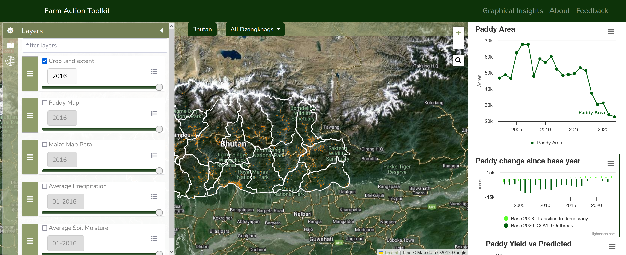
Dr. Aparna Phalke, Sarah Cox, and Tony Kim traveled to Thimphu, Bhutan, to represent the SERVIR Science Coordination Office (SCO) at the official launch of the Farm Action Toolkit service on May 17, 2024. The Farm Action Toolkit was co-developed by SERVIR and Bhutan’s implementing partners to support their mission to obtain food self-sufficiency and save operational costs. This service provides 30-meter scale cropland, paddy, and maize area maps and paddy yield estimations covering mountainous and marginal farmlands across Bhutan from 2002 to 2023.
Kim, Phalke, and Cox conducted in-person outreach events at the Royal Thimphu College and Royal University of Bhutan’s (RUB) College of Natural Resources on May 14 and May 24, respectively. Over 100 students from each academic institution participated in the outreach events, which focused on how to leverage Earth observations to address immediate environmental issues in Bhutan.
Following the launch, a SERVIR SCO service team led by Phalke and Bhutan’s partner team from Druk Holding and Investments Limited (DHI) performed surveys of agricultural fields across the Thimphu, Punakha, and Paro areas of Bhutan using GPS, helmet data collection with GoPro cameras and drones. The team interviewed individual farmers from rice cultivation areas with pest, disease, and water related issues. They also collected market analysis data from over 50 vendors and interviewed farmers on agricultural commodities and the supply chain. These field surveys will play a significant role in the operation and adoption of the Farm Action Toolkit service.
Astrophysics
Imaging X-ray Polarimetry Explorer (IXPE) Lead Scientists Awarded the Antonio Feltrinelli Prize for Astronomy
On Jun. 13, 2025, the International Antonio Feltrinelli Award for Physical, Mathematical and Natural Sciences – Astronomy was presented to Marshall Astrophysicist (Emeritus) Martin Weisskopf, and Scientists/IXPE Partners, Enrico Costa and Ronaldo Bellzzini. The announcement can be found here.
The citation recognizes the success of the Imaging X-ray Polarimetry Explorer (IXPE) and the three scientists: “For their extraordinary contribution to the realization and success of the Imaging X-ray Polarimetry Explorer (IXPE) space mission, launched in 2021 and still operational. The mission represents a historic milestone for contemporary astrophysics, as it has allowed, for the first time, the systematic observation of the X-ray polarimetry of cosmic sources, such as neutron stars, black holes and active galactic nuclei, with unprecedented sensitivity, spatial resolution and analysis capabilities. IXPE is the result of an international collaboration between the NASA Marshall Space Flight Center, the National Institute of Astrophysics (INAF), the National Institute of Nuclear Physics (INFN) and the Italian Space Agency (ASI). It is one of the most advanced missions ever carried out in the field of high-energy astrophysics, the synthesis of decades of work in the refinement of grazing incidence optics and innovative detectors. Thanks to IXPE activity, innovative results have been obtained in the study of pulsars, neutron stars, galactic and extragalactic black holes, AGNs and blazars. The mission is revealing the structure of magnetic fields in extreme and time-varying physical environments, opening up new perspectives for fundamental physics and theoretical astrophysics. IXPE measurements are also promising for testing quantum effects in strong gravitational fields, such as vacuum birefraction predicted by quantum electrodynamics. Among the most surprising results, the polarization of X-rays reflected by molecular clouds in the galactic center revealed that about two centuries ago Sgr A*, the black hole at the center of the Milky Way, experienced an episode of intense activity, with a brightness comparable to that of a Seyfert-type galaxy.”
Calibration of the University of Arizona Flex Module Optics at the Marshall 11-Meter X-ray Beamline/Stray Light Test Facility
Marshall Scientists, Nick Thomas and Danielle Gurgew, Astrophysics Branch, along with Steve Cheney, Optics Branch, hosted Professor Brandon Chalifoux and Brody McElwain of the Wyant College of Optical Sciences at the University of Arizona to calibrate Flex Module Optics at the Marshall 100-Meter X-ray Beamline/Stray Light Test Facility. Proposed and selected through NASA’s Astrophysics Research and Analysis program, Professor Chalifoux’s team aims to deliver high-angular resolution performance through non-contact figuring of segmented optics using Ultrafast Laser Stress Figuring. While visiting Marshall, McElwain also gave a Space Science/Astrophysics Seminar on this process at the National Space Science and Technology Center (NSSTC) organized by Marshall Astrophysicist, Peter Maksym.

Imaging X-ray Polarimetry Explorer (IXPE), General Observer Cycle 3 Pre-proposal Workshop
On Jul. 23, 2025, the Imaging X-Ray Polarimetry Explorer (IXPE) mission held a pre-proposal workshop for General Observer Program proposals for Cycle 3. Talks were presented on “IXPE Science Highlights” by Roger Romani, Stanford University, “IXPE Mission and Cycle 3 Overview” by Marshall Scientist, Philip Kaaret, Astrophysics Branch, “GO Proposal Submission Procedures” by Mihoko Yukita, Johns Hopkins University/Goddard, “Tools for proposals and analysis” by Marshall Scientist, Douglas Swartz, Astrophysics Branch, and “ixpeobssim for proposals” by Niccolò di Lalla, Stanford University. There was also a lively Question and Answer session. There were 144 registrants for the virtual workshop. The goal of the workshop was to help expand the IXPE user community. A metric of success is that 32% percent of participants indicted that they had no familiarity with IXPE data analysis prior to the workshop, while 40% indicated some familiarity. Also, 62% of participants indicated that they plan to submit an IXPE proposal while an additional 28% are considering doing so. The charts from all the talks and a video recording of the full workshop are available here.
IXPE General Observer Program Proposal Results
The second cycle of the Imaging X-ray Polarimetry Explorer (IXPE) General Observer program results were announced, and many Marshall Astrophysics scientists are involved in the approved observing programs. Steven Ehlert is the Principal Investigator (PI) on “In Search of Unique Polarization Signals in the Perseus Cluster,” which was the only “Large program” selected in Cycle 2. Philip Kaaret is the PI on “X-ray Polarization of the Wester Lobe SS 433” and lead Co-Investigator (Co-I) on “Probing the Accretion Ejection-Geometry of the Hyper-Eddington Black-Hole Binary SS 433 with X-ray Spectro-Polarimetry” and “Weakly Magnetized Neutron-Star X-ray Binaries in the Hard State: The Challenging Case of 4U 1812-12.” Sudip Chakraborty, the newest member of the Marshall IXPE team, is the PI on “Deciphering the Comptonization Properties of Low-Luminosity AGN Through X-ray Polarimetry” and “Face-Off with a Face-On System: Polarimetric Diagnostic of the Persisting Low-Inclination LMXB AT2019WEY.” He is also lead U.S. Co-I on “Solving the Mystery Behind the X-ray Dimming of GRS 1915+05 Using X-ray Polarimetry.” These programs were awarded observing time and funding ranging from $27,000 to $180,000.
First Pre-release of Fast EMRI Waveforms Code in Kerr Background with Eccentricity
Marshall Astrophysicist Michael Katz is the founder and a lead-developer of the Fast Extreme Mass-Ratio Inspiral (EMRI) Waveforms (FEW) package. It is currently the only efficient code available to compute gravitational waveforms for intermediate and extreme mass ratio inspirals, a key source for Laser Interferometer Space Antenna (LISA) and other gravitational wave detectors. Last week, Marshall pre-released the new code that contains the first fully relativistic, fast, and accurate waveforms built in the Kerr-equatorial-eccentric limit, including the spin on the central black hole, for the first time with eccentricity. This release has been years in the making. Katz contributed directly to this release by implementing a new customized RK8 integrator method that is powerful and adaptable to future expected cases like resonances. He also implemented the 2+1 cubic+linear interpolation scheme for the harmonic amplitudes of these waveforms, a crucial part of this update.
Imaging X-ray Polarimetry Explorer (IXPE): Ph.D Thesis Award
Jakub Podgorny, a member of the Imaging X-ray Polarimetry Explorer (IXPE) Science Team, recently received the National Prize for Ph.D. Theses in Natural Sciences in the Czech Republic. Podgorny’s Ph.D. research focused on X-ray polarization simulations and IXPE observations for stellar and supermassive black holes.