Abstract
Authors: Ved Chirayath, Ron Instrella, Laboratory for Advanced Sensing, NASA Ames Research Center.
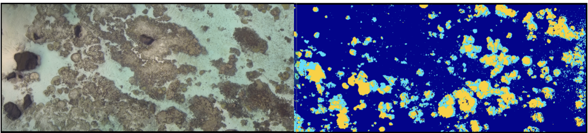
Airborne Fluid Lensing technology has enabled centimeter-resolution multispectral 3D remote sensing of aquatic systems through refractive distortions from ocean waves. In 2013, an airborne Fluid Lensing campaign conducted over the coral reef of Ofu Island, American Samoa, revealed complex morphological and bathymetric diversity at the cm-scale, or reef-scale, characteristic of the annual growth rate of such ecosystems. In this paper, we develop and validate a supervised machine learning algorithm for accurate automated segmentation of coral reefs using airborne Fluid Lensing multispectral 3D imagery. The algorithm generates cm-resolution data products such as percent cover of living structure and morphology distribution in 3D for the Ofu Island reef ecosystem with ~two-sigma accuracy. By comparison, classification of meter-resolution remote sensing imagery, representative of the effective spatial resolution of commonly-used airborne and spaceborne aquatic remote sensing platforms, produces data products with one-sigma accuracy. These results suggest existing methodologies do not sufficiently resolve coral reef systems for accurate determination of percent cover of living structure and morphology breakdown.
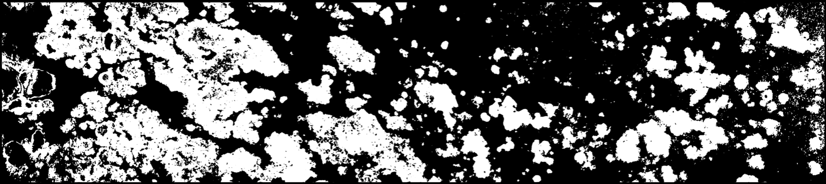
The presented algorithm is based on multidimensional naïve-Bayes maximum a posteriori (MAP) estimation. Provided a user-selected training subset of 3D multispectral images, comprising ~1% of the total dataset, the algorithm separates living structure from nonliving structure with 95% accuracy and segments the coral reef into four distinct morphological classes – branching coral, mounding coral, basalt rock, and sand, with 92% accuracy. The user-selected training data and algorithm classification results are created and verified, respectively, with sub-cm-resolution ground-truth maps, manually generated from extensive in-situ mapping, underwater gigapixel photogrammetry, and visual inspection of the 3D dataset. The methods and data products presented here enable accurate and quantitative health assessment capabilities for coral reef ecosystems at the reef-scale, or cm-resolution, over regions tens of square kilometers in area. The accurate and automated determination of percent cover and morphology distribution at cm-resolution may lead to a significantly improved understanding of reef ecosystem dynamics and responses in a rapidly-changing global climate.
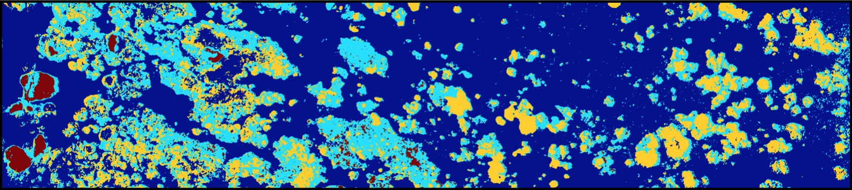
Available Datasets
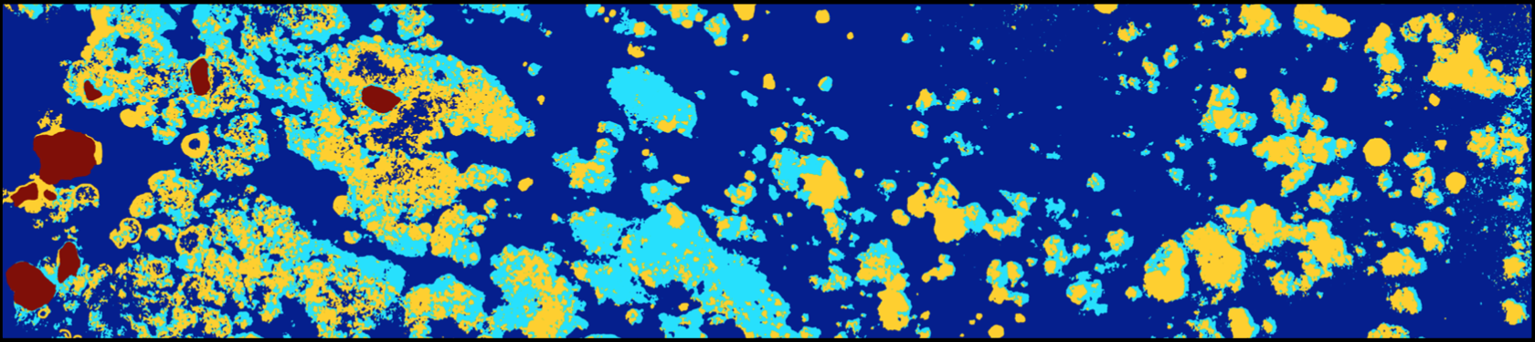
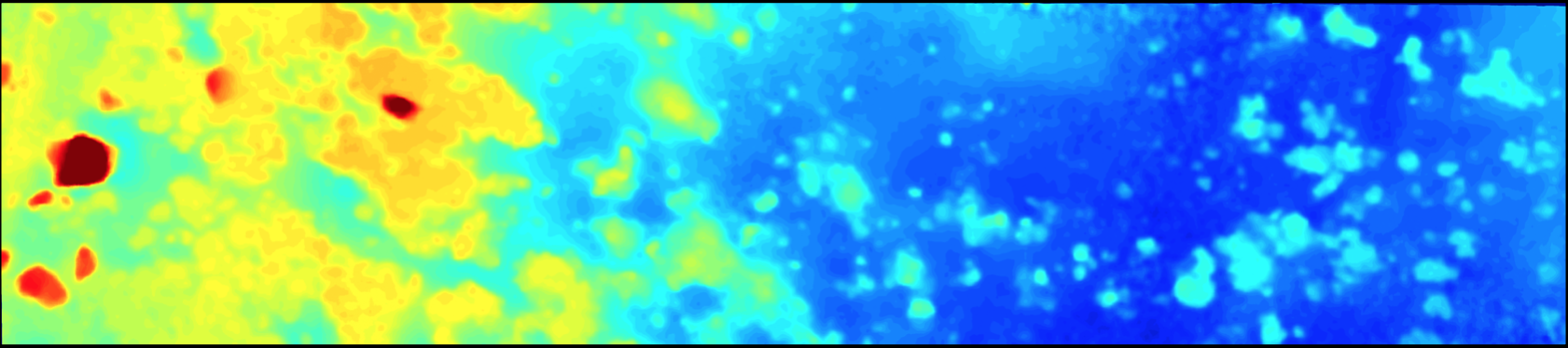
The following airborne datasets from Ofu Island, American Samoa are available for public use. Example transect 1 (shown below) has dimensions of 103m by 30m, coordinates are -14.182º,-169.658º. Please use the titled links below to access each dataset. Appropriate credit must be given to authors Ved Chirayath and Ron Instrella (Laboratory for Advanced Sensing), NASA Ames Research Center.
2D Airborne Fluid Lensing Coral Dataset – Transect 1 – TIFF (157 MB)
3D Airborne Fluid Lensing Depth Elevation Map (DEM) – Example Transect 1 – TIFF (124 MB), MAT (256 MB)
Coral Percent Cover Product (2D Segmentation) – Transect 1 – TIFF (1.1MB)
Coral Morphology Product – Transect 1 – TIFF (157MB)
Coral Morphology Reference Map – Transect 1 – TIFF (117MB)