


Much like the sky, rivers are rarely painted one color. Rivers around the world appear in shades of yellow, green, blue, and brown—and subtle changes in the environment can alter their colors.
New research shows the dominant color has changed in about one-third of large rivers in the continental United States over the past 35 years.
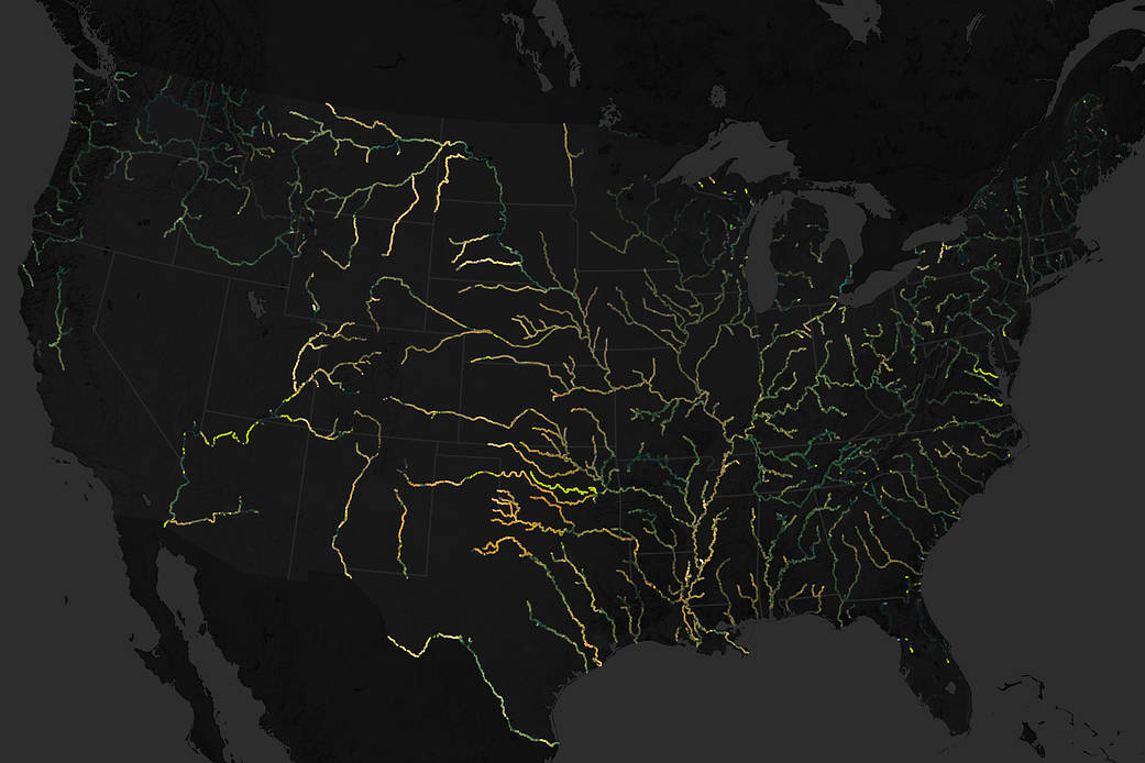
The figure above shows data from a map of river color for the contiguous United States. The rivers are colored as they would approximately appear to the human eye. The map was built from 234,727 images collected by Landsat satellites between 1984 and 2018. The dataset includes 67,000 miles (100,000 kilometers) of waterways of at least 200 feet (60 meters) wide.
While is not unusual for rivers to change colors over time due to fluctuations in flow, concentrations of sediments, and the amount of dissolved organic matter or algae in the water, scientists have found that the most extreme changes often occur near man-made reservoirs. Around 56 percent of rivers were dominantly yellow over the course of the investigation, and 38 percent were dominantly green.
Want more? Read Amazing Earth: Satellite Images from 2021
Image Credit: NASA Earth Observatory image by Joshua Stevens, using data courtesy of Gardner, J., et al. (2020).