


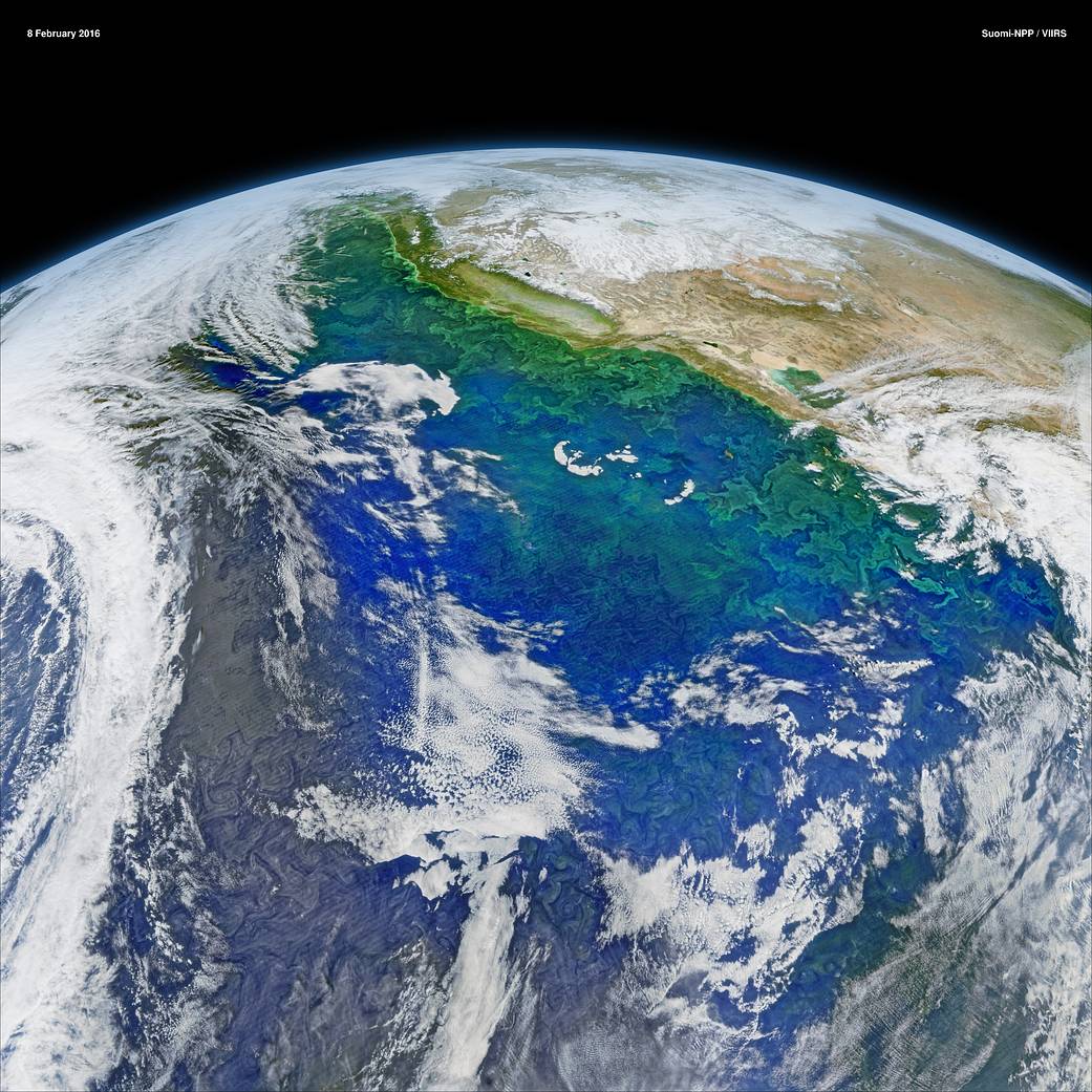
This Feb. 8 2016, composite image by the Visible Infrared Imaging Radiometer Suite (VIIRS) on NASA/NOAA's Suomi NPP satellite reveals the complex distribution of phytoplankton in one of Earth's eastern boundary upwelling systems — the California Current.
This Feb. 8 2016, composite image by the Visible Infrared Imaging Radiometer Suite (VIIRS) on NASA/NOAA’s Suomi NPP satellite reveals the complex distribution of phytoplankton in one of Earth’s eastern boundary upwelling systems — the California Current.
Recent research suggests that our warming climate may be increasing the intensity of upwelling in such regions with possible repercussions for the species that comprise those ecosystems.
Image Credit: NASA