


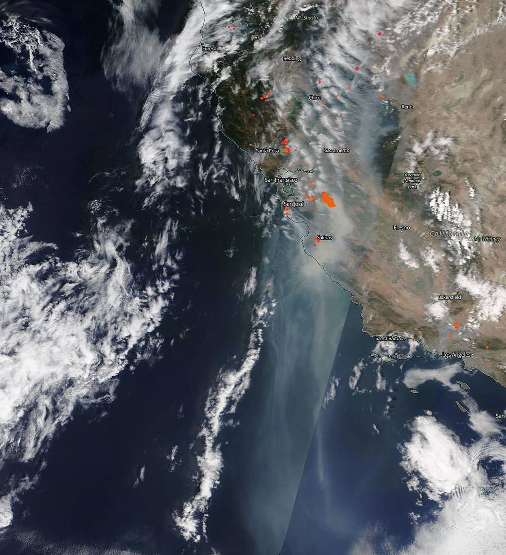
Copious clouds of smoke spill off the California coast and travel almost 600 miles in NASA’s Terra satellite image from Aug. 19, 2020. In the year 2020, California has already seen 5,762 incidents affecting 204,481 acres (319 sq. miles). That is more than quadruple the number of acres burned in 2019 per CAL Fire. More than 22,000 residents have now been asked to evacuate ahead of the spreading fires near San Mateo and Santa Cruz. Near Vacaville, 10,000 residents have been asked to evacuate. Fifty structures have been destroyed and 50 more are in danger just in that area. So many fires have started around Sonoma, Lake, Napa and Solano counties that they have been dubbed the LNU Lightning Complex because they all began from lightning strikes from summer storms. California continues to experience a sweltering late summer heat wave that has broken several record highs in recent days. The hot, dry conditions are expected to continue at least into the weekend providing perfect conditions for more wildfire outbreaks. California Gov. Gavin Newsom has declared a state of emergency due to the fires on Tuesday.
NASA’s Earth Observing System Data and Information System (EOSDIS) Worldview application provides the capability to interactively browse over 700 global, full-resolution satellite imagery layers and then download the underlying data. Many of the available imagery layers are updated within three hours of observation, essentially showing the entire Earth as it looks “right now.” Actively burning fires, detected by thermal bands, are shown as red points. Image Courtesy: NASA Worldview, Earth Observing System Data and Information System (EOSDIS). Caption: Lynn Jenner with information from CAL Fire.