


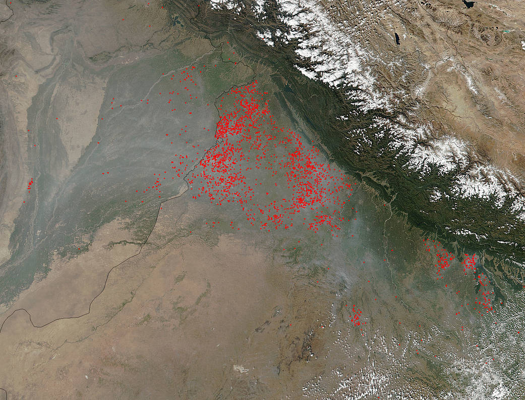
Agricultural fires in the northernmost section of the Punjab state of India form a large cluster in this satellite image taken by Suomi NPP. Actively burning areas, detected by VIIRS are outlined in red. When they are accompanied by smoke, as in this image, they are indicative of fire. This form of farming in the region known as “slash and burn” has been practiced for thousands of years. It enables farmers to clear old crop, return nutrients to the soil, and prepare the ground for a new growing season.
This image was captured by NOAA/NASA’s Suomi NPP’s Visible Infrared Imaging Radiometer Suite (VIIRS) instrument on October 20, 2017. The Suomi NPP satellite is a joint mission between NASA and NOAA.
NASA image courtesy Jeff Schmaltz, MODIS Rapid Response Team. Caption: NASA/Goddard, Lynn Jenner