


![Request for Information – Potential [Placeholder for Prize]](https://assets.science.nasa.gov/dynamicimage/assets/science/psd/solar/2023/09/s/solarsystem_0.jpg?w=1024)


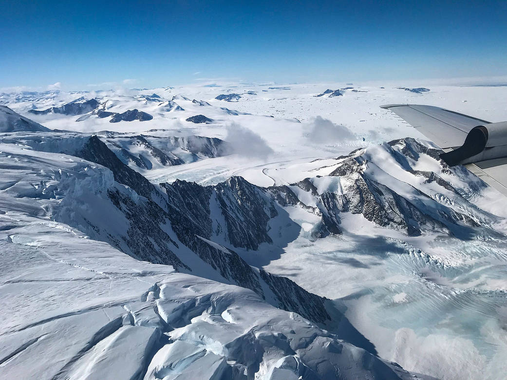
For nine years, NASA’s Operation IceBridge has been flying over Antarctica to measure changes in land and sea ice at the bottom of the world. This image, taken on Oct. 31, 2017, shows the flight over the Larsen C ice shelf. Soon after beginning this year’s campaign, the mission flew over one of the most obvious signs of change in 2017: a giant iceberg the size of Delaware that recently calved off of Larsen C. The iceberg is more than 600 feet thick and has a total volume twice the size of Lake Erie. Even so, it won’t contribute any more to sea level rise, as it’s been floating as part of an ice shelf for a long time. Scientists are still researching whether the removal off all that ice will have any effect on the flow rates of glaciers upstream from the Larsen C.
Learn more about Operation IceBridge.
Image Credit: NASA/Nathan Kurtz