


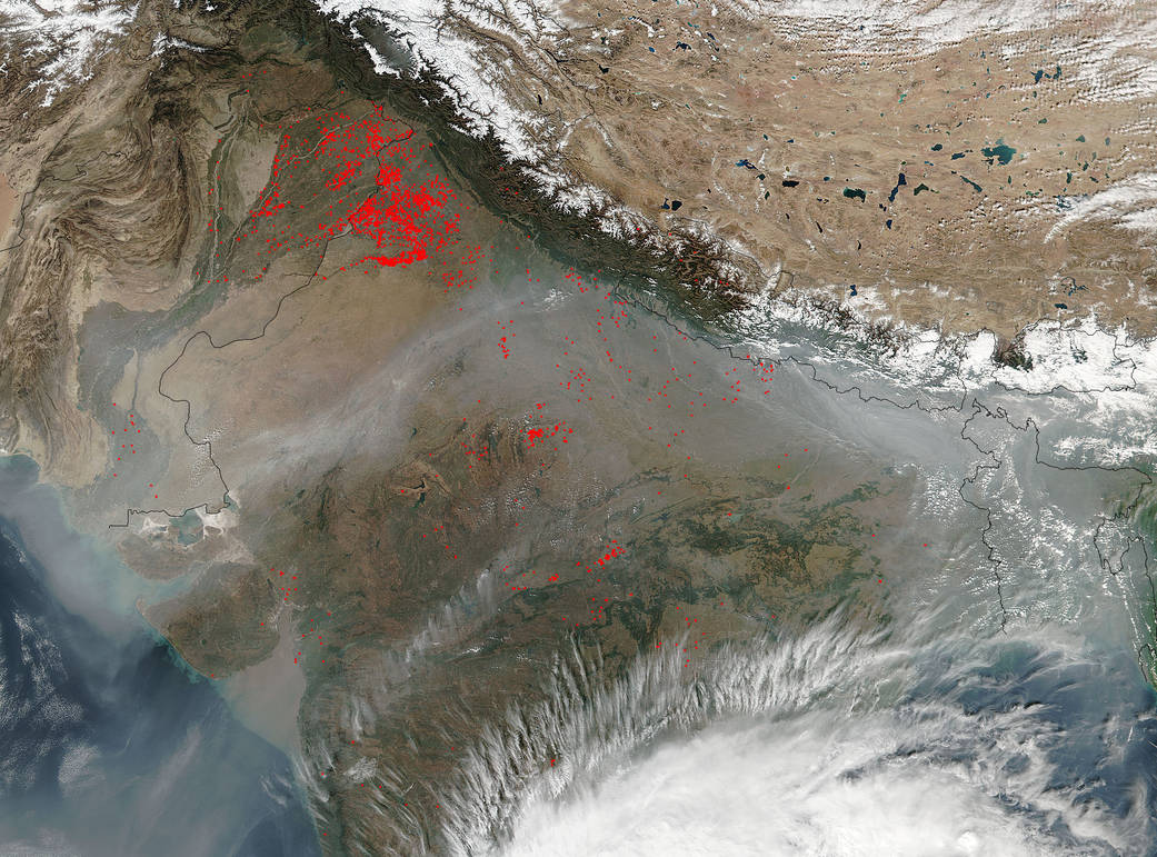
On November 16, 2015 the Visible Infrared Imaging Radiometer Suite (VIIRS) image on the Suomi NPP (National Polar-orbiting Partnership) satellite sensors detected numerous agricultural fires and these fires are marked with red dots. The foothills of the Himalaya Mountains in northwest India provide a particularly fertile terrain where the rivers and streams of the region spill out of the mountains. These agricultural fires are used to clear fields of previous growth and to return nutrients to the soil. These fires have been burning since the very beginning of November. Satellites from NASA have detected these Indian agricultural fires on numerous days:
These fires will continue until the land is readied for planting. The crop of choice in this area is wheat. Once the planting begins the fires will be extinguished. There is always a chance that an agricultural fire will get out of hand and produce a wildfire. Smoke is also a concern as smoke released by any type of fire (forest, brush, crop, structure, tires, waste or wood burning) is a mixture of particles and chemicals produced by incomplete burning of carbon-containing materials. All smoke contains carbon monoxide, carbon dioxide and particulate matter or soot and is hazardous to breathe.
NASA image courtesy Jeff Schmaltz, MODIS Rapid Response Team. Caption: NASA/Goddard, Lynn Jenner