


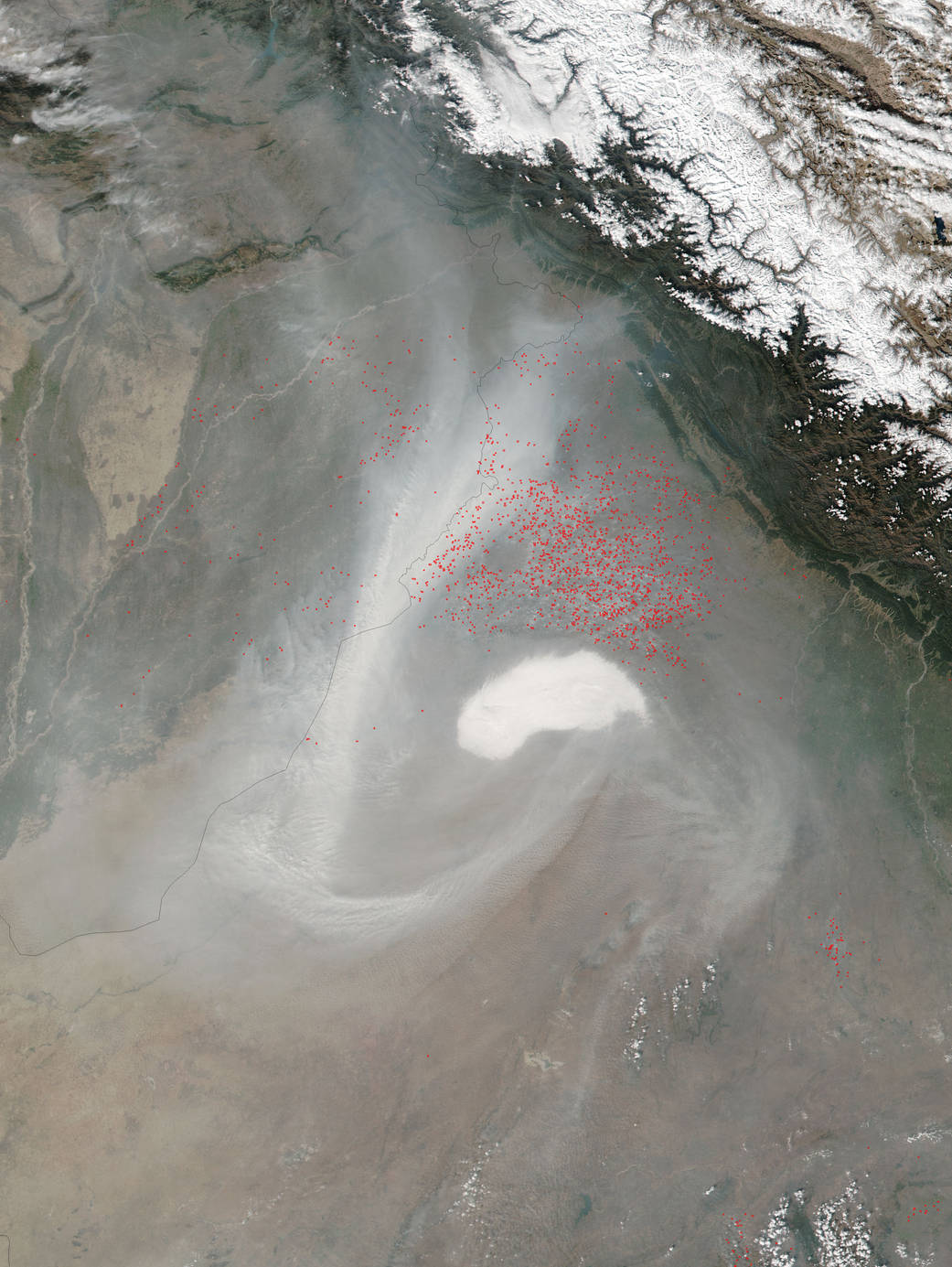
In November, farmers in the Punjab region of India set fire to their fields to clear them prior to planting. Preparing for planting with fire has the benefit of clearing out some pests that eat crops and turning crop residues from the previous season into fertilizing ash. Red outlines show the approximate locations of active burning. These red outlines are particularly hard to see because of the smoke and clouds obscuring the image, but there are literally hundreds of red marks from fires in this image. This area of India comprises only about 1.6 percent of India’s land surface but this is the area that grows about one-fifth of India’s wheat.
As useful as this system is for cleaning fields, the byproduct, smoke, harms human health and aggravates heart and lung disease especially in older adults, children, and people with chronic health conditions. The smoke rising from the fire can include thousands of compounds, including carbon dioxide, carbon monoxide, nitrogen oxides, and particulate matter. These components have the potential to affect human health, but exactly how different types of smoke affect people is not yet fully understood.
NASA’s Suomi NPP satellite collected this natural-color image using the VIIRS (Visible Infrared Imaging Radiometer Suite) instrument on November 06, 2015. Actively burning areas, detected by MODIS’s thermal bands, are outlined in red. NASA image courtesy Jeff Schmaltz LANCE/EOSDIS MODIS Rapid Response Team, GSFC. Caption by Lynn Jenner