Engineers have further matured two landing sensor systems that could be used for future lunar and Martian touchdowns, thanks to a recent flight test above the mountains north of California’s Mojave Desert.
One of the two systems – a vision-based sensor system called Terrain Relative Navigation, or TRN – is composed of a camera and a computer. Its onboard software compares captured images to a terrain map in real-time to determine a vehicle’s exact location and orientation, enabling safe and precise planetary landings. The system was developed under a NASA Tipping Point contract by Astrobotic Technology, Inc., partnered with Moog, NASA’s Jet Propulsion Laboratory (JPL), and NASA’s Johnson Space Center. This TRN system will fly on Astrobotic’s Peregrine and Griffin landers under NASA’s Commercial Lunar Payload Services initiative.
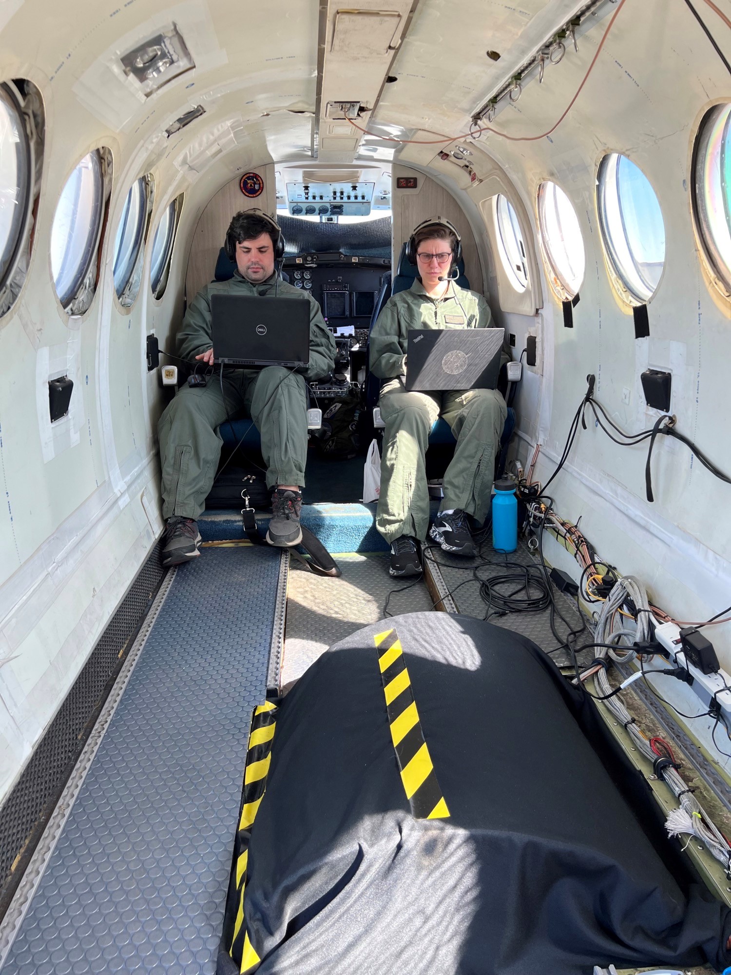
For the recent terrestrial flight test, Astrobotic’s TRN system was mounted behind an optical window in the belly of a NASA King Air B200 twin-turboprop fixed-wing aircraft. The plane traversed roughly 62.1 miles (100 kilometers) of terrain, descending from 5.6 miles (9 kilometers) above the surface, while TRN captured live images, assessed them in real time, and provided location measurements. Thousands of images combined with ground truth data were collected over five days of flight testing.
During the flight, engineers from Astrobotic studied whether they could generate accurate, reliable estimates from the TRN system while in flight, and whether they could do that repeatedly as the plane descended from high altitude over rugged terrain with similar topography to the Moon’s surface. This type of live location estimation is critical for safe and precise touchdowns on other worlds, where GPS isn’t an option. It can also provide a backup when GPS isn’t available for terrestrial applications.
“We are thrilled with the success of this challenging flight test. Our hardware and software captured images, detected, and matched features in our map, and successfully produced valid location estimates across the descent trajectories, just as it will at the Moon,” said Dr. Andrew Horchler, chief research scientist at Astrobotic and principal investigator for the TRN system. The Astrobotic team will use this data to assess and improve TRN performance and robustness in detail prior to the system’s launch on Peregrine Mission 1.
Astrobotic has been developing its commercial TRN system for over a decade. Early testing of the system in 2014 under NASA’s Flight Opportunities program on a Masten Space Systems vehicle provided the foundation for the fundamental algorithms and system architecture. Under this Tipping Point partnership, Astrobotic has incorporated key elements and lessons learned from the Mars 2020 TRN system developed by JPL. Johnson has provided independent verification and validation of Astrobotic’s maps, simulation tools, and closed loop hardware and software testing.
This recent terrestrial flight test in California provides different performance markers than what engineers have tested in the past. Prior TRN tests were restricted to lower altitudes and relatively small regions, but the descent profile of a lunar lander traverses hundreds of kilometers of terrain as it deaccelerates and descends toward its landing site. The results from this test will be key to further verification and validation of TRN prior to Astrobotic’s upcoming lunar missions. The extent, range of altitudes, and lighting conditions captured in the real-world data under this test will augment already extensive simulation-based testing, help tune Astrobotic’s TRN algorithms and hardware acceleration, and help mission success.
In tandem on this flight, Astrobotic also successfully flew and collected valuable data with a laser-based landing system called the Navigation Doppler Lidar (NDL), developed by NASA’s Langley Research Center. The NDL system was funded by NASA’s Science Mission Directorate, with maturation funding by NASA’s Game Changing Development under the Space Technology Mission Directorate.
The Tipping Point award is funded by GCD. Engineers from Langley’s Research Services Directorate provided the aircraft, pilots, and integrated the sensors for this test. The Astrobotic team will review data from this successful testing in detail in preparation for use aboard Astrobotic’s Peregrine Lander, which is planned to be among the first American spacecraft to land on the Moon since the Apollo program.