


CRATER
The CRATER (Costa Rica Airborne research on foresT Ecosystem Response to volcanic emissions) project seeks to advance our understanding of the interactions between volcanic gas emissions and tropical ecosystems.
TYPE
Airborne/Atmospheric Science, Ecology
FIELDWORK
Summer 2025
PRINCIPAL INVESTIGATOR
Jay Tomlin
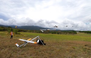
UAS Measures Emissions
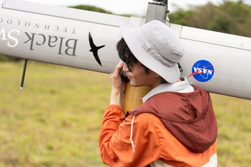
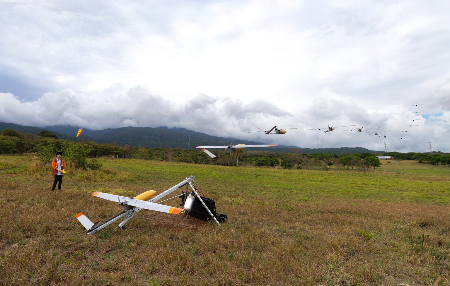
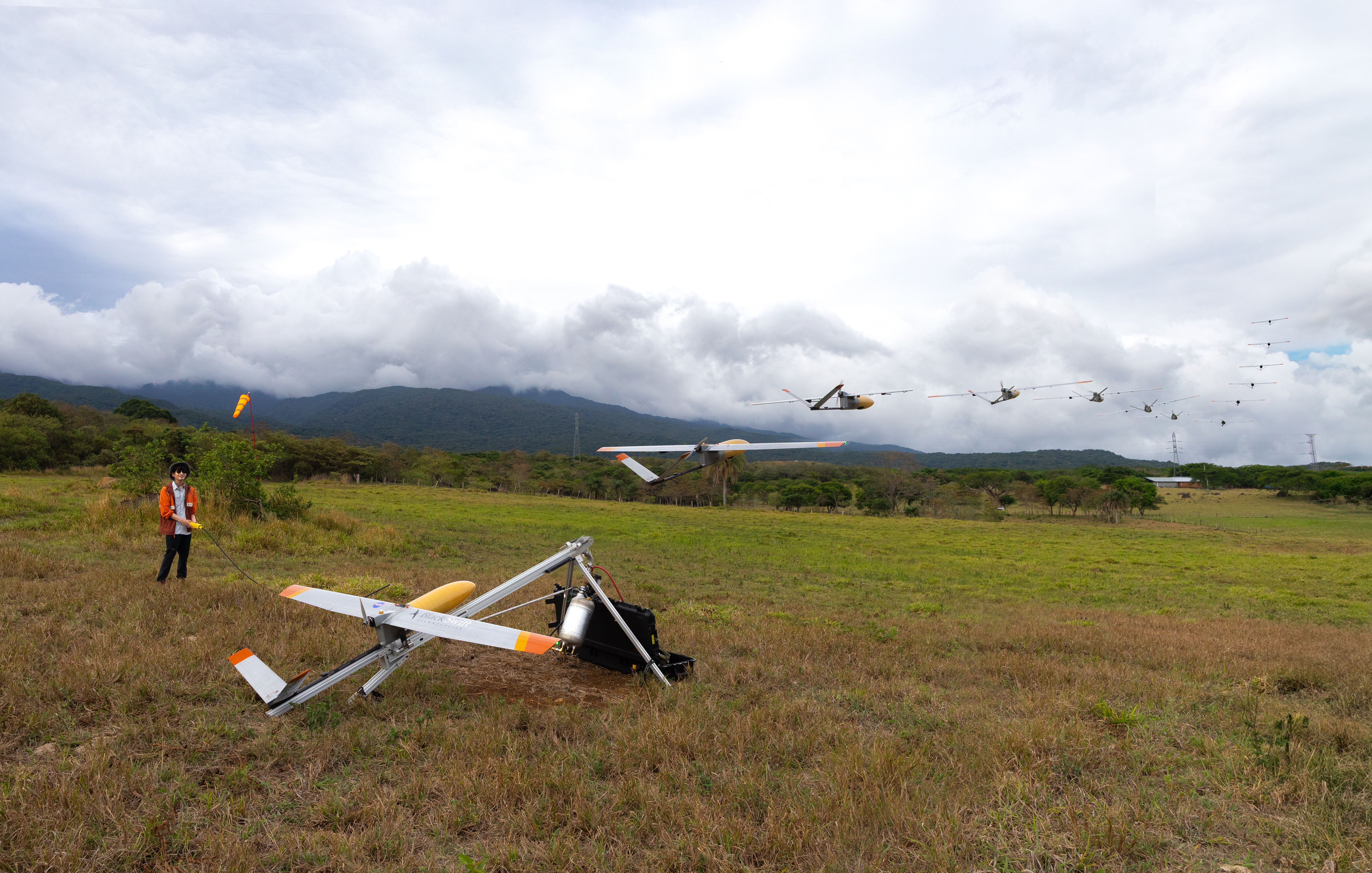
Jay Tomlin Launches the S2
In this composite image, CRATER science principal investigator Jay Tomlin launches the S2 Black Swift uncrewed aircraft system (UAS) into the sky at Rincon de la Vieja National Park, Costa Rica, during the 2025 campaign. CRATER (Costa Rica Airborne research on foresT Ecosystem Response to volcanic emissions), is a NASA-led project investigating the use of an uncrewed aircraft for volcanic trace gas sampling, in order to better understand the impact of elevated carbon dioxide emissions on vegetation. Credits: NASA/Milan Loiacono
Overview
CRATER seeks to increase our understanding of the interaction between persistent gas emission and tropical ecosystems, using the S2 Black Swift uncrewed aircraft system (UAS) to measure trace gas concentrations around Rincón de la Vieja Volcano, Costa Rica.
What is CRATER?
CRATER, which stands for Costa Rica Airborne research on foresT Ecosystem Response to volcanic gas emissions, aims to characterize and track the location, distribution, and fate of these gases.
These low-altitude airborne observations, when combined with existing ground-based datasets available from collaborators on site, will provide a more complete picture of how persistent volcanic emissions influence surrounding ecosystems.
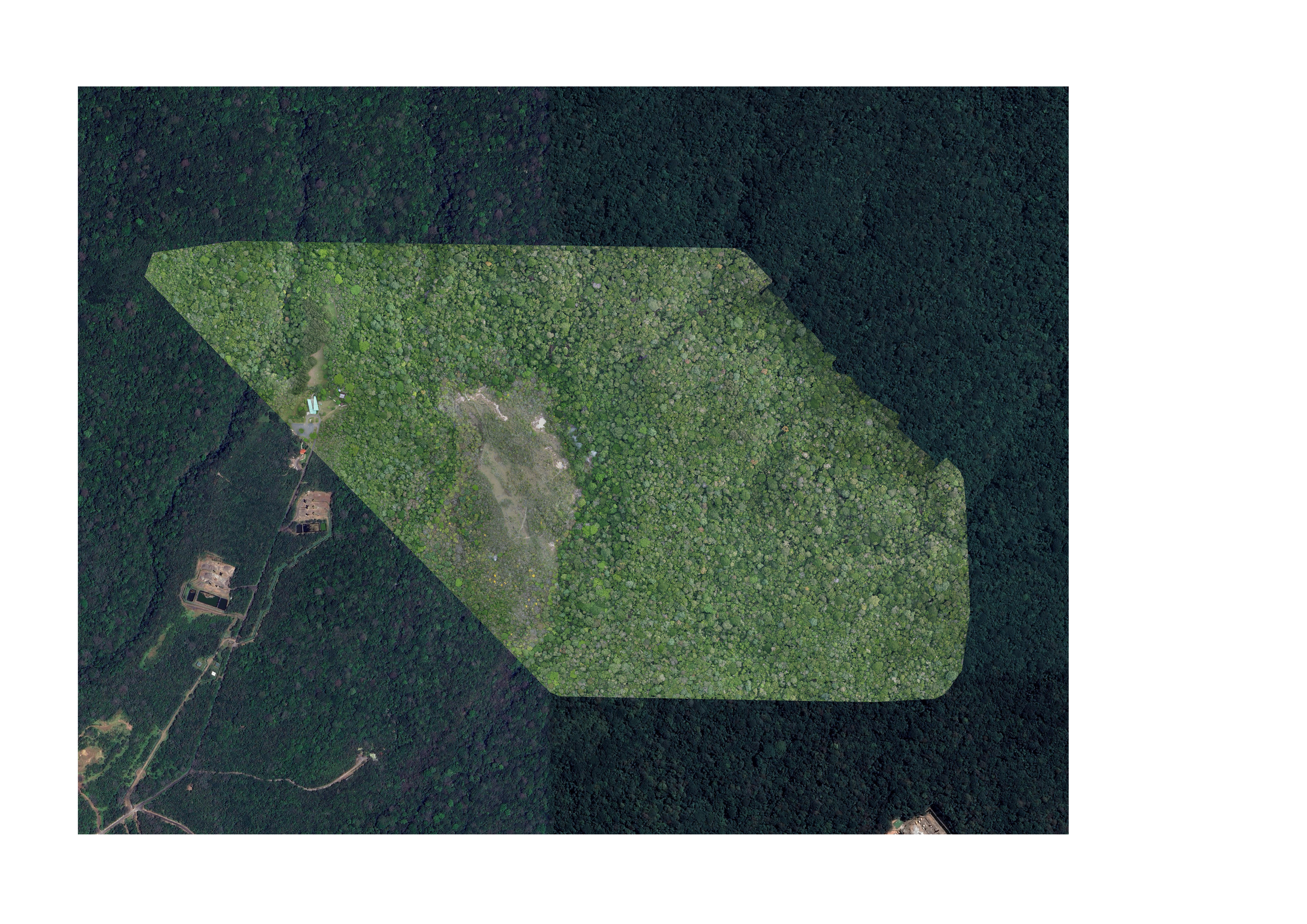


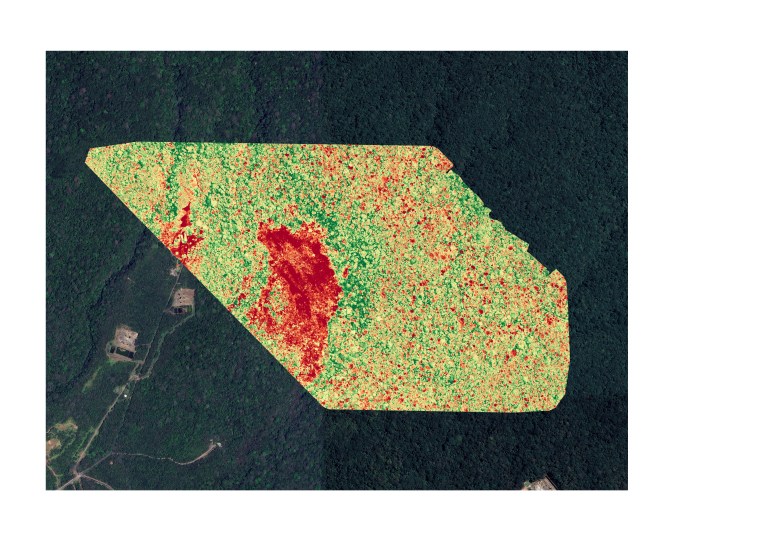
Orthomosaic and Vegetation Mapping
CRATER’s Science Objectives
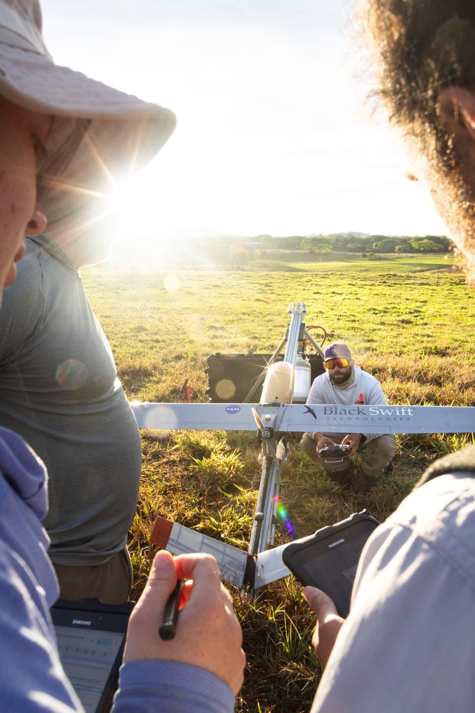
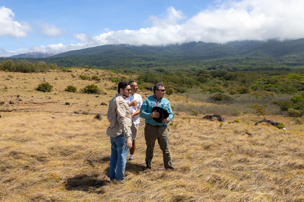
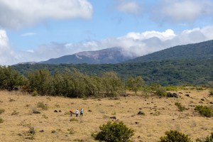
The Costa Rica Airborne research on foresT Ecosystem Response to volcanic emissions (CRATER) mission seeks to advance our understanding of the interactions between persistent volcanic gas emission and tropical ecosystems. NASA Ames Research Center’s Flight Operations and Earth Science Division collaborate with Black Swift Technologies LLC to deploy an Ames fixed-wing electric S2 uncrewed aircraft system (UAS) at Rincón de la Vieja Volcano, Costa Rica with support from University of Costa Rica collaborators. The S2 will collect high-resolution infrared and visual imagery, and trace gas concentration data (CO2, H2O, H2S, SO2, and SO2 plume cross-sections via mini-DOAS) along the volcano’s south-southeastern flank.
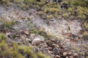
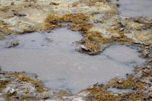
This mission will enable spot quantification of “diffuse” volcanic CO2 flux as this “cold” volcanic gas continuously seeps into and through tropical forests from below. It will also improve our understanding of how these diffuse emissions and those from the crater vent are transported and dispersed along the flanks of Rincón de la Vieja, and how surrounding and overlaying vegetation responds to such elevated CO2. We aim to characterize plume structure and distribution, and to identify volcanic CO2 transport pathways. These near surface (<120 m) airborne observations, when combined with existing ground-based datasets available from our collaborators on site, will provide a more complete picture of how persistent volcanic gas emissions influence surrounding ecosystems. The region’s unique exposure to elevated CO2 offers a natural laboratory to explore how tropical vegetation responds to long-term gas inputs, insight that may illuminate broader ecological consequences of rising atmospheric CO2 levels and reveal early indicators of volcanic unrest.
Together, these areas of research will answer:
- How does persistent volcanic CO2 affect surrounding vegetation, and can remote sensing detect these changes?
- How do volcanic CO2 emissions from the crater compare in magnitude and spatial distribution to persistent, variable emissions from surface vents?
- How do continuously released gases disperse, including elusive downslope flow of CO2, influence local variability in ecosystem response and volcanic emission changes
- How effective are UAS-based methods for detecting and quantifying gas fluxes in rugged volcanic environments compared to ground-based or satellite methods? What lessons from this campaign can inform safe, efficient, and robust operation protocols of future UAS deployments in challenging terrain?
What can volcano emissions teach us about tropical ecosystems?
Volcanoes are effective natural laboratories. Persistent volcanic gas emissions offer a unique opportunity to study how tropical ecosystems respond to elevated levels of carbon dioxide (CO2), providing insight into how rising atmospheric CO2 may impact forest health, growth, and resilience on a changing planet.


