![Request for Information – Potential [Placeholder for Prize]](https://assets.science.nasa.gov/dynamicimage/assets/science/missions/a-step/FFR_Earth_Background_20251120%20.png?w=1024)


For 30 total minutes in February, NASA lit a beacon on the Moon – successfully testing a sophisticated positioning system that will make it safer for Artemis-era explorers to visit and establish a permanent human presence on the lunar surface.
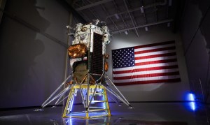
The Lunar Node 1 demonstrator, or LN-1, is an autonomous navigation system intended to provide a real-time, point-to-point communications network on the Moon. The system – tested during Intuitive Machines’ IM-1 mission as part of NASA’s CLPS (Commercial Lunar Payload Services) initiative – could link orbiters, landers, and even individual astronauts on the surface, digitally verifying each explorer’s position relative to other networked spacecraft, ground stations, or rovers on the move.
That system would be a marked improvement over conventional, Earth-based radio data relays, NASA researchers said – even more so compared to Apollo-era astronauts trying to “eyeball” distance and direction on the vast, mostly grey lunar surface.
“We’ve lit a temporary beacon on the lunar shore,” said Evan Anzalone, LN-1 principal investigator at NASA’s Marshall Space Flight Center in Huntsville, Alabama. “Now, we seek to deliver a sustainable local network – a series of lighthouses that point the way for spacecraft and ground crews to safely, confidently spread out and explore.”
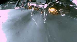
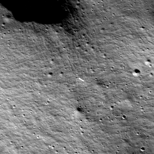
The experiment was launched Feb. 15 as a payload on the IM-1 mission. The Nova-C lander, named Odysseus, successfully touched down Feb. 22 near Malapert A, a lunar impact crater near the Moon’s South Pole region, executing the first American commercial uncrewed landing on the Moon. The lander spent its subsequent days on the surface conducting six science and technology demonstrations, among them LN-1, before it officially powered down on Feb. 29.
“This feat from Intuitive Machines, SpaceX, and NASA demonstrates the promise of American leadership in space and the power of commercial partnerships under NASA’s CLPS initiative,” NASA Administrator Bill Nelson said in a statement after the landing. “Further, this success opens the door for new voyages under Artemis to send astronauts to the Moon, then on to Mars.”
During IM-1’s translunar journey, the Marshall team conducted daily tests of the LN-1 beacon. The original plan was for the payload to transmit its beacon around the clock upon landing. NASA’s Deep Space Network, the international giant radio antenna array, would have received that signal for, on average, 10 hours daily.
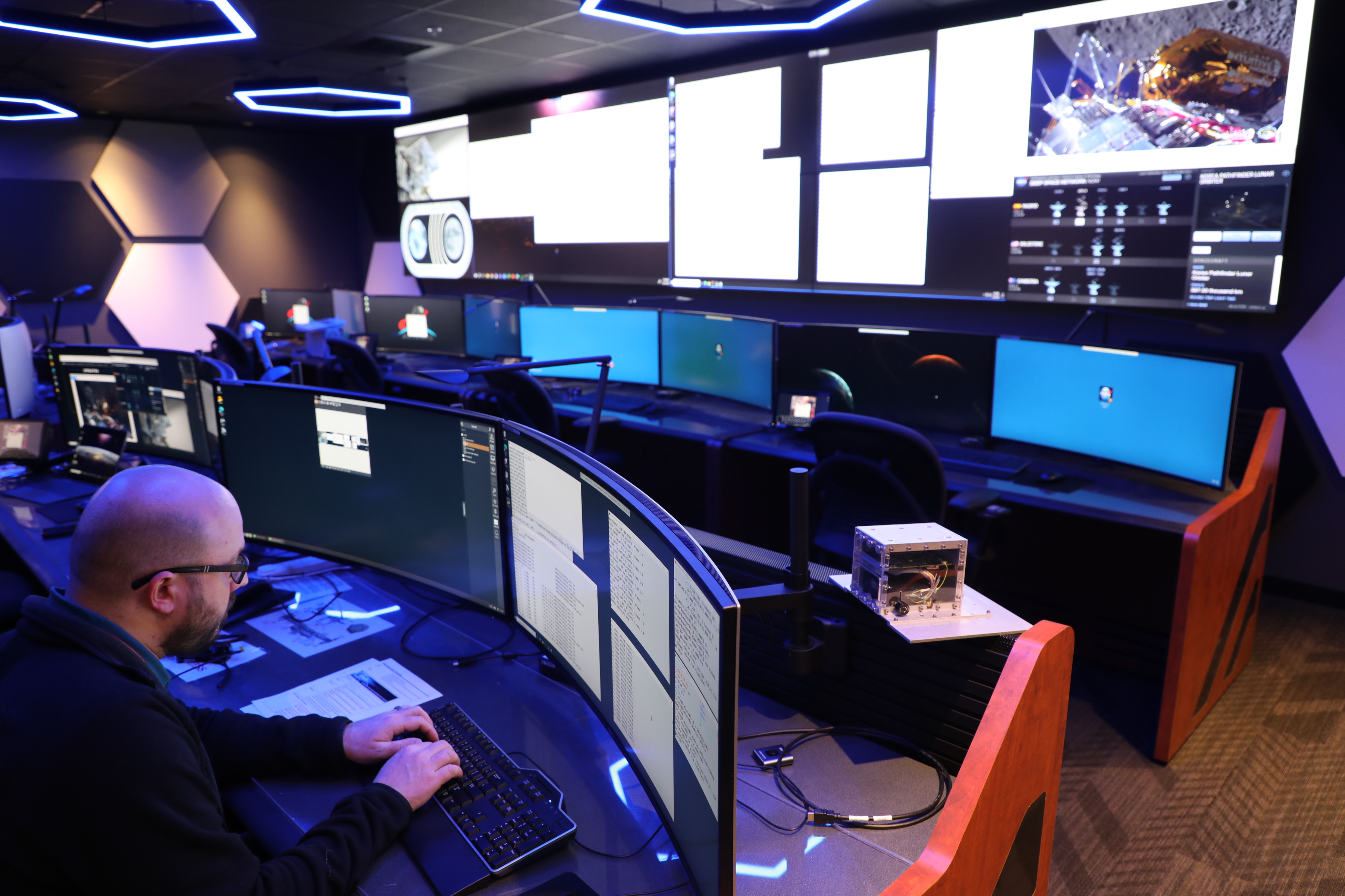
Instead, due to the lander’s touchdown orientation, LN-1 conducted two 15-minute transmissions from the surface. DSN assets successfully locked on the signal, feeding telemetry, navigation measurements, and other data to researchers at Marshall, NASA’s Jet Propulsion Laboratory, and Morehead State University in Morehead, Kentucky. The team continues to evaluate the data.
LN-1 even provided critical backup to IM-1’s onboard navigation system, noted Dr. Susan Lederer, CLPS project scientist at NASA’s Johnson Space Center in Houston. The LN-1 team “really stepped up to the task,” she said, by relaying spacecraft positioning data during translunar flight to NASA’s Deep Space Network satellites at the Goldstone and Madrid Deep Space Communications Complexes in Fort Irwin, California, and Robledo de Chavela, Spain, respectively.
In time, navigation aids such as Lunar Node-1 could be used to augment navigation and communication relays and surface nodes, providing increased robustness and capability to a variety of users in orbit and on the surface.
As the lunar infrastructure expands, Anzalone envisions LN-1 evolving into something akin to a network that monitors and maintains a busy metropolitan subway system, tracking every “train” in real time, and operating as one part of a larger, LunaNet-compatible architecture, augmenting other NASA and international investments, including the Japanese Aerospace Exploration Agency’s Lunar Navigation Satellite System.
And the technology promises even greater value to NASA’s Moon to Mars efforts, he said. LN-1 may improve data delivery to lunar explorers by just a matter of seconds over conventional relays – but real-time navigation and positioning becomes much more vital on Mars, where transmission delays from Earth can take up to 20 minutes.
“That’s a very long time to wait for a spacecraft pilot making a precision orbital adjustment, or humans traversing uncharted Martian landscapes,” Anzalone said. “LN-1 can make lighthouse beacons of every explorer, vehicle, temporary or long-term camp, and site of interest we send to the Moon and to Mars.”
Marshall engineers designed, developed, integrated, and tested LN-1 as part of the NPLP (NASA-Provided Lunar Payloads) project funded by the agency’s Science Mission Directorate. Marshall also developed MAPS (Multi-spacecraft Autonomous Positioning System), the underlying networked computer navigation software. MAPS previously was tested on the International Space Station in 2018, using NASA’s Space Communications and Navigations (SCaN) Testbed.
NASA’s CLPS initiative oversees industry development, testing, and launch of small robotic landers and rovers supporting NASA’s Artemis campaign. Learn more here.
Jonathan Deal
Marshall Space Flight Center, Huntsville, Ala.
256-544-0034