![Request for Information – Potential [Placeholder for Prize]](https://assets.science.nasa.gov/dynamicimage/assets/science/psd/solar/2023/09/s/solarsystem_0.jpg?w=1024)


Editor’s note: The UAS in the NAS project was concluded in September 2020. This material is being kept online for historical purposes, but it will no longer be updated.
Unmanned aircraft systems (UAS) promise to dramatically change the face of commercial aviation, enabling whole new markets, and potentially spurring economic growth and job creation. According to industry forecasts, UAS operations will increase exponentially once they are fully integrated within the national airspace system. Today, in the United States, there are about 50 companies, universities, and government organizations developing more than 150 different unmanned aircraft designs.
UAS are increasingly being used for civil applications where it’s not feasible or practical to rely on extended human-piloted flights:
- Long-duration scientific research
- Remote sensing
- Firefighting
- Aerial photography
- Land and crops surveying
- Pipeline monitoring
- Border protection
- Emergency management
- Airborne communications
NASA has a history of supporting research, development and flight tests for many types of UAS’s that are being used entirely for civilian purposes.
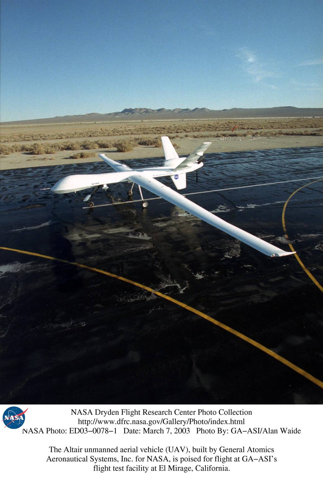
Altair/Repurposed for Science
One of three Predator B unmanned military aircraft repurposed by NASA for scientific research, the Altair has conducted missions related to earth science, disaster management, homeland security and law enforcement. In 2006, the Altair was dispatched on a 16-hour mission when California’s Office of Emergency Services requested NASA support to chart the perimeter of that state’s 40,000 acre Esperanza Fire.
Learn More
View Videos
View Photos
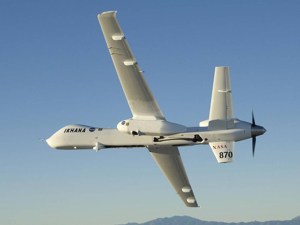
Ikhana/Multiple Research Roles
Ikhana is a Choctaw Native American word for “intelligent, conscious, or aware.” NASA uses this airborne platform to demonstrate and validate electronic sensor technologies, conduct long-duration Earth observation; and develop technologies that improve the capability, reliability, and safety of manned and unmanned aircraft.
Learn More
View Videos
View Photos
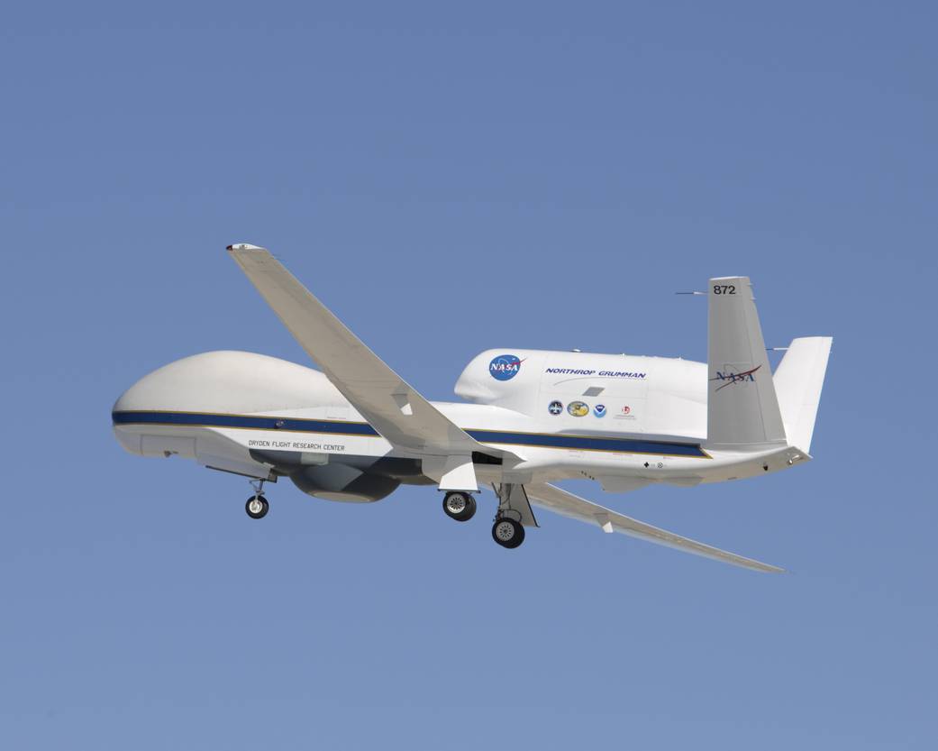
Global Hawk/Long-Duration Observations
Three Northrop Grumman Global Hawk unmanned aircraft are stationed at NASA’s Dryden Flight Research Center. Each is used in high-altitude, long-duration Earth-science missions. The vehicles’ ability to remain aloft for extended periods while carrying large payloads enables the science community to better observe and monitor remote locations not otherwise accessible by piloted craft.
Learn More 1 | Learn More 2
View Videos
View Photos
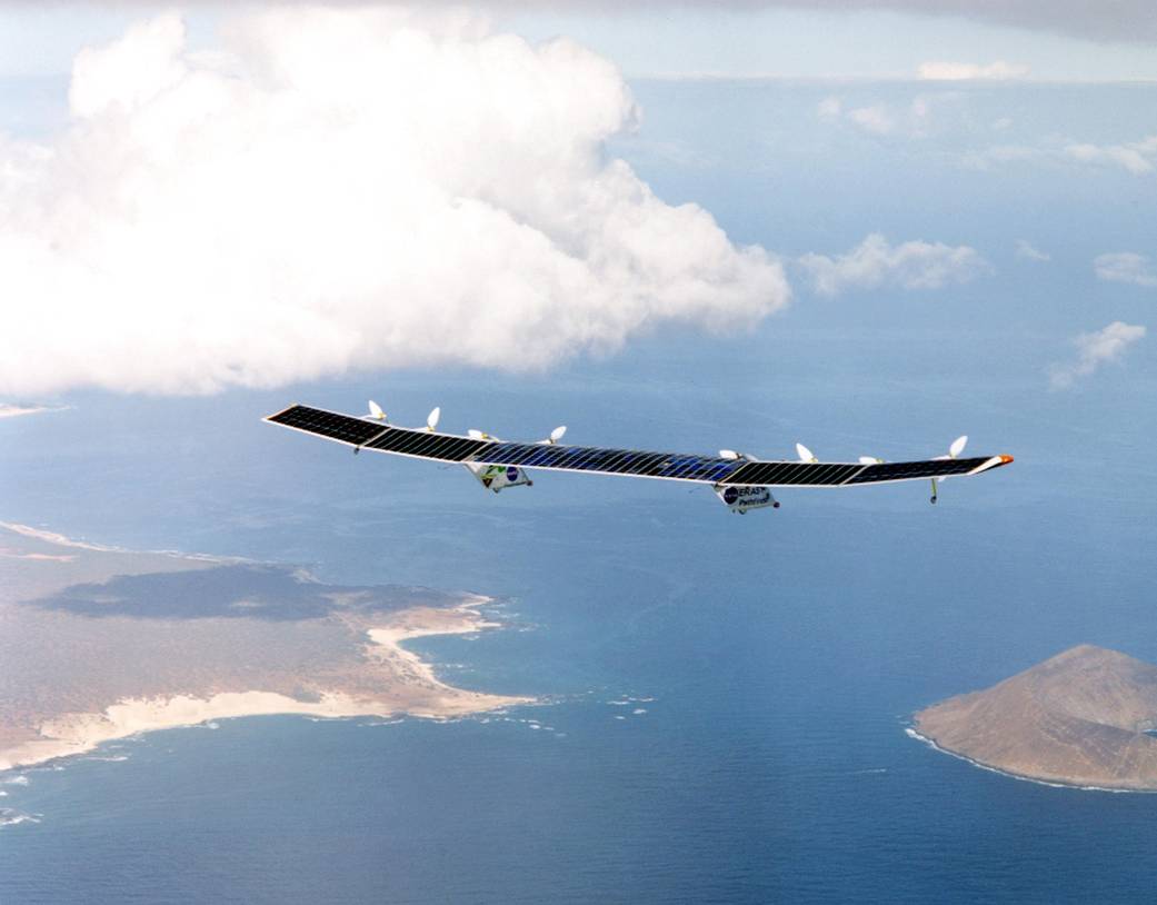
Pathfinder Plus/Advanced Technology Studies
Pathfinder was an unpiloted aircraft used by NASA’s ERAST (Environmental Research Aircraft and Sensor Technology) program, a NASA-industry alliance organized to develop advanced technologies to enable aircraft to study the global environment during extremely long flights at altitudes in excess of 100,000 feet.
Learn More
View Videos
View Photos
SIERRA/Tracking Arctic Ice
The Science Instrumentation Environmental Remote Research Aircraft (SIERRA) has flown as part of the Characterization of Arctic Sea Ice Experiment project, to monitor receding Arctic sea ice, and better understand its life cycle and long-term stability. In coordination with satellite observations, SIERRA has tracked ice slabs as they drifted from the Arctic Ocean south into the North Atlantic.