


Faculty Advisors:
Tom Bell, Woods Hole Oceanographic Institute
Graduate Mentor:
Sarah Lang, University of Rhode Island
Oceans Group Introduction
Faculty Advisor Tom Bell and Graduate Mentor Sarah Lang
Isabella Showman
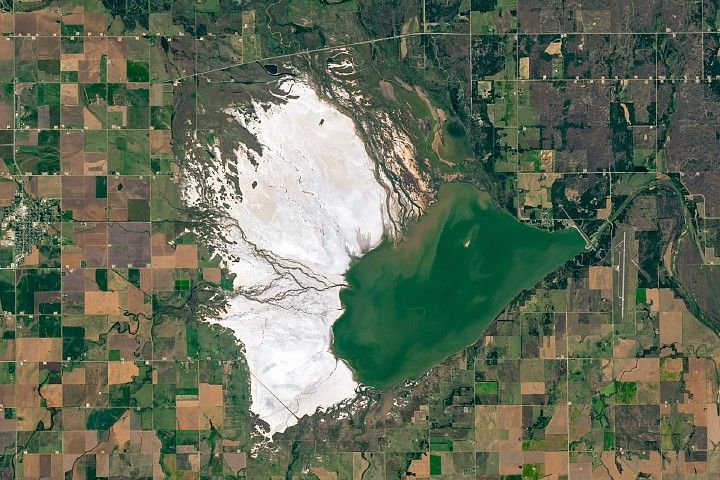
Detecting Coastal Sea Ice Extent and Freshet Event Timing in Prudhoe Bay, Alaska Using Sentinel-1 C-SAR
Isabella Showman, University of Washington
The detachment of coastal sea ice due to increasing upstream snowmelt causes dramatic seasonal changes in the Arctic Ocean. Termed a freshet, these freshwater pulses influence the timing of sea ice degradation, but the effects are difficult to quantify because of frequent cloud cover and limited ground observations. Sentinel-1 C-SAR (Synthetic Aperture Radar) collects high-spatiotemporal data using microwave radiation backscatter allowing it to see through clouds, making it a valuable tool to identify freshet timing in the Arctic.
We used SAR imagery to classify seasonal sea ice extent for a 45 km transect north of Prudhoe Bay, Alaska. The backscatter signature of SAR is influenced by roughness, and since ocean water is smoother than ice, the backscatter differences allow for the estimation of proportional sea ice cover along the transect. We validated the accuracy of our SAR classifications using shortwave infrared from cloud-free Sentinel-2 images, and found strong agreement between the methods. We then calculated the average annual percent ice cover from 2017 to 2024, serving as a seasonal baseline to compare against individual years. We found mean sea ice decline throughout the spring and summer months and associated freshet event timing to begin in the middle of June. The rate of decline in sea ice cover along the transect has higher variability in the weeks following the onset of sea ice melt.
The use of SAR to track localized seasonal ice melt and identify the timing of spring freshet events allows for a more complete seasonal time series than optical imagery alone. Variability in Arctic freshet timing influences how and when sea ice degradation begins, having potential implications for organisms reliant on sea ice extent and larger-scale surface albedo. This study also lays the groundwork for future investigations to better understand across- watershed variability and environmental factors like river discharge and surface temperature on freshet timing.
Sarah Gryskewicz
Investigating the Impacts of the January 2025 California Wildfires on Phytoplankton Blooms in the Pacific Ocean
Sarah Gryskewicz, State University of New York at Oswego
Wildfires are increasing in frequency and intensity across North America as a result of climate change. The release of particulates by these events result in short-range and long-range implications on human and ecophysiological health. Marine ecosystems may also be impacted due to the deposition of these chemical constituents, particularly ash, which can alter nutrient cycling in the water by fertilization and reduce light availability for phytoplankton. Phytoplankton are microscopic organisms that live in marine waters and are responsible for half of the photosynthetic activity on Earth. An area of complex interdisciplinary research concerns the interactions between wildfires and the marine ecosystem. There is a large scientific need to understand biogeochemical cycling between wildfire emissions and phytoplankton blooms.
This study investigates the January 2025 California wildfire impacts on phytoplankton blooms offshore the southern California coast in nutrient limited waters. The Visible Infrared Imaging Radiometer Suite (VIIRS) onboard the Suomi National Polar-orbiting Partnership (SNPP) satellite is used to assess interannual and seasonal variabilities while the Plankton, Aerosol, Cloud, ocean Ecosystem (PACE) satellite was utilized for the additional ocean-based analyses. Variables considered include chlorophyll-a (chl-a) as a proxy for phytoplankton biomass, particulate organic carbon (POC) to assess phytoplankton physiology, and diffuse attenuation at 490 nm (Kd490) to assess light availability. From this analysis, it was found that there was no evident fertilization of a phytoplankton bloom given that chl-a eight-day composites did not deviate significantly from 2012-2025 average geometric mean concentrations. Analyses of the chl-a:POC and chl-a:Kd490 ratios suggest a potential physiological or phytoplankton community shift, but future work using in-situ data is necessary to connect wildfires impacts on phytoplankton communities offshore Southern California. Additionally, the research sets the stage for future work using PACE to investigate impacts on phytoplankton community groups. Future research also involves the expansion of sample wildfire cases and consideration of forested versus urban emission impacts.
Philip Espinal
How Well Can Machine Learning Forecast Kelp Biomass Along the Central California Coast?
Philip Espinal, Texas A&M University
Giant Kelp is an integral part of the coastal ecosystem off the Central California Coast because it provides food and shelter for several marine organisms, and supports a multi-million dollar commercial fishing industry. In recent decades, Giant Kelp forests have been in decline due to warming ocean temperatures and overgrazing by marine organisms such as sea urchins. Conservation efforts like outplanting, transplanting, and sea urchin removal are occurring in an effort to restore Giant Kelp populations along the California Coast. Knowing when the environment will be favorable for kelp growth is important to focus conservation resources and effort most efficiently. Observations from the Landsat series of satellites allow for the estimation of kelp biomass density going back to 1984. Two machine learning algorithms, random forests and a simple neural network, were trained on the Landsat observations, coastal wave model output, climate indices, and reanalysis products from 1984 to 2015. Models were evaluated on the mean absolute error (MAE) for predictions from 2016 to 2021, as well the MAE and mean absolute percent error (MAPE) of just the third quarters, when maximum biomass density is typically achieved. The random forest models showed little skill even at the minimum forecast horizon of one quarter, performing similar to a prediction made by a 5-year rolling seasonal average. The neural networks performed significantly better than the random forests and seasonal averages when forecasting one quarter into the future, and performed marginally better at two and four quarters into the future. The neural network trained to forecast one quarter ahead had a third quarter MAPE of 13.4% while the 5-year seasonal average had a MAPE of 42.8%. Models performed poorly in the area surrounding Monterey, greatly overestimating the amount of kelp biomass. This overprediction may be due to the severe reduction in kelp biomass since 2015 due to sea urchin overgrazing. While the predictions did not match the actual outcome, the environment may have in fact still been productive for kelp if not for the presence of sea urchins. Overall, these models can serve as a proof of concept that machine learning models, especially neural networks, can use current environmental conditions to forecast kelp biomass one to two quarters into the future, providing useful operational guidance for conservationists.
Carolyn Chen
Sea Surface Temperature as an Indicator of Benthic Symbiont Loss in the Florida Keys: A Comparative Analysis of ECOSTRESS and MODIS
Carolyn Chen, University of Florida
Coral bleaching events, which pose significant threats to marine biodiversity and reef structure, have increased in frequency and severity over recent decades. Accurate monitoring of sea surface temperature is vital for understanding the drivers of zooxanthellae loss in these foundational habitats. Traditional methods of satellite temperature data collection have relatively coarse spatial resolution (1 km). This can obscure finer-scale thermal variability, especially in nearshore and coastal reef environments where localized temperature anomalies may lead to significant biological impacts. Here, we use ECOSTRESS at a fine spatial resolution (70 m) to investigate the relationships between sea surface temperature and bleaching in the Florida Keys. Thermal imagery from July 24, 2023 was spatially overlaid with in situ coral bleaching survey data to investigate potential thermal stress–bleaching relationships. We then quantified this relationship through correlation analyses at varying spatial thresholds, examining the strength and direction of associations between sea surface temperature and corresponding levels of coral bleaching intensity across survey sites. Parallel analyses were conducted using MODIS for comparative assessment. We were able to determine that ECOSTRESS sea surface temperature had a weak association with bleaching intensity (r² = 0.348, p<0.001). Greater thresholds yielded lower correlation. Comparatively, MODIS showed low correlation at all spatial thresholds. These findings demonstrate the potential of ECOSTRESS for quantifying thermal relationships and lays the groundwork for future work across temporal scales.
Joshua Chapin
Impacts of Atmospheric Rivers on Phytoplankton in the Central California Current System
Joshua Chapin, The University of Alabama in Huntsville
Atmospheric rivers (ARs) are powerful meteorological events that deliver large volumes of freshwater to coastal systems, potentially reshaping oceanographic and ecological conditions. This study investigates the impact of AR-induced freshwater outflow—specifically from the Russian River (RR) and other freshwater sources–on phytoplankton communities in the central California Current System on April 11, 2023. Using Sentinel-3 ocean color reflectance bands within the visual spectrum (e.g., bands 2 through 11), we applied k-means clustering to classify waters with distinct bio-optical properties. To validate and interpret these water types, we integrated data from NASA’s Sub-Mesoscale Ocean Dynamics Experiment (S-MODE) field campaign, including flow-through measurements of temperature, salinity, chlorophyll-a, and particulate organic carbon (POC), along with bottle sample data on nutrients and high-performance liquid chromatography (HPLC) pigments (e.g., fucoxanthin, peridinin, nitrate). These in situ observations revealed physical and biological signatures across the clustered water masses. One cluster is characterized by cold temperatures, low salinity, low chlorophyll-a concentrations. The cluster is also characterized by reduced fucoxanthin (denoting reduced diatom concentrations) and low nitrate. These T/S and bio-optical characteristics suggest an association with terrestrial outflow, potentially linked to AR-driven discharge from the Russian River and adjacent watersheds. However, within the same T/S space, elevated chlorophyll-a concentrations are observed, indicating that some RR water is associated with elevated productivity. . T/S diagrams also indicated that elevated chl-a was associated with mixing of the RR with surrounding waters. In contrast, other clusters were characterized by warmer temperatures, higher salinity, elevated chlorophyll-a concentrations, higher nitrate levels, and higher accessory pigment concentrations such as alloxanthin and prasinoxanthin (associated with this cluster). Overall, these contrasting signatures among clustered water masses illustrate the ecological gradients shaped by AR-driven freshwater delivery. This integrated approach highlights the ecological consequences of terrestrial runoff following AR events and demonstrates the utility of combining satellite-based classifications with high-resolution in situ measurements to monitor phytoplankton variability in dynamic coastal environments.
Eli Mally
Predicting Phytoplankton Pigment Groups in Coastal Southern California with PACE
Eli Mally, University of California, Irvine
Phytoplankton produce half of the world’s oxygen, influence nutrient cycling, and form the basis of the ocean’s food chain. Predicting phytoplankton pigment groups from hyperspectral satellite data, especially in coastal areas where accurate retrievals are challenging, is crucial to gaining a better understanding of ocean ecosystems. Phytoplankton community models from hyperspectral data (such as the MOANA model) have recently become available for the Atlantic, but are not yet available for the Pacific Ocean. To address this observational gap, we created regional models of phytoplankton pigment groups in coastal southern California. We used Level 2 Ocean Color Instrument reflectance data in mid-September 2024 from the NASA PACE satellite. We matched the reflectance data with in situ high performance liquid chromatography (HPLC) data from PACE validation cruises (PACE-PAX) in the Santa Barbara Channel and near Long Beach, with a focus on total chlorophyll, chlorophyll-a, -b, and -c, and five pigments associated with different phytoplankton groups characterized in Kramer et al. 2022 (diatoms, dinoflagellates, haptophytes, green algae, and cyanobacteria). We then performed a principal component regression on the satellite data to find models for each pigment. This project resulted in significant models and R2 values for total chlorophyll (0.911), chlorophyll-a (0.868), -b (0.650), and -c (0.861), 19′-hexanoyloxyfucoxanthin (0.517), peridinin (0.327), zeaxanthin (0.381), fucoxanthin (0.678), and monovinyl chlorophyll-b (0.650). Furthermore, these results help validate PACE satellite measurements, which provide much finer spectral detail on phytoplankton community groups than multispectral data. Further cruises in this area would increase the scope and amount of HPLC samples, and therefore the accuracy and scope of our phytoplankton pigment models.