


Ozone Where We Live (OWWL)
Meet the OWWL Team

Emma Yates
Research Scientist

Laura Iraci
Research Scientist, Trace Gas Group Lead

Kristen Okorn
Research Scientist, Center Coordinator for NASA's Disasters Response Coordination System

Matthew Johnson
Research Scientist, Assistant Biospheric Science Branch Chief

Claudia Bernier
NASA Postdoctoral Research Fellow
About OWWL
Ozone Where We Live (OWWL) is a NASA science project aimed at better understanding air quality in and around California’s San Joaquin Valley. We need community-based volunteers to collect air quality data with simple-to-use scientific sensors. We are looking for volunteers to locate sensors within Bakersfield (at homes, schools or other places in the community) and civilian pilots who regularly fly within the San Joaquin Valley. These observations collected by community volunteers will be used by NASA researchers to help “train” satellites and models to accurately monitor and predict ozone in the San Joaquin Valley and beyond.
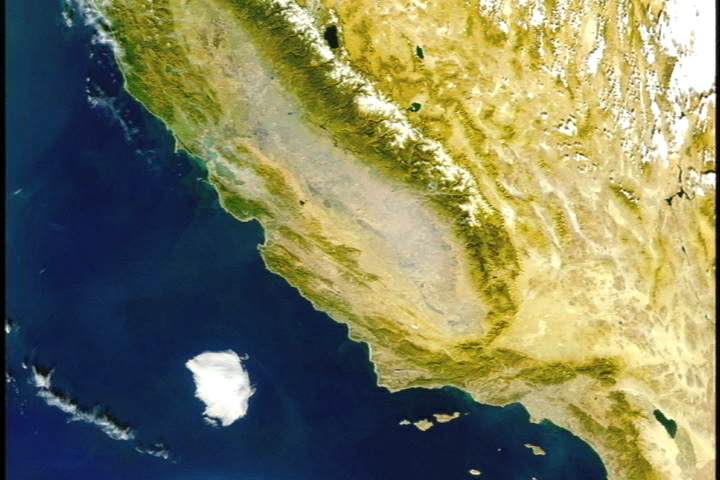
Ever wondered why on many sunny summers days you cannot see the blue sky? This is because of “smog”. The main component of summertime “smog” is ozone which at ground-level is formed from chemical reactions between volatile organic compounds (VOCs) and nitrogen oxides (NOx) that react in sunlight. The San Joaquin Valley sees a lot of sunshine, this combined with stagnant air (low/little wind) and pollution sources (e.g. fuel combustion including transport and soil emissions associated with agriculture) that emit VOCs and NOx, makes the San Joaquin Valley a perfect place for ozone formation. In fact, the San Joaquin Valley has some of the most polluted air in the country! Ozone/smog is a dangerous pollutant with severe public health impacts in both short- and long-term exposures.
The OWWL project will provide an increased understanding of ozone/smog within the San Joaquin Valley, including better predictions of pollution events for the community. The increased ozone observations provided by OWWL volunteers, combined with access to real-time OWWL observations to people living in the area, through our work with community partners, will allow San Joaquin Valley residents to make informed decisions to protect themselves and their families from potential air pollution hazards.
The OWWL data will be used by NASA researchers for two purposes. The first of these is to validate a new dataset from NASA’s TEMPO (Tropospheric Emissions: Monitoring of Pollution) satellite, which looks at low-level ozone. The second purpose is to improve air quality models and predictions for the San Joaquin Valley, to evaluate air quality model performance in Bakersfield and identify model parameters that could be improved to better simulate ozone within highly polluted cities.
How it Works
Our team of air quality scientists will recruit, train, and work side-by-side with community volunteers to collect air quality data within the San Joaquin Valley.
Airborne component: The NASA team will provide 10 ozone sensors to volunteer pilots, who will provide invaluable ozone data by bringing these sensors onboard for their normal flight plans. The project is most interested in ozone data near the ground (0 to 6,000 ft), so most data will be sampled from takeoffs and landings. These observations will primarily be used to validate new TEMPO satellite ozone datasets.
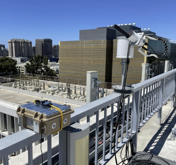
Ground-based component: The NASA team is building roughly a dozen ground-based sensors to measure atmospheric gases such as ozone, nitrogen dioxide, methane, and formaldehyde. We are looking for community volunteers who would like to deploy these sensors within Bakersfield (e.g. at a home, school, libraries). Though work with our community partner, Central California Asthma Collaborative (CCAC), we plan to incorporate these observations into their SJVAir network to provide real-time ozone pollution levels to people living within the San Joaquin Valley. In addition, these data will be used by NASA researchers to improve air quality models and measurements for the region.

Ways to get involved:
Air Based
We are looking for pilots within the San Joaquin Valley or San Francisco Bay Area who have access to an aircraft who are interested in being part of an effort to better understand and predict air quality pollution events in the San Joaquin Valley. We will provide training to operate a small, low cost ozone and GPS sensor. The hand-held sensor was originally designed to fly on weather balloons, it is battery operated, requires no interaction with aircraft systems and weighs one pound. We will provide pilots with training to operate the low-cost sensors, as well as educational opportunities to learn more about ozone, the sensors, and how to interpret the data.
The ozone sampling will be ‘missions of opportunity:’ we will sample ozone wherever the pilot flies, but the pilots do not need to change or add flight plans for this project. After a flight, the pilot will email the data file from the flight to a science team member, who will analyze the data and keep the citizen scientist pilots informed on how their data is contributing to the validation of NASA ozone satellite data products.
Ground Based
We are looking for individuals and organizations willing to install and maintain a low-cost air sensor in Bakersfield, California. Our sensors require an outdoor power outlet, access to outside air, and a WIFI connection. Examples of previous sensor location include outside of individual homes, libraries, schools, or colleges.
We will provide citizen scientists with the sensors and training to operate these simple-to-use sensors, and with educational opportunities to learn more about ozone, the sensors, and how to interpret the data. This ground-based citizen science data will be incorporated into Central California Asthma Collaborative’s SJVAir website and app.
The Process
For any questions, or to express interest in joining the project, email emma.l.yates@nasa.gov.
Additional Partners:
Central California Asthma Collaborative (CCAC) https://cencalasthma.org/
Civil Air Patrol (CAP) https://www.gocivilairpatrol.com/