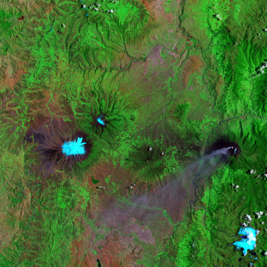
Landsat 7’s Enhanced Thematic Mapper Plus (ETM+) sensor captured this image or Ecuador’s Mount Chimborazo on September 16, 2001. Snowcapped Chimborazo is on the left, and the smoking Tungurahua Volcano is on the right. In this false-color image, pale blue indicates snow cover, bright green indicates lush vegetation, and red indicates sparser vegetation. Tungurahua’s volcanic ash plume appears in lavender. This steep-sloped volcano is one of Ecuador’s most active volcanoes; an eruption beginning in 1995 forced a temporary evacuation of a nearby city, situated at the volcano’s base.
In 1802, Mount Chimborazo was thought to be the world’s tallest mountain, and the ambitious young German naturalist Alexander von Humboldt set out to climb it. He didn’t reach the summit, but he did reach an altitude of nearly 6,100 meters (20,000 feet), which was a new record for European mountaineers at that time. Humboldt’s trip to South America, including his trek up the side of Chimborazo, changed the way naturalists thought about altitude, vegetation and volcanoes.Image Credit: NASA
1 min read


