


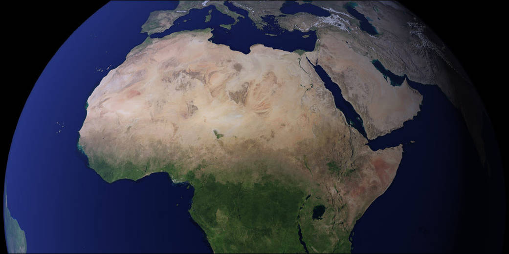
In 2002, NASA produced the Blue Marble, the most detailed true-color image of the Earth’s surface ever produced. Using data from NASA’s Terra satellite, scientists stitched together four months of observations of the land surface, coastal oceans, sea ice, and clouds into a seamless, photo-like mosaic of every square kilometer (.386 square mile) of our planet. In October 2005, the creators of the Blue Marble released a new version of the spectacular image collection that provides a full year’s worth of monthly observations with twice the level of detail as the original called the Blue Marble: Next Generation.
Like the original, the Blue Marble: Next Generation is a mosaic of satellite data taken mostly from a NASA sensor called the Moderate Resolution Imaging Spectroradiometer (MODIS) that flies board NASA’s Terra and Aqua satellites.
Blue Marble: Next Generation improves the techniques for turning satellite data into digital images, providing greater detail in areas that usually appear very dark to the satellite (because a large amount of sunlight is being absorbed), for example in dense tropical forests. The ability to create a digital image that provides great detail in darker regions without ‘washing out’ brighter regions, like glaciers, snow-covered areas, and deserts is one of the great challenges of visualizing satellite data. The new version also improves image clarity, and gives highly reflective bodies of water a more realistic appearance.Image Credit: NASA