Ecologists and ranchers alike know that rivers and streams with healthy beaver populations support more biodiversity, are more drought resilient, and keep water available on the land for more days of the year. But witnessing the impact of nature’s engineers on a single stream is easier than measuring it across a region, or choosing which of a hundred streams is an ideal site to reintroduce beavers.
Now a NASA-supported effort in Idaho adds remote sensing data to the suite of tools used to predict which streams can support beavers and to monitor how water and vegetation change once they return.
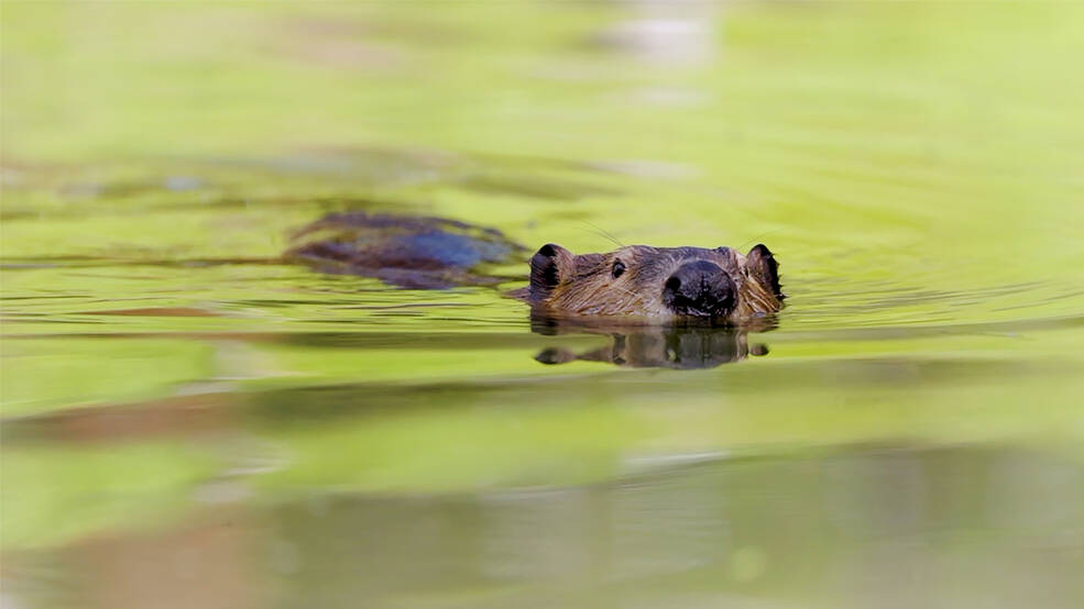
Credits: NASA/Boise State University
NASA Collaborates with Conservationists
While working on water monitoring for ranchers, scientists Jodi Brandt and Nick Kolarik heard about “beaver fever.” Ranchers had gone from seeing beavers as a nuisance to recruiting them onto their land. Brandt is now an associate professor of human-environment systems at Boise State University, and Nick Kolarik is her Ph.D. student. Brandt leads a team using NASA’s Earth observation data to help quantify how beavers can have an outsized and positive impact on local ecosystems. She works with Wally Macfarlane and Joe Wheaton, both at Utah State University, who developed the Beaver Restoration Assessment Tool (BRAT).
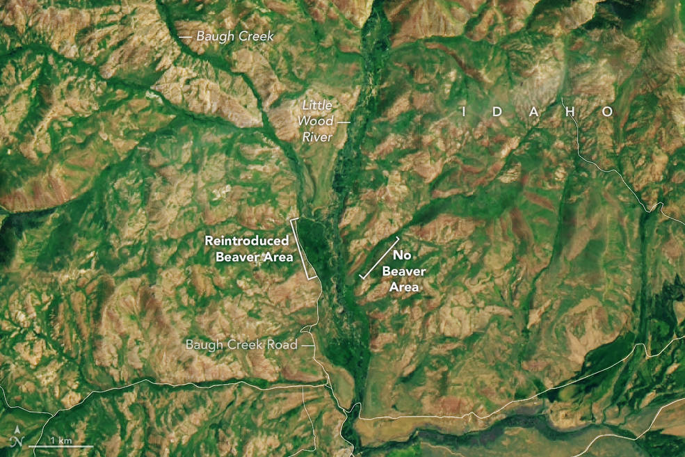
The team is focusing on Idaho and nearby regions because, while wet ecosystems comprise only 5% of the landscape, those areas are critical for more than 90% of species living in the area during the dry season. Brandt’s team collaborates with dozens of local fish and wildlife organizations, watershed managers, land trusts, conservation and restoration NGOs, and individual ranchers.
Adding water and vegetation data from NASA missions to their process addresses two major challenges: how to quantify change over time and how to consistently monitor large areas.
Earth Observations Streamline Results
Sending people out into the field to take measurements is time-intensive, which can be expensive for smaller research teams working in remote sites. It is also limiting because humans can only visit one location at a time, and not necessarily in all seasons.
NASA’s fleet of Earth-observing missions collect data across large areas of the world and pass over the same areas regularly and across seasons. Researchers can observe an area in real time and also look back to previous weeks, months, or even years. In the case of Brandt’s team, the scientists are turning data from Earth science missions like Landsat and Sentinel into information that more people can understand and use.
Cory Mosby of Idaho Fish and Game is excited about how satellite data can expand his crew’s ability to the monitor miles of waterways across his state. What they’re looking to establish, he says, is more vegetation. Or, as he puts it, “more green groceries” to support wildlife and livestock.
When spring snow melts in Idaho, if there’s no interruption, the water flows straight over the land, down the rivers, and into the ocean. When beaver build dams across streams, they naturally disperse and hold water on the land longer, which supports more plants and creates habitats like ponds and meadows. Mosby said that restored ecosystems provide better places to live for aquatic species—like salmon and trout—and land creatures—like sage grouse and mule deer. The dams also create more fresh drinking water and better grazing land for cattle, and they make the landscape more resilient to fire and drought.
According to Mosby, remote sensing data helps them monitor more areas and quantify those positive changes. “We’re going to see a wider green vein later into the year and we will see more water later in the season.”
It’s a response Idaho cattle rancher Jay Wilde has seen firsthand. He began stream restoration with beaver rewilding in 2014. By 2022, he was a “beaver believer.” Now there are more than 200 beaver dams along Birch creek near Preston, Idaho, resulting in the stream flowing 40 days longer into the year.
Beaver rewilding can also restore habitat for threatened fish populations. A project at Bridge Creek, Oregon, led to a 170% increase in steelhead trout, according to Nicolaas Bouwes, a researcher at Utah State University.
It’s a bonus effect of reintroducing beavers, added Utah State University’s Macfarlane. “Prior to beaver trapping, beaver dams were just about everywhere in the west. So what we’re attempting to do is to bring beaver dam densities back to historic levels where possible,” he said. “In doing so, we’re building important drought resiliency and restoring stream areas. I think there’s a lot of foresight by NASA realizing how these things connect.”
Decision Support Tools for Beaver Rewilding
NASA Applied Sciences’ Ecological Conservation program area funds the beaver rewilding project. Associate program manager Cindy Schmidt recently joined the team in Idaho to build beaver dam analogs—temporary, human-created structures which help beavers get established in an area. After seeing how the beavers benefited the land, “I became a beaver believer,” Schmidt said.
The project includes four parts: updating the existing Beaver Restoration Assessment Tool, creating two applications using Earth observations to measure beaver rewilding impacts, and a smartphone application for comparing photos of field sites.
- Monthly Mesic Resource Restoration Monitoring Aid(MRRMaid): This application quantifies surface water and mesic vegetation (plants that grow near rivers and streams) at a resolution of 10 meters using data from the European Space Agency’s Sentinel-1 and Sentinel-2 satellites. This is an improvement over products using only 30-meter data because it can capture small, fluctuating bodies of water like ponds. MRRMaid also uses historic data from the NASA-U.S. Geological Survey’s Landsat missions, as well as machine learning, to estimate past and future surface water. This is useful for comparing results before and after the arrival of beavers.
- Mesic Vegetation Persistence (MVP): This application uses Sentinel-2 and Landsat data to produce near-real time measures of mesic vegetation. Measuring this vegetation is a proxy for knowing where streams or creeks are flowing but perhaps too small or narrow to detect directly.
- Beaver Restoration Assessment Tool (BRAT): An existing tool run by Utah State University which uses LANDFIRE data, BRAT evaluates the potential of a site to support beaver populations and to function as stream conservation and restoration agents. With NASA’s support, BRAT is being improved so anyone will be able to use it to evaluate sites across the U.S.
- Phlux: This smartphone application will allow people in the field to compare photos of the same area and check visible change over time. Such ground observations also help validate satellite data.
Data Supports People on the Ground
“The real value of using satellite data for monitoring is that there are people on the ground working hard and implementing things like increasing water availability, increasing fish and species habitat,” Brandt said. “The more support we can give them, the more broadly these practices can proliferate.”
The current project runs through 2025 and aims to make the tools easy to use for a variety of decision makers. Beyond that, the team has their sights set on expanding to nearby states that have similar terrain and water management strategies.
Banner Image: