


![Request for Information – Potential [Placeholder for Prize]](https://assets.science.nasa.gov/dynamicimage/assets/science/missions/a-step/FFR_Earth_Background_20251120%20.png?w=1024)


Lee esta historia en español aquí.
On its mission to the Moon, NASA’s Orion spacecraft is designed to use NASA’s Near Space Network and Deep Space Network to navigate. But if the craft loses communication with the ground or the Networks, crews can use a backup autonomous navigation system known as Optical Navigation (OpNav). This system analyzes images of the Moon or Earth taken from the spacecraft to determine its position relative to either of those two bodies.
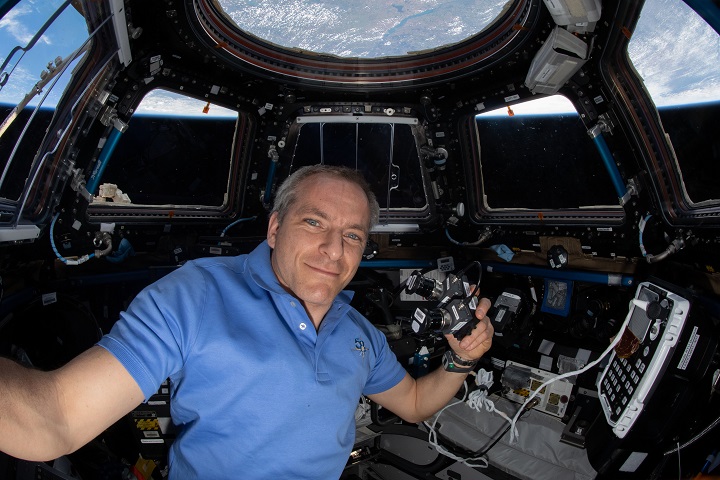
An investigation currently underway aboard the International Space Station is helping developers of OpNav fine-tune the system to ensure that crews return home safely. The Moon Imagery investigation uses photographs of the Moon taken from the space station to calibrate the system software.
“The space station gives us a platform to collect images of the Moon without interference from Earth’s atmosphere,” says principal investigator Steve Lockhart at NASA’s Johnson Space Center in Houston. “We can get pretty decent images from the ground, especially when the Moon is near full and high in the sky. The challenge is getting clear images of the Moon in its very thin phases. Because it is close to the Sun then, the sky is only dark enough to get images when the Moon is close to horizon, and then you are looking through a lot of atmosphere.”
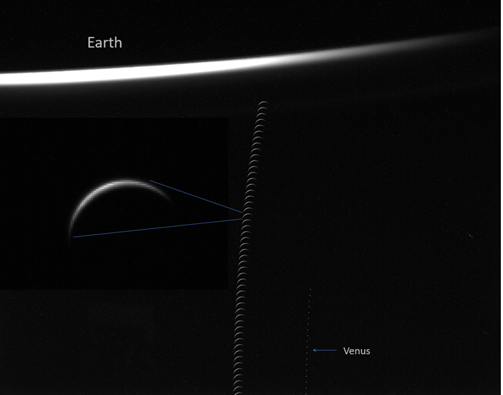
The investigation uses two cameras mounted on a plate and offset about 20 degrees from each other. The plate is installed in the station’s cupola, a seven-windowed observation module, and the cameras point out one of the windows that has pure glass for the clearest view. One camera captures images of the stars and the other takes photos of specified views of the Moon. Each specific view is available only once a month for a short four-minute window. Software then uses algorithms to analyze these images and determine the craft’s position in space.
“We know where the space station is at all times and where it was when a particular photo was taken based on the time it was taken,” says Lockhart. “The algorithm tells us where it thinks station is and we can compare that to the actual known location to judge the accuracy of our system.”
The system is automated, he adds. The space station crew simply commands the camera to point at Earth or the Moon, whichever is the most suitable target at the time, to take a series of photos for an hour or so.
Crew members now have conducted four runs of the investigation, photographing an entire 29-day cycle of the Moon’s phases.
Images from the most recent run in May captured different exposures, from very under-exposed to highly over-exposed. Researchers plan to analyze these images to see whether they can be used to determine range and bearing from the space station and, from that, a spacecraft’s location, such as Orion’s position between the Moon and Earth.
That run also captured a very thin crescent Moon, one of the most challenging conditions for the system’s image-processing algorithms. The team can improve future versions of the algorithm based on how the system handles this challenging Moon stage, one of several objectives for the upcoming Artemis I mission.
During trajectory correction maneuvers, the OpNav camera mounted on the outside of Orion will take repeated Moon and Earth images for about two hours. These multiple images should ensure accurate measurements of Orion’s location in the event the backup navigation system is needed. Accurately knowing a spacecraft’s location is critical to guiding it safely back to re-entry into Earth’s atmosphere.
Communications and navigation capability is one of the key technologies needed for humans to explore farther into space. Orion is NASA’s next generation spacecraft, capable of transporting humans to low-Earth orbit and beyond, including to the Moon. Lockhart says that commercial space exploration companies also have shown interest in the autonomous navigation system.
The Moon Imagery investigation is one example of how the space station provides researchers with a platform to lay the groundwork for technologies and demonstrations that move humanity closer to deep space exploration.
For daily updates, follow @ISS_Research, Space Station Research and Technology News or our Facebook. For opportunities to see the space station pass over your town, check out Spot the Station.
Melissa Gaskill
International Space Station Program Research Office
Johnson Space Center