


![Request for Information – Potential [Placeholder for Prize]](https://assets.science.nasa.gov/dynamicimage/assets/science/psd/solar/2023/09/s/solarsystem_0.jpg?w=1024)


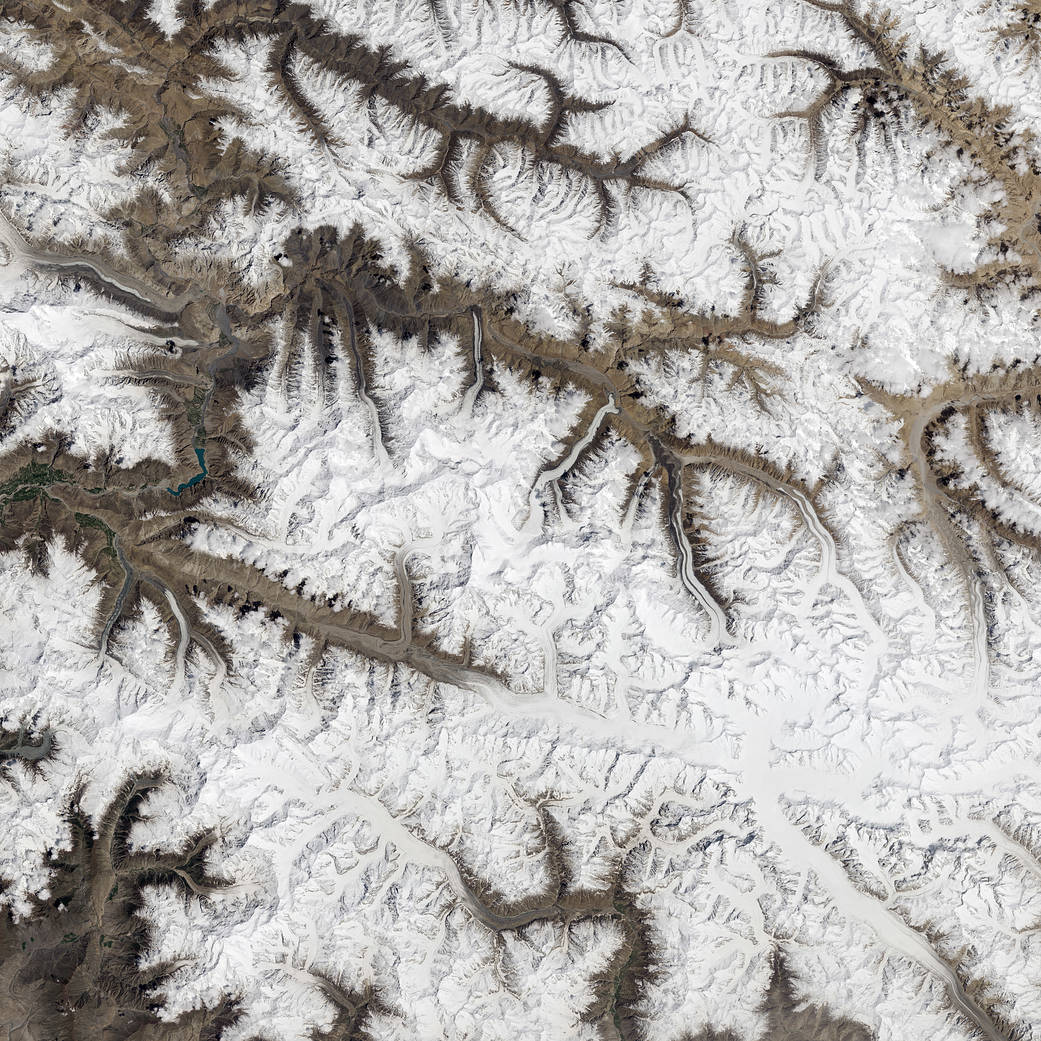
For most alpine areas, scientists are concerned that global warming and retreating ice will swell glacial lakes and increase the risk of floods downstream. In the Karakoram Mountains of northern Pakistan, the remote Shimshal Valley has the same concern, but for a somewhat different reason.
Several of the glaciers that flow into this valley surge, meaning they cycle through periods when they flow forward several times faster than usual. Since the valley is narrow and has a river running through it, surging glaciers regularly dam the river and create flood hazards. The floods occur when water pooling up behind the tongue of the advancing glacier suddenly breaks through the natural ice dam and cascades down the gorge.
As seen in this Landsat 8 image, several glaciers flow into the Shimshal Valley perpendicular to the flow of the river, and they have little room to move before they intersect with the water. In recent decades, the four glaciers most prone to blocking the river have been the Khurdopin, Yukshin Gardan, Yazghil, and Malungutti. The Operational Land Imager (OLI) on Landsat 8 captured this image on May 13, 2017.
Annotated images, references and further reading: NASA Earth Observatory
Image Credit: NASA Earth Observatory image by Jesse Allen, using Landsat data from the U.S. Geological Survey
Caption: Adam Voiland, with information and fact checking by Lasafam Iturrizaga (University of Göttingen) and Jakob Steiner (Utrecht University)